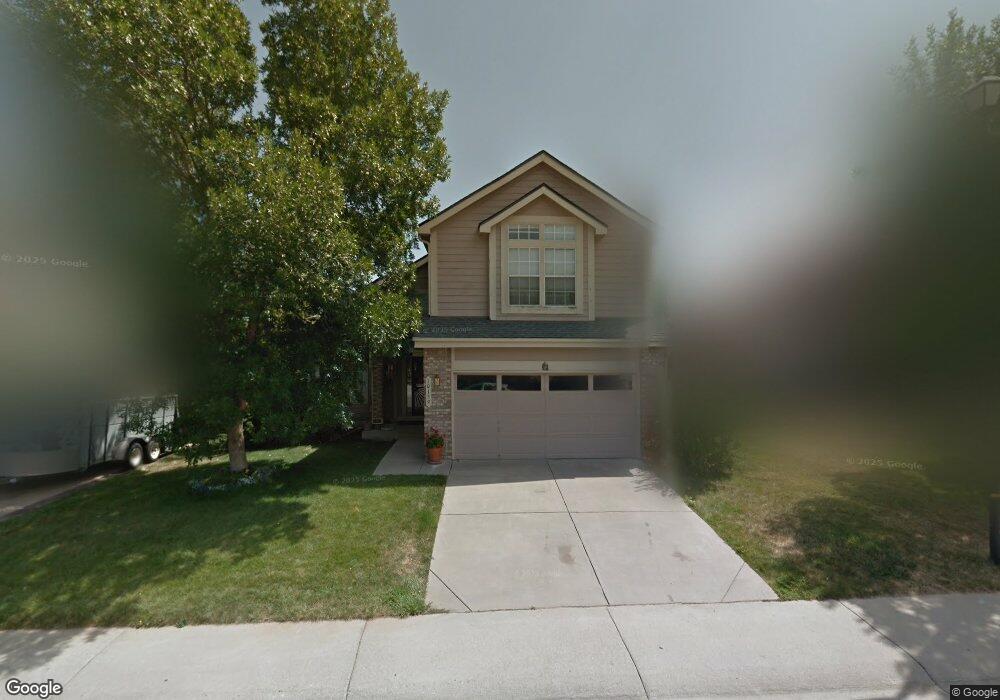
10159 Westside Cir Littleton, CO 80125
Estimated Value: $517,000 - $586,000
3
Beds
4
Baths
1,752
Sq Ft
$317/Sq Ft
Est. Value
About This Home
This home is located at 10159 Westside Cir, Littleton, CO 80125 and is currently estimated at $555,670, approximately $317 per square foot. 10159 Westside Cir is a home located in Douglas County with nearby schools including Roxborough Elementary School, Roxborough Intermediate School, and Ranch View Middle School.
Ownership History
Date
Name
Owned For
Owner Type
Purchase Details
Closed on
Jan 21, 1994
Sold by
U S Home Corp
Bought by
Riley Richard M and Leslie A Riley C
Current Estimated Value
Home Financials for this Owner
Home Financials are based on the most recent Mortgage that was taken out on this home.
Original Mortgage
$92,000
Interest Rate
7.09%
Purchase Details
Closed on
May 19, 1993
Sold by
Roxborough Acquisition Corp
Bought by
Us Home Corp
Create a Home Valuation Report for This Property
The Home Valuation Report is an in-depth analysis detailing your home's value as well as a comparison with similar homes in the area
Home Values in the Area
Average Home Value in this Area
Purchase History
| Date | Buyer | Sale Price | Title Company |
|---|---|---|---|
| Riley Richard M | $137,185 | -- | |
| Us Home Corp | $24,500 | -- |
Source: Public Records
Mortgage History
| Date | Status | Borrower | Loan Amount |
|---|---|---|---|
| Closed | Riley Richard M | $92,000 |
Source: Public Records
Tax History Compared to Growth
Tax History
| Year | Tax Paid | Tax Assessment Tax Assessment Total Assessment is a certain percentage of the fair market value that is determined by local assessors to be the total taxable value of land and additions on the property. | Land | Improvement |
|---|---|---|---|---|
| 2024 | $3,579 | $37,920 | $6,760 | $31,160 |
| 2023 | $3,603 | $37,920 | $6,760 | $31,160 |
| 2022 | $2,897 | $27,690 | $5,030 | $22,660 |
| 2021 | $3,028 | $27,690 | $5,030 | $22,660 |
| 2020 | $3,090 | $26,660 | $5,760 | $20,900 |
| 2019 | $3,140 | $26,660 | $5,760 | $20,900 |
| 2018 | $3,159 | $21,910 | $4,160 | $17,750 |
| 2017 | $3,036 | $21,910 | $4,160 | $17,750 |
| 2016 | $2,785 | $19,850 | $3,580 | $16,270 |
| 2015 | $1,438 | $19,850 | $3,580 | $16,270 |
| 2014 | $1,235 | $15,850 | $1,990 | $13,860 |
Source: Public Records
Map
Nearby Homes
- 8109 Mount Ouray Rd
- 8176 Locust Dr
- 8032 Mount Ouray Rd
- 8129 Locust Dr
- 7888 Canvasback Cir
- 10441 Beech St
- 9804 Rosalee Peak St
- 10448 Kicking Horse Dr
- 7910 Jared Way
- 7832 Elmwood St
- 9786 Rosalee Peak St
- 9780 Banner Peak St
- 8145 Monte Vista Cir
- 9753 Middle Peak St
- 10538 Pony Cart Place
- 9613 Browns Peak Cir
- 9625 Browns Peak Cir
- 9617 Browns Peak Cir
- Panorama Plan at Prospect Village at Sterling Ranch - Townhomes
- Peak Plan at Prospect Village at Sterling Ranch - Townhomes
- 10155 Westside Cir
- 10163 Westside Cir
- 10097 Jasmine Ct
- 10093 Jasmine Ct
- 10167 Westside Cir
- 10143 Westside Cir
- 10162 Westside Cir
- 10092 Jasmine Ct
- 10158 Westside Cir
- 10087 Jasmine Ct
- 10154 Westside Cir
- 10131 Westside Cir
- 10166 Westside Cir
- 10009 Westside Cir
- 10171 Westside Cir
- 10011 Westside Cir
- 10086 Jasmine Ct
- 10125 Westside Cir
- 10150 Westside Cir
- 10083 Jasmine Ct