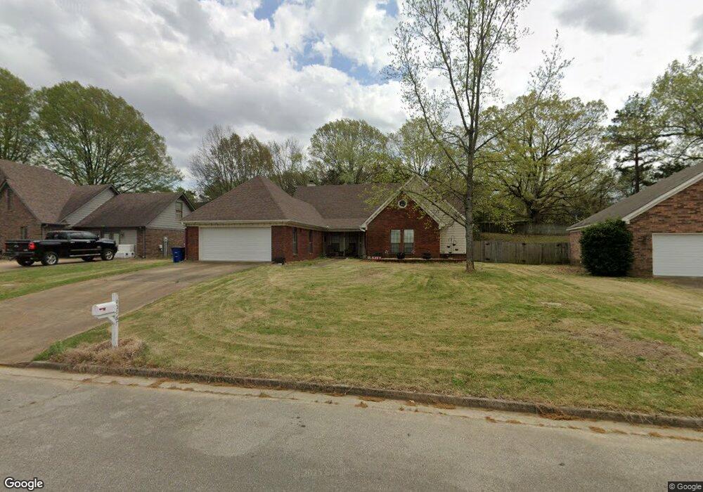
10167 Fox Run Dr Olive Branch, MS 38654
Estimated Value: $264,000 - $277,534
3
Beds
2
Baths
1,864
Sq Ft
$147/Sq Ft
Est. Value
About This Home
This home is located at 10167 Fox Run Dr, Olive Branch, MS 38654 and is currently estimated at $273,134, approximately $146 per square foot. 10167 Fox Run Dr is a home located in DeSoto County with nearby schools including Olive Branch Elementary School, Chickasaw Elementary School, and Olive Branch Middle School.
Ownership History
Date
Name
Owned For
Owner Type
Purchase Details
Closed on
Aug 21, 2023
Sold by
Barlow Glen A and Barlow Sarah D
Bought by
Barlow Family Revocable Living Trust and Barlow
Current Estimated Value
Purchase Details
Closed on
Nov 4, 2005
Sold by
Baxter Christopher D and Baxter Connie L
Bought by
Barlow Glen A and Barlow Sarah L
Home Financials for this Owner
Home Financials are based on the most recent Mortgage that was taken out on this home.
Original Mortgage
$153,088
Interest Rate
5.9%
Mortgage Type
VA
Create a Home Valuation Report for This Property
The Home Valuation Report is an in-depth analysis detailing your home's value as well as a comparison with similar homes in the area
Home Values in the Area
Average Home Value in this Area
Purchase History
| Date | Buyer | Sale Price | Title Company |
|---|---|---|---|
| Barlow Family Revocable Living Trust | -- | None Listed On Document | |
| Barlow Family Revocable Living Trust | -- | None Listed On Document | |
| Barlow Glen A | -- | First National Financial Tit |
Source: Public Records
Mortgage History
| Date | Status | Borrower | Loan Amount |
|---|---|---|---|
| Previous Owner | Barlow Glen A | $153,088 |
Source: Public Records
Tax History Compared to Growth
Tax History
| Year | Tax Paid | Tax Assessment Tax Assessment Total Assessment is a certain percentage of the fair market value that is determined by local assessors to be the total taxable value of land and additions on the property. | Land | Improvement |
|---|---|---|---|---|
| 2024 | $1,407 | $12,504 | $2,000 | $10,504 |
| 2023 | $1,407 | $12,504 | $0 | $0 |
| 2022 | $1,407 | $12,504 | $2,000 | $10,504 |
| 2021 | $1,407 | $12,504 | $2,000 | $10,504 |
| 2020 | $1,294 | $11,676 | $2,000 | $9,676 |
| 2019 | $1,294 | $11,676 | $2,000 | $9,676 |
| 2017 | $1,257 | $20,698 | $11,349 | $9,349 |
| 2016 | $1,257 | $11,349 | $2,000 | $9,349 |
| 2015 | $1,557 | $20,698 | $11,349 | $9,349 |
| 2014 | $1,333 | $11,901 | $0 | $0 |
| 2013 | $1,285 | $11,901 | $0 | $0 |
Source: Public Records
Map
Nearby Homes
- 9861 Alexanders Ridge Dr
- 10335 Yates Dr
- 10101 Stephenson Ln
- 7669 Meadow Ridge Ln
- 6825 Charlotte Dr
- 9745 Riggan Dr
- 10155 Riggan Dr
- 7868 Plantation Ridge Cove
- 6729 Branch Rd S
- 10668 Stark Acres Rd
- 8031 Alexander Rd
- 9919 Adina Cove
- 6741 Hacks Cross Rd
- 8151 Montrose Dr
- 9759 Pigeon Roost Park Cir
- 8247 Montrose Dr
- 9800 Cherokee Dr
- 9355 Pigeon Roost Rd
- 10625 Kristen Dr
- 10862 Wiseman Dr
- 10181 Fox Run Dr
- 10153 Fox Run Dr
- 7255 Foxdale Dr
- 7271 Foxdale Dr
- 10137 Fox Run Dr
- 10166 Fox Run Dr
- 7232 Alexander Rd
- 7232 Alexander Rd
- 7232 Alexander Rd
- 10203 Fox Run Dr
- 10184 Fox Run Dr
- 10121 Fox Run Dr
- 10124 Fox Run Dr
- 10192 Fox Run Dr
- 7322 Fox Glen Dr
- 10200 Fox Run Dr
- 10105 Fox Run Dr
- 10108 Fox Run Dr
- 7272 Foxdale Dr
- 7258 Foxdale Dr