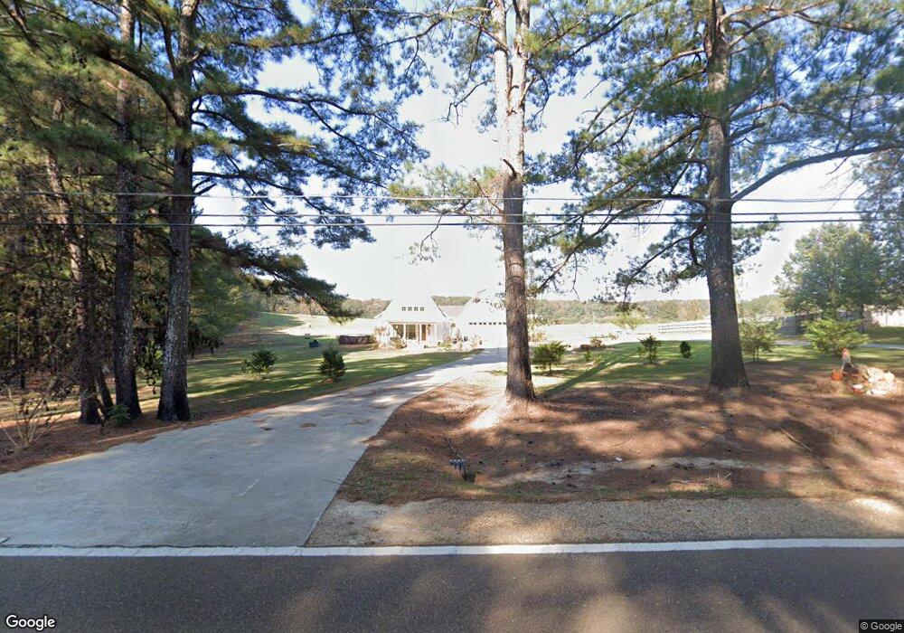
10169 Highway 21 N Philadelphia, MS 39350
Estimated Value: $223,181 - $348,000
--
Bed
--
Bath
2,522
Sq Ft
$108/Sq Ft
Est. Value
About This Home
This home is located at 10169 Highway 21 N, Philadelphia, MS 39350 and is currently estimated at $273,545, approximately $108 per square foot. 10169 Highway 21 N is a home.
Ownership History
Date
Name
Owned For
Owner Type
Purchase Details
Closed on
Sep 3, 2017
Sold by
Mike Tinsley Realty Inc
Bought by
Puckett Joseph and Puckett Amanda
Current Estimated Value
Create a Home Valuation Report for This Property
The Home Valuation Report is an in-depth analysis detailing your home's value as well as a comparison with similar homes in the area
Home Values in the Area
Average Home Value in this Area
Purchase History
| Date | Buyer | Sale Price | Title Company |
|---|---|---|---|
| Puckett Joseph | -- | -- |
Source: Public Records
Tax History Compared to Growth
Tax History
| Year | Tax Paid | Tax Assessment Tax Assessment Total Assessment is a certain percentage of the fair market value that is determined by local assessors to be the total taxable value of land and additions on the property. | Land | Improvement |
|---|---|---|---|---|
| 2025 | $1,883 | $17,547 | $0 | $0 |
| 2024 | $1,883 | $17,527 | $0 | $0 |
| 2023 | $920 | $15,813 | $0 | $0 |
| 2022 | $921 | $15,813 | $0 | $0 |
| 2021 | $971 | $16,250 | $0 | $0 |
| 2020 | $1,777 | $16,250 | $0 | $0 |
| 2019 | $299 | $2,730 | $0 | $0 |
| 2018 | $299 | $2,730 | $0 | $0 |
| 2017 | $293 | $2,730 | $0 | $0 |
| 2016 | $294 | $2,730 | $0 | $0 |
| 2015 | -- | $2,730 | $0 | $0 |
| 2014 | -- | $2,730 | $0 | $0 |
Source: Public Records
Map
Nearby Homes
- 103 Gateway Dr
- 0 S Plantation Unit 25-813
- 0 S Plantation Unit 25-814
- 0 S Plantation Unit 25-812
- 138 Plantation Point Dr N
- 0 Woodland Hills Dr
- 0 Country Ln
- 408 Hospital St
- 904 Pecan Ave
- 206 Woodbriar Ln
- 708 Forest Park Cir
- 1012 Kosciusko Rd
- 0 Columbus Ave
- 736 Forest Park Cir
- 738 Forest Park Cir
- 457 Pecan Ave
- 100 Highway 19
- 0 Mississippi 19
- 01 Mississippi 19
- 414 Columbus Ave Unit A
- 101 Condo Dr
- 105 Condo Dr
- 103 Condo Dr
- 105 Gateway Dr
- 102 Condo Dr
- 100 Condo Dr
- 27 Plantation Point S
- 115 Plantation Point S
- 10270 Highway 21 N
- 119 Plantation Point Dr N
- 117 Plantation Point Dr N
- 125 Plantation Point Dr N
- 113 Plantation Point Dr N
- 1 Highway 21 N
- 10060 Highway 21 N
- 10750 Bia 0241
- 102 Pleasant Ridge Dr
- 111 Plantation Point Dr N
- 101 N Hill Dr
- 109 Plantation Point Dr N