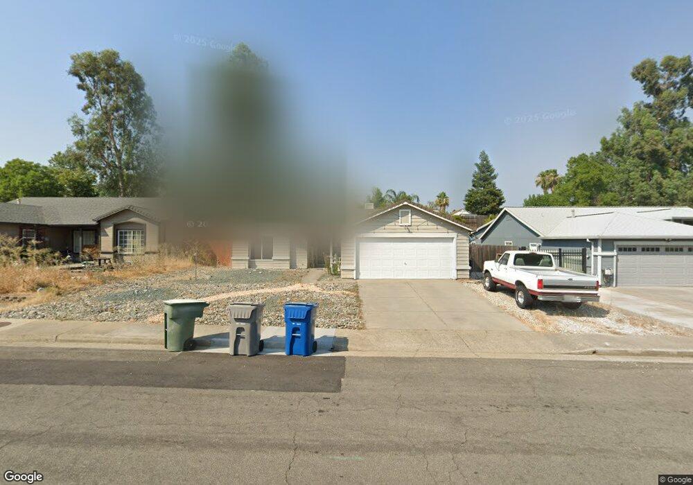
1017 Grouse Dr Redding, CA 96003
Boulder Creek NeighborhoodEstimated Value: $358,000 - $382,000
4
Beds
2
Baths
1,485
Sq Ft
$246/Sq Ft
Est. Value
About This Home
This home is located at 1017 Grouse Dr, Redding, CA 96003 and is currently estimated at $365,553, approximately $246 per square foot. 1017 Grouse Dr is a home located in Shasta County with nearby schools including Boulder Creek Elementary School, Enterprise High School, and Montessori Children's House of Shady Oaks.
Ownership History
Date
Name
Owned For
Owner Type
Purchase Details
Closed on
Nov 12, 2007
Sold by
Terhorst Angela P and Thurston Angela P
Bought by
Westlund Robert and Westlund Connie E
Current Estimated Value
Home Financials for this Owner
Home Financials are based on the most recent Mortgage that was taken out on this home.
Original Mortgage
$183,200
Outstanding Balance
$115,733
Interest Rate
6.35%
Mortgage Type
Unknown
Estimated Equity
$249,820
Purchase Details
Closed on
Oct 24, 2003
Sold by
Thurston Angela P
Bought by
Thurston Angela P
Home Financials for this Owner
Home Financials are based on the most recent Mortgage that was taken out on this home.
Original Mortgage
$141,000
Interest Rate
9.25%
Mortgage Type
Unknown
Create a Home Valuation Report for This Property
The Home Valuation Report is an in-depth analysis detailing your home's value as well as a comparison with similar homes in the area
Home Values in the Area
Average Home Value in this Area
Purchase History
| Date | Buyer | Sale Price | Title Company |
|---|---|---|---|
| Westlund Robert | $229,000 | Placer Title Company | |
| Terhorst Angela P | -- | Placer Title Company | |
| Thurston Angela P | -- | Alliance Title Company |
Source: Public Records
Mortgage History
| Date | Status | Borrower | Loan Amount |
|---|---|---|---|
| Open | Westlund Robert | $183,200 | |
| Previous Owner | Thurston Angela P | $141,000 |
Source: Public Records
Tax History
| Year | Tax Paid | Tax Assessment Tax Assessment Total Assessment is a certain percentage of the fair market value that is determined by local assessors to be the total taxable value of land and additions on the property. | Land | Improvement |
|---|---|---|---|---|
| 2025 | $3,267 | $300,778 | $118,207 | $182,571 |
| 2024 | $3,222 | $294,882 | $115,890 | $178,992 |
| 2023 | $3,222 | $289,101 | $113,618 | $175,483 |
| 2022 | $3,131 | $283,434 | $111,391 | $172,043 |
| 2021 | $3,025 | $277,877 | $109,207 | $168,670 |
| 2020 | $2,795 | $255,000 | $50,000 | $205,000 |
| 2019 | $2,718 | $245,000 | $50,000 | $195,000 |
| 2018 | $2,574 | $230,000 | $45,000 | $185,000 |
| 2017 | $2,614 | $225,000 | $45,000 | $180,000 |
| 2016 | $2,468 | $220,000 | $45,000 | $175,000 |
| 2015 | $2,375 | $210,000 | $45,000 | $165,000 |
| 2014 | $2,014 | $175,000 | $35,000 | $140,000 |
Source: Public Records
Map
Nearby Homes
- 1088 Burton Dr
- 1285 Lancers Ln
- 1110 Grouse Dr
- 953 Oakmont Dr
- 771 Flower Ash Ln
- 825 Mission Sierra Ct
- 1991 Tiburon Dr
- 667 Reddington Dr
- 856 Mission de Oro Dr
- 965 Willow Brook Ln
- 1750 Hawthorne Ct
- 651 Mission de Oro Dr
- 531 Fair Hill Dr
- 790 Volcano View Trail
- 1026 Palisades Ave
- 592 Mill Valley Pkwy
- 1018 Pineland Dr
- 1953 Cameo Ct
- 775 Stonebriar Trail
- 720 Stonebriar Trail
- 1023 Grouse Dr
- 1011 Grouse Dr
- 1005 Grouse Dr
- 966 Partridge Dr
- 1029 Grouse Dr
- 960 Partridge Dr
- 972 Partridge Dr
- 1014 Grouse Dr
- 1020 Grouse Dr
- 1008 Grouse Dr
- 954 Partridge Dr
- 1035 Grouse Dr
- 978 Partridge Dr
- 1026 Grouse Dr
- 1255 Gabriel St
- 1255 Gabriel St
- 993 Grouse Dr
- 975 Grouse Dr
- 1032 Grouse Dr
- 948 Partridge Dr
Your Personal Tour Guide
Ask me questions while you tour the home.