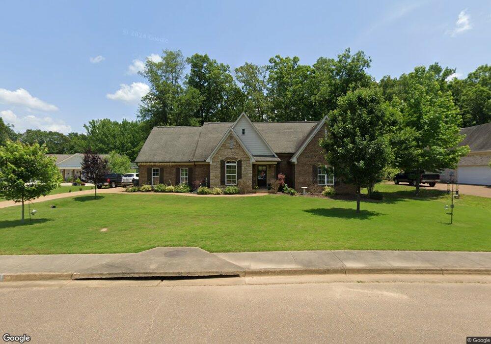
1017 Whitetail Dr Oxford, MS 38655
Estimated Value: $430,000 - $476,000
3
Beds
3
Baths
2,420
Sq Ft
$187/Sq Ft
Est. Value
About This Home
This home is located at 1017 Whitetail Dr, Oxford, MS 38655 and is currently estimated at $453,011, approximately $187 per square foot. 1017 Whitetail Dr is a home located in Lafayette County with nearby schools including Lafayette Elementary School, Lafayette Upper Elementary School, and Lafayette Middle School.
Ownership History
Date
Name
Owned For
Owner Type
Purchase Details
Closed on
Jun 11, 2012
Sold by
Southbank
Bought by
Reichley Christopher M and Richley Amber N
Current Estimated Value
Home Financials for this Owner
Home Financials are based on the most recent Mortgage that was taken out on this home.
Original Mortgage
$185,250
Outstanding Balance
$128,565
Interest Rate
3.86%
Mortgage Type
New Conventional
Estimated Equity
$324,446
Purchase Details
Closed on
Sep 9, 2011
Sold by
Brad Rainey Homes Inc
Bought by
Southbank
Purchase Details
Closed on
Jun 16, 2008
Sold by
Big Leaf Development Llc
Bought by
Brad Rainey Homes Inc
Create a Home Valuation Report for This Property
The Home Valuation Report is an in-depth analysis detailing your home's value as well as a comparison with similar homes in the area
Home Values in the Area
Average Home Value in this Area
Purchase History
| Date | Buyer | Sale Price | Title Company |
|---|---|---|---|
| Reichley Christopher M | -- | None Available | |
| Southbank | $154,000 | None Available | |
| Brad Rainey Homes Inc | -- | None Available |
Source: Public Records
Mortgage History
| Date | Status | Borrower | Loan Amount |
|---|---|---|---|
| Open | Reichley Christopher M | $185,250 |
Source: Public Records
Tax History Compared to Growth
Tax History
| Year | Tax Paid | Tax Assessment Tax Assessment Total Assessment is a certain percentage of the fair market value that is determined by local assessors to be the total taxable value of land and additions on the property. | Land | Improvement |
|---|---|---|---|---|
| 2024 | $3,771 | $34,701 | $0 | $0 |
| 2023 | $3,771 | $34,701 | $0 | $0 |
| 2022 | $3,702 | $34,701 | $0 | $0 |
| 2021 | $3,760 | $34,701 | $0 | $0 |
| 2020 | $3,526 | $33,237 | $0 | $0 |
| 2019 | $3,526 | $33,237 | $0 | $0 |
| 2018 | $3,505 | $32,958 | $0 | $0 |
| 2017 | $3,505 | $32,958 | $0 | $0 |
| 2016 | $3,237 | $30,794 | $0 | $0 |
| 2015 | -- | $30,794 | $0 | $0 |
| 2014 | -- | $30,794 | $0 | $0 |
Source: Public Records
Map
Nearby Homes
- 1023 Whitetail Dr
- 1025 Whitetail Dr
- 1027 White Tail Dr
- 128 Cedar Hill Dr
- 108 Cedar Hill Dr
- 8021 Cart Path Ln
- 8017 Cart Path Ln
- 1817 Atlanta Ave
- TBD Cr 103
- 492 Co Rd 101
- 492 County Road 101
- 1701 Rhett's Dr
- 218 Avalon Ln
- 207 Avalon Ln
- 11 County Road 1057
- 1018 Briarwood Dr
- 100 Heights Dr
- 133 Heights Dr
- 4144 Fieldstone Loop
- 717 Savannah Dr
- 1019 Whitetail Dr
- 1102 Fawn Cove
- 1004 Fawn Cove
- 1021 Whitetail Dr
- 1012 Whitetail Dr
- 1104 Fawn Cove
- 1016 Whitetail Dr
- 1015 Whitetail Dr
- 1020 Whitetail Dr
- 1010 Whitetail Dr
- 1105 Fawn Cove
- 1022 Whitetail Dr
- 1013 Whitetail Dr
- Lot 4 Whitetail Dr
- Lot 9 Whitetail Dr
- Lot 32 Whitetail Dr
- Lot 5 Whitetail Dr
- Lot 31 Whitetail Dr
- Lot 8 Whitetail Dr
- Lot 7 Whitetail Dr