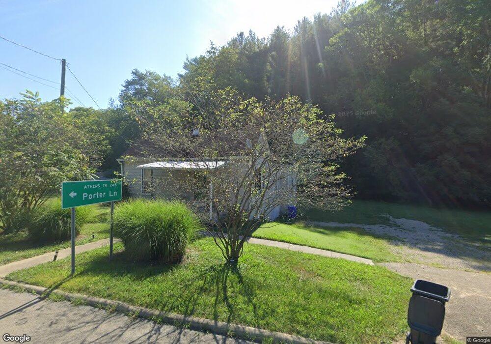
10176 State Route 682 Athens, OH 45701
Estimated Value: $135,540 - $251,000
2
Beds
1
Bath
1,143
Sq Ft
$169/Sq Ft
Est. Value
About This Home
This home is located at 10176 State Route 682, Athens, OH 45701 and is currently estimated at $193,385, approximately $169 per square foot. 10176 State Route 682 is a home located in Athens County with nearby schools including West Elementary School, Athens Middle School, and Athens High School.
Ownership History
Date
Name
Owned For
Owner Type
Purchase Details
Closed on
Oct 31, 2017
Sold by
Sechkar Sam T and Sechkar Jessica
Bought by
Sjs Rentals Llc
Current Estimated Value
Purchase Details
Closed on
Jul 13, 2006
Sold by
Thompson Kelly L
Bought by
Sechkar Samuel T
Home Financials for this Owner
Home Financials are based on the most recent Mortgage that was taken out on this home.
Original Mortgage
$45,200
Interest Rate
6.73%
Mortgage Type
New Conventional
Purchase Details
Closed on
Jan 1, 1989
Create a Home Valuation Report for This Property
The Home Valuation Report is an in-depth analysis detailing your home's value as well as a comparison with similar homes in the area
Home Values in the Area
Average Home Value in this Area
Purchase History
| Date | Buyer | Sale Price | Title Company |
|---|---|---|---|
| Sjs Rentals Llc | -- | Attorney | |
| Sechkar Samuel T | $56,500 | None Available | |
| -- | $33,500 | -- |
Source: Public Records
Mortgage History
| Date | Status | Borrower | Loan Amount |
|---|---|---|---|
| Previous Owner | Sechkar Samuel T | $45,200 |
Source: Public Records
Tax History Compared to Growth
Tax History
| Year | Tax Paid | Tax Assessment Tax Assessment Total Assessment is a certain percentage of the fair market value that is determined by local assessors to be the total taxable value of land and additions on the property. | Land | Improvement |
|---|---|---|---|---|
| 2024 | $5,628 | $28,710 | $10,240 | $18,470 |
| 2023 | $1,790 | $28,710 | $10,240 | $18,470 |
| 2022 | $1,379 | $23,440 | $8,660 | $14,780 |
| 2021 | $1,422 | $23,440 | $8,660 | $14,780 |
| 2020 | $1,312 | $23,440 | $8,660 | $14,780 |
| 2019 | $1,241 | $21,160 | $7,510 | $13,650 |
| 2018 | $1,204 | $21,160 | $7,510 | $13,650 |
| 2017 | $1,965 | $21,160 | $7,510 | $13,650 |
| 2016 | $1,028 | $19,510 | $6,830 | $12,680 |
| 2015 | $1,948 | $19,510 | $6,830 | $12,680 |
| 2014 | $1,948 | $19,510 | $6,830 | $12,680 |
| 2013 | $1,853 | $19,020 | $6,830 | $12,190 |
Source: Public Records
Map
Nearby Homes
- 10639 Ohio 682
- 10639 State Route 682
- 8175 Vore Ridge Rd
- 115 University Estates Blvd
- 0 Luhrig Rd
- 0 S Plains Rd
- 4-20 Beech Rd
- 0 Carol Ln Unit 2433046
- 0 Shady Ln
- 7 W 2nd St
- 550 W Union St
- 8850 Lavelle Rd
- 36 Johnson Rd
- 8750 Lavelle Rd
- 5 Oak St
- 98 Central Ave
- 56.15/15.5 Central & Clark
- 15 S Shafer St Unit 1509
- 15 S Shafer St Unit 303
- 8488 Windfall Ridge
- 10198 State Route 682
- 10175 Porter Ln
- 10204 State Route 682
- 10212 Porter Ln
- 10109 State Route 682
- 10216 Porter Ln
- 10226 Porter Ln
- 10106 State Route 682
- 10233 Porter Ln
- 10233 Porter Ln
- 10000 State Route 682
- 10242 Porter Ln
- 10242 Porter Ln
- 10245 Porter Ln
- 10245 Porter Ln
- 10295 State Route 682
- 10005 State Route 682
- 10304 State Route 682
- 9949 State Route 682
- 9946 State Route 682