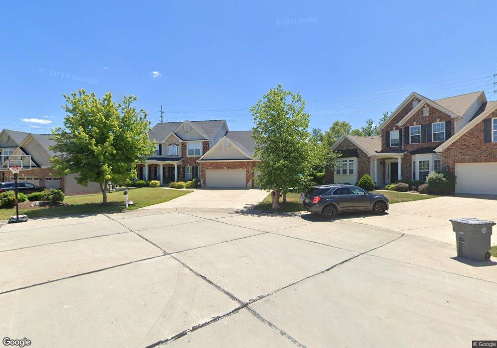
1018 Brook Mont Dr O Fallon, MO 63366
Estimated Value: $546,023 - $614,000
4
Beds
4
Baths
3,290
Sq Ft
$175/Sq Ft
Est. Value
About This Home
This home is located at 1018 Brook Mont Dr, O Fallon, MO 63366 and is currently estimated at $574,256, approximately $174 per square foot. 1018 Brook Mont Dr is a home located in St. Charles County with nearby schools including Ostmann Elementary School, Fort Zumwalt West Middle School, and Fort Zumwalt West High School.
Ownership History
Date
Name
Owned For
Owner Type
Purchase Details
Closed on
Oct 7, 2005
Sold by
Mckelvey Homes Llc
Bought by
Schaeperkoetter Seth A and Schaeperkoetter Samantha J
Current Estimated Value
Home Financials for this Owner
Home Financials are based on the most recent Mortgage that was taken out on this home.
Original Mortgage
$307,800
Outstanding Balance
$159,965
Interest Rate
5.69%
Mortgage Type
Fannie Mae Freddie Mac
Estimated Equity
$414,291
Create a Home Valuation Report for This Property
The Home Valuation Report is an in-depth analysis detailing your home's value as well as a comparison with similar homes in the area
Home Values in the Area
Average Home Value in this Area
Purchase History
| Date | Buyer | Sale Price | Title Company |
|---|---|---|---|
| Schaeperkoetter Seth A | $385,892 | Ust |
Source: Public Records
Mortgage History
| Date | Status | Borrower | Loan Amount |
|---|---|---|---|
| Open | Schaeperkoetter Seth A | $307,800 |
Source: Public Records
Tax History
| Year | Tax Paid | Tax Assessment Tax Assessment Total Assessment is a certain percentage of the fair market value that is determined by local assessors to be the total taxable value of land and additions on the property. | Land | Improvement |
|---|---|---|---|---|
| 2025 | $6,332 | $102,585 | -- | -- |
| 2023 | $6,335 | $96,124 | $0 | $0 |
| 2022 | $5,598 | $79,016 | $0 | $0 |
| 2021 | $5,603 | $79,016 | $0 | $0 |
| 2020 | $5,572 | $76,045 | $0 | $0 |
| 2019 | $5,585 | $76,045 | $0 | $0 |
| 2018 | $5,570 | $72,424 | $0 | $0 |
| 2017 | $5,516 | $72,424 | $0 | $0 |
| 2016 | $4,991 | $65,277 | $0 | $0 |
| 2015 | $4,640 | $65,277 | $0 | $0 |
| 2014 | $4,284 | $59,240 | $0 | $0 |
Source: Public Records
Map
Nearby Homes
- 6 Sage Meadows Ct
- 113 Royal Troon Dr
- 126 Royal Troon Dr
- New Build Berkshire II "D" @ Inverness
- 128 Royal Troon Dr
- New Build Berkshire "A" @ Inverness
- TBB Glenwyck "A"@inverness
- New Build Berkshire "C" @ Inverness
- 322 Kingsbarns Ct
- 143 Royal Troon Dr
- 142 Royal Troon Dr
- 239 Kerry Downs Dr
- 321 Kingsbarns Ct
- 11 Warchol Ct
- 152 Royal Troon Dr
- 610 Cruden Bay Ct
- 1723 Monet Dr
- 107 Royal Inverness Pkwy
- 1455 Norwood Hills Dr
- 2132 Bates Rd
- 1016 Brook Mont Dr
- 1020 Brook Mont Dr
- 1014 Brook Mont Dr
- 1022 Brook Mont Dr
- 1015 Brook Mont Dr
- 1019 Brook Mont Dr
- 1012 Brook Mont Dr
- 5 Jura Ct
- 1013 Brook Mont Dr
- 1025 Brook Mont Dr
- 1026 Brook Mont Dr
- 1010 Brook Mont Dr
- 0 Stump Rd Unit 15039001
- 0 Stump Rd Unit 90010191
- 0 Stump Rd Unit 11041031
- 0 Stump Rd Unit 13045700
- 34 Brook Mont Ct
- 1077 Brook Mont Dr
- 1027 Brook Mont Dr
- 1028 Brook Mont Dr
Your Personal Tour Guide
Ask me questions while you tour the home.