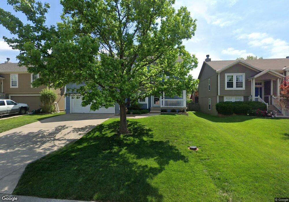
1018 N Clinton St Olathe, KS 66061
Estimated Value: $377,003 - $389,000
3
Beds
3
Baths
1,690
Sq Ft
$227/Sq Ft
Est. Value
About This Home
This home is located at 1018 N Clinton St, Olathe, KS 66061 and is currently estimated at $383,001, approximately $226 per square foot. 1018 N Clinton St is a home located in Johnson County with nearby schools including Fairview Elementary School, Summit Trail Middle School, and Olathe Northwest High School.
Ownership History
Date
Name
Owned For
Owner Type
Purchase Details
Closed on
Dec 23, 2011
Sold by
Clark Thomas W and Clark Amanda
Bought by
Clark Thomas W and Clark Amanda
Current Estimated Value
Home Financials for this Owner
Home Financials are based on the most recent Mortgage that was taken out on this home.
Original Mortgage
$128,800
Outstanding Balance
$9,871
Interest Rate
3.37%
Mortgage Type
New Conventional
Estimated Equity
$373,130
Purchase Details
Closed on
Jun 24, 2003
Sold by
Supple Duane W and Supple Nancy L
Bought by
Clark Thomas W
Home Financials for this Owner
Home Financials are based on the most recent Mortgage that was taken out on this home.
Original Mortgage
$168,298
Interest Rate
5.44%
Mortgage Type
FHA
Create a Home Valuation Report for This Property
The Home Valuation Report is an in-depth analysis detailing your home's value as well as a comparison with similar homes in the area
Home Values in the Area
Average Home Value in this Area
Purchase History
| Date | Buyer | Sale Price | Title Company |
|---|---|---|---|
| Clark Thomas W | -- | Platinum Title Llc | |
| Clark Thomas W | -- | Security Land Title Company |
Source: Public Records
Mortgage History
| Date | Status | Borrower | Loan Amount |
|---|---|---|---|
| Open | Clark Thomas W | $128,800 | |
| Closed | Clark Thomas W | $168,298 |
Source: Public Records
Tax History
| Year | Tax Paid | Tax Assessment Tax Assessment Total Assessment is a certain percentage of the fair market value that is determined by local assessors to be the total taxable value of land and additions on the property. | Land | Improvement |
|---|---|---|---|---|
| 2025 | $4,283 | $40,365 | $7,084 | $33,281 |
| 2023 | $4,059 | $35,512 | $6,441 | $29,071 |
| 2022 | $3,687 | $31,406 | $5,859 | $25,547 |
| 2021 | $3,435 | $27,842 | $5,328 | $22,514 |
| 2020 | $3,400 | $27,313 | $5,328 | $21,985 |
| 2019 | $3,197 | $25,530 | $5,104 | $20,426 |
| 2018 | $3,094 | $24,541 | $4,432 | $20,109 |
| 2017 | $3,083 | $24,196 | $4,432 | $19,764 |
| 2016 | $2,657 | $21,424 | $3,867 | $17,557 |
| 2015 | $2,656 | $21,424 | $3,867 | $17,557 |
| 2013 | -- | $21,022 | $3,867 | $17,155 |
Source: Public Records
Map
Nearby Homes
- 1010 N Clinton St
- 1024 N Marion St
- 1034 N Parker Terrace
- 1051 W Ashbury St
- 20952 W 125th Terrace
- 12683 S Belford St
- 612 N Logan St
- 12391 S Parker Terrace
- 1220 N Leeview Cir
- 12376 S Quail Ridge Dr
- 12280 S Crest Dr
- 709 N Woodland St
- 12344 S Sagebrush Dr
- 21738 W 123rd Terrace
- 12187 S Troost St
- 625 N Stevenson St
- 900 N Walker Ln
- 12132 S Redbud Ln
- 525 N Stevenson St
- 725 N Hamilton St
- 1022 N Clinton St
- 1014 N Clinton St
- 1026 N Clinton St
- 1012 N Clinton St
- 1057 N Logan St
- 1061 N Logan St
- 1053 N Logan St
- 1030 N Clinton St
- 1017 N Clinton St
- 1065 N Logan St
- 1013 N Clinton St
- 1021 N Clinton St
- 1009 N Clinton St
- 1047 N Logan St
- 1025 N Clinton St
- 1034 N Clinton St
- 1008 N Clinton St
- 1005 N Clinton St
- 1069 N Logan St
- 1029 N Clinton St
Your Personal Tour Guide
Ask me questions while you tour the home.