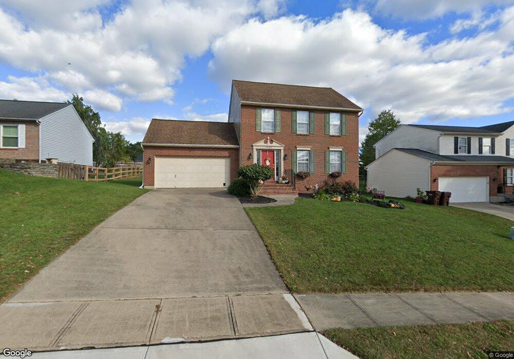
10185 Falcon Ridge Dr Independence, KY 41051
Estimated Value: $307,000 - $324,000
3
Beds
3
Baths
1,568
Sq Ft
$201/Sq Ft
Est. Value
About This Home
This home is located at 10185 Falcon Ridge Dr, Independence, KY 41051 and is currently estimated at $314,765, approximately $200 per square foot. 10185 Falcon Ridge Dr is a home located in Kenton County with nearby schools including Kenton Elementary School, Simon Kenton High School, and St. Cecilia Catholic School.
Ownership History
Date
Name
Owned For
Owner Type
Purchase Details
Closed on
Dec 1, 1998
Sold by
Deters Josh
Bought by
Proffitt Rebecca D and Proffitt Stephen W
Current Estimated Value
Home Financials for this Owner
Home Financials are based on the most recent Mortgage that was taken out on this home.
Original Mortgage
$97,600
Outstanding Balance
$20,939
Interest Rate
6.95%
Mortgage Type
New Conventional
Estimated Equity
$293,826
Purchase Details
Closed on
Mar 27, 1996
Sold by
Falcon Ridge Dev
Bought by
Deters Builders
Create a Home Valuation Report for This Property
The Home Valuation Report is an in-depth analysis detailing your home's value as well as a comparison with similar homes in the area
Home Values in the Area
Average Home Value in this Area
Purchase History
| Date | Buyer | Sale Price | Title Company |
|---|---|---|---|
| Proffitt Rebecca D | $122,000 | -- | |
| Deters Builders | $22,000 | -- |
Source: Public Records
Mortgage History
| Date | Status | Borrower | Loan Amount |
|---|---|---|---|
| Open | Proffitt Rebecca D | $97,600 |
Source: Public Records
Tax History
| Year | Tax Paid | Tax Assessment Tax Assessment Total Assessment is a certain percentage of the fair market value that is determined by local assessors to be the total taxable value of land and additions on the property. | Land | Improvement |
|---|---|---|---|---|
| 2025 | $2,841 | $244,300 | $35,000 | $209,300 |
| 2024 | $2,189 | $178,700 | $30,000 | $148,700 |
| 2023 | $2,255 | $178,700 | $30,000 | $148,700 |
| 2022 | $2,317 | $178,700 | $30,000 | $148,700 |
| 2021 | $2,351 | $178,700 | $30,000 | $148,700 |
| 2020 | $2,054 | $152,100 | $30,000 | $122,100 |
| 2019 | $2,059 | $152,100 | $30,000 | $122,100 |
| 2018 | $2,070 | $152,100 | $30,000 | $122,100 |
| 2017 | $2,014 | $152,100 | $30,000 | $122,100 |
| 2015 | $1,954 | $152,100 | $30,000 | $122,100 |
| 2014 | $1,927 | $152,100 | $30,000 | $122,100 |
Source: Public Records
Map
Nearby Homes
- 10422 Flintrock Bluff
- 1197 Catletts Ct
- 10690 Melbury Ct Unit 305GL
- 10700 Melbury Ct
- 1217 Cannonball Way
- 800 Berlander Dr
- 10654 Sinclair Dr
- 1202 Wellford Dr
- 9877 Flagstone Dr
- 1247 Monocacy Ct
- 1211 Wellford Dr
- 10362 Petersburg Ct
- 10213 Highmeadow Ln
- 1381 Poplartree Place
- 1748 Cherry Blossom Dr
- 1707 Cherry Blossom Dr
- 1727 Cherry Blossom Dr
- 1739 Cherry Blossom Dr
- 1736 Cherry Blossom Dr
- 1727 Cherry Blossom Dr
- 10181 Falcon Ridge Dr
- 10189 Falcon Ridge Dr
- 10177 Falcon Ridge Dr
- 10186 Hiddenknoll Dr
- 10193 Falcon Ridge Dr
- 10190 Hiddenknoll Dr
- 10182 Hiddenknoll Dr
- 10192 Falcon Ridge Dr
- 10184 Falcon Ridge Dr
- 10178 Hiddenknoll Dr
- 10173 Falcon Ridge Dr
- 10180 Falcon Ridge Dr
- 10201 Falcon Ridge Dr
- 10200 Falcon Ridge Dr
- 10194 Hiddenknoll Dr
- 10174 Hiddenknoll Dr
- 10197 Falcon Ridge Dr
- 10169 Falcon Ridge Dr
- 10174 Falcon Ridge Dr
- 10205 Falcon Ridge Dr
Your Personal Tour Guide
Ask me questions while you tour the home.