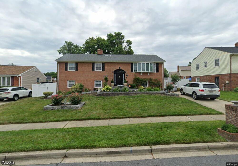
102 Chartsey St Upper Marlboro, MD 20774
Estimated Value: $354,667 - $444,000
Studio
3
Baths
1,352
Sq Ft
$298/Sq Ft
Est. Value
About This Home
This home is located at 102 Chartsey St, Upper Marlboro, MD 20774 and is currently estimated at $402,417, approximately $297 per square foot. 102 Chartsey St is a home located in Prince George's County with nearby schools including Perrywood Elementary School, Kettering Middle School, and Largo High School.
Ownership History
Date
Name
Owned For
Owner Type
Purchase Details
Closed on
Dec 14, 1993
Sold by
Young Dannie E
Bought by
Clarke Gemma T
Current Estimated Value
Home Financials for this Owner
Home Financials are based on the most recent Mortgage that was taken out on this home.
Original Mortgage
$142,861
Interest Rate
6.78%
Purchase Details
Closed on
Nov 14, 1973
Sold by
Maryland Community
Bought by
Young Dannie E and Young Blinda J
Create a Home Valuation Report for This Property
The Home Valuation Report is an in-depth analysis detailing your home's value as well as a comparison with similar homes in the area
Home Values in the Area
Average Home Value in this Area
Purchase History
| Date | Buyer | Sale Price | Title Company |
|---|---|---|---|
| Clarke Gemma T | $146,000 | -- | |
| Young Dannie E | $45,600 | -- |
Source: Public Records
Mortgage History
| Date | Status | Borrower | Loan Amount |
|---|---|---|---|
| Closed | Clarke Gemma T | $142,861 |
Source: Public Records
Tax History
| Year | Tax Paid | Tax Assessment Tax Assessment Total Assessment is a certain percentage of the fair market value that is determined by local assessors to be the total taxable value of land and additions on the property. | Land | Improvement |
|---|---|---|---|---|
| 2025 | $4,720 | $390,700 | $101,100 | $289,600 |
| 2024 | $4,720 | $375,833 | -- | -- |
| 2023 | $4,574 | $360,967 | $0 | $0 |
| 2022 | $4,365 | $346,100 | $101,100 | $245,000 |
| 2021 | $4,105 | $316,167 | $0 | $0 |
| 2020 | $3,945 | $286,233 | $0 | $0 |
| 2019 | $3,776 | $256,300 | $100,500 | $155,800 |
| 2018 | $3,641 | $241,467 | $0 | $0 |
| 2017 | $3,529 | $226,633 | $0 | $0 |
| 2016 | -- | $211,800 | $0 | $0 |
| 2015 | $3,187 | $211,800 | $0 | $0 |
| 2014 | $3,187 | $211,800 | $0 | $0 |
Source: Public Records
Map
Nearby Homes
- 12812 Staton Ct
- 12912 Princeleigh St
- 13008 Mears Ct
- 13108 Keverton Dr
- 13001 Payton Dr
- 12709 Whiteholm Dr
- 12916 Fox Bow Dr Unit 304
- 12916 Fox Bow Dr Unit 107
- 12602 Darlenen St
- 12708 Whiteholm Dr
- 13216 Fox Bow Dr Unit 405
- 13216 Fox Bow Dr Unit 403
- 13216 Fox Bow Dr Unit 305
- 13914 New Acadia Ln
- 12900 Fox Bow Dr Unit 206
- 14000 New Acadia Ln Unit 106
- 14040 New Acadia Ln Unit 406
- 14040 New Acadia Ln Unit 107
- 14040 New Acadia Ln Unit 105
- 13301 New Acadia Ln Unit 109
- 104 Chartsey St
- 100 Chartsey St
- 105 Essenton Dr
- 103 Essenton Dr
- 107 Essenton Dr
- 101 Essenton Dr
- 101 Chartsey St
- 106 Chartsey St
- 105 Chartsey St
- 109 Essenton Dr
- 107 Chartsey St
- 12903 Cambleton Dr
- 108 Chartsey St
- 12906 Cambleton Dr
- 12904 Cambleton Dr
- 12908 Cambleton Dr
- 109 Chartsey St
- 106 Essenton Dr
- 104 Essenton Dr
- 108 Essenton Dr
Your Personal Tour Guide
Ask me questions while you tour the home.