Estimated Value: $134,000 - $1,319,052
--
Bed
--
Bath
64
Sq Ft
$11,352/Sq Ft
Est. Value
About This Home
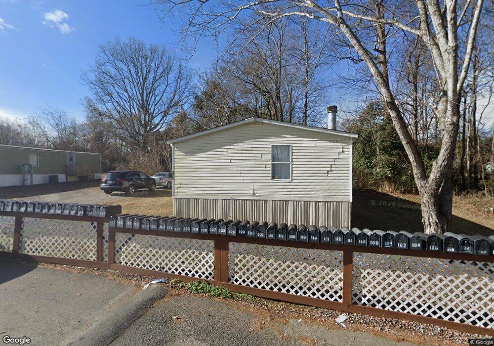
This home is located at 102 Countryside Cir, Moore, SC 29369 and is currently estimated at $726,526, approximately $11,351 per square foot. 102 Countryside Cir is a home located in Spartanburg County with nearby schools including Dorman High School Freshman Campus, Dorman High School, and Westgate Christian School.
Ownership History
Date
Name
Owned For
Owner Type
Purchase Details
Closed on
Nov 21, 2017
Sold by
Carolina Partneers Llc
Bought by
Acg Country Side Llc
Current Estimated Value
Purchase Details
Closed on
May 21, 2014
Sold by
Freedom Real Estate Llc
Bought by
Carolina Partners Llc and Sc Caroline Partners Llc
Purchase Details
Closed on
Mar 20, 2008
Sold by
Griffin James T
Bought by
Freedom Real Estate Llc
Create a Home Valuation Report for This Property
The Home Valuation Report is an in-depth analysis detailing your home's value as well as a comparison with similar homes in the area
Home Values in the Area
Average Home Value in this Area
Purchase History
| Date | Buyer | Sale Price | Title Company |
|---|---|---|---|
| Acg Country Side Llc | $500,000 | None Available | |
| Carolina Partners Llc | -- | -- | |
| Carolina Partners Llc | $675,000 | -- | |
| Freedom Real Estate Llc | $550,000 | Attorney |
Source: Public Records
Tax History Compared to Growth
Tax History
| Year | Tax Paid | Tax Assessment Tax Assessment Total Assessment is a certain percentage of the fair market value that is determined by local assessors to be the total taxable value of land and additions on the property. | Land | Improvement |
|---|---|---|---|---|
| 2025 | $14,501 | $40,548 | $14,910 | $25,638 |
| 2024 | $14,501 | $40,548 | $14,910 | $25,638 |
| 2023 | $14,501 | $40,548 | $14,910 | $25,638 |
| 2022 | $14,126 | $37,500 | $13,800 | $23,700 |
| 2021 | $13,976 | $37,500 | $13,800 | $23,700 |
| 2020 | $13,901 | $37,500 | $13,800 | $23,700 |
| 2019 | $13,714 | $30,000 | $10,296 | $19,704 |
| 2018 | $10,971 | $30,000 | $10,296 | $19,704 |
| 2017 | $344 | $29,340 | $7,896 | $21,444 |
| 2016 | $345 | $29,340 | $7,896 | $21,444 |
| 2015 | $10,360 | $29,340 | $7,896 | $21,444 |
| 2014 | $9,989 | $28,920 | $7,896 | $21,024 |
Source: Public Records
Map
Nearby Homes
- 309 Stratford Rd
- 2708 Millhone Dr
- ATWOOD Plan at Hampshire Heights
- HUNTINGTON Plan at Hampshire Heights
- JOSIE Plan at Hampshire Heights
- GIBSON Plan at Hampshire Heights
- 2011 Lachaise Ln
- 105 Peccole Pass
- 2160 Davenport Ct
- 2208 Davenport Ct
- 2209 Davenport Ct
- 2054 Lachaise Ln
- 131 Linville Dr
- 348 Prosperity Ln
- 221 Angel Rose Dr
- 2236 Davenport Ct
- 2240 Davenport Ct
- 2244 Davenport Ct
- 2601 Karkinnen Way
- Reynolds Plan at Hampshire Heights
- 121 Countryside Cir
- 301 Wintergreen Terrace
- 303 Wintergreen Terrace
- 205 Wintergreen Terrace
- 437 Litchfield Dr
- 203 Wintergreen Terrace
- 305 Wintergreen Terrace
- 441 Litchfield Dr
- 201 Wintergreen Terrace
- 445 Litchfield Dr
- 544 Yorktown Place
- 449 Litchfield Dr
- 433 Litchfield Dr
- 117 Charlestown Ct
- 302 Wintergreen Terrace
- 116 Charlestown Ct
- 300 Wintergreen Terrace
- 540 Yorktown Place
- 113 Wintergreen Terrace
- 540 Yorktown Rd