Estimated Value: $607,586 - $960,000
4
Beds
4
Baths
3,172
Sq Ft
$240/Sq Ft
Est. Value
About This Home
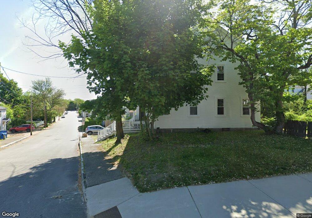
This home is located at 102 Locust St, Dover, NH 03820 and is currently estimated at $762,647, approximately $240 per square foot. 102 Locust St is a home located in Strafford County with nearby schools including Woodman Park School, Dover Middle School, and Dover Senior High School.
Ownership History
Date
Name
Owned For
Owner Type
Purchase Details
Closed on
Sep 30, 2022
Sold by
Starbranch Harry N
Bought by
102 Locust Street Llc
Current Estimated Value
Purchase Details
Closed on
May 14, 1998
Sold by
Dixon Myra B
Bought by
Starbranch Harry N
Home Financials for this Owner
Home Financials are based on the most recent Mortgage that was taken out on this home.
Original Mortgage
$108,000
Interest Rate
7.08%
Create a Home Valuation Report for This Property
The Home Valuation Report is an in-depth analysis detailing your home's value as well as a comparison with similar homes in the area
Home Values in the Area
Average Home Value in this Area
Purchase History
| Date | Buyer | Sale Price | Title Company |
|---|---|---|---|
| 102 Locust Street Llc | -- | None Available | |
| Starbranch Harry N | $120,000 | -- |
Source: Public Records
Mortgage History
| Date | Status | Borrower | Loan Amount |
|---|---|---|---|
| Previous Owner | Starbranch Harry N | $200,000 | |
| Previous Owner | Starbranch Harry N | $108,000 |
Source: Public Records
Tax History Compared to Growth
Tax History
| Year | Tax Paid | Tax Assessment Tax Assessment Total Assessment is a certain percentage of the fair market value that is determined by local assessors to be the total taxable value of land and additions on the property. | Land | Improvement |
|---|---|---|---|---|
| 2024 | $13,504 | $743,200 | $174,600 | $568,600 |
| 2023 | $11,792 | $630,600 | $149,600 | $481,000 |
| 2022 | $11,483 | $578,800 | $141,300 | $437,500 |
| 2021 | $11,462 | $528,200 | $141,300 | $386,900 |
| 2020 | $10,566 | $425,200 | $128,800 | $296,400 |
| 2019 | $9,887 | $392,500 | $116,400 | $276,100 |
| 2018 | $9,270 | $372,000 | $103,900 | $268,100 |
| 2017 | $8,423 | $325,600 | $79,000 | $246,600 |
| 2016 | $7,532 | $286,500 | $69,200 | $217,300 |
| 2015 | $7,036 | $264,400 | $64,900 | $199,500 |
| 2014 | $6,877 | $264,400 | $64,900 | $199,500 |
| 2011 | $7,003 | $278,800 | $83,200 | $195,600 |
Source: Public Records
Map
Nearby Homes
- 20-22 Kirkland St
- 0 Hemlock Rd Unit 5059998
- 58 Saint Thomas St
- 73 Cricketbrook
- 93 Henry Law Ave Unit 61
- 93 Henry Law Ave Unit 29
- 93 Henry Law Ave Unit Cricket Brook Condo
- 79 Silver St
- 4 Little Bay Dr
- 36 Little Bay Dr
- 22 Little Bay Dr
- 98 Henry Law Ave Unit 28
- 18 S Pine St
- 98 Silver St
- 25 School St Unit 7
- 206 Locust St
- 32 Lenox Dr Unit D
- 15 Lenox Dr Unit A
- 25 Lenox Dr Unit A
- 21 Lenox Dr Unit A
- 24 Kirkland St
- 13 Church St
- 3 Academy St
- 22 Kirkland St Unit B
- 9 Academy St
- 5 Academy St
- 5 Academy St
- 21 Kirkland St
- 20 Kirkland St Unit 22
- 86 Locust St
- 84 Locust St
- 14 Church St Unit 2
- 14 Church St
- 113 Locust St
- 8 Academy St
- 4 Church St
- 12-14 Church St
- 11-13 Kirkland St
- 12 Church St Unit 14
- 12 Church St