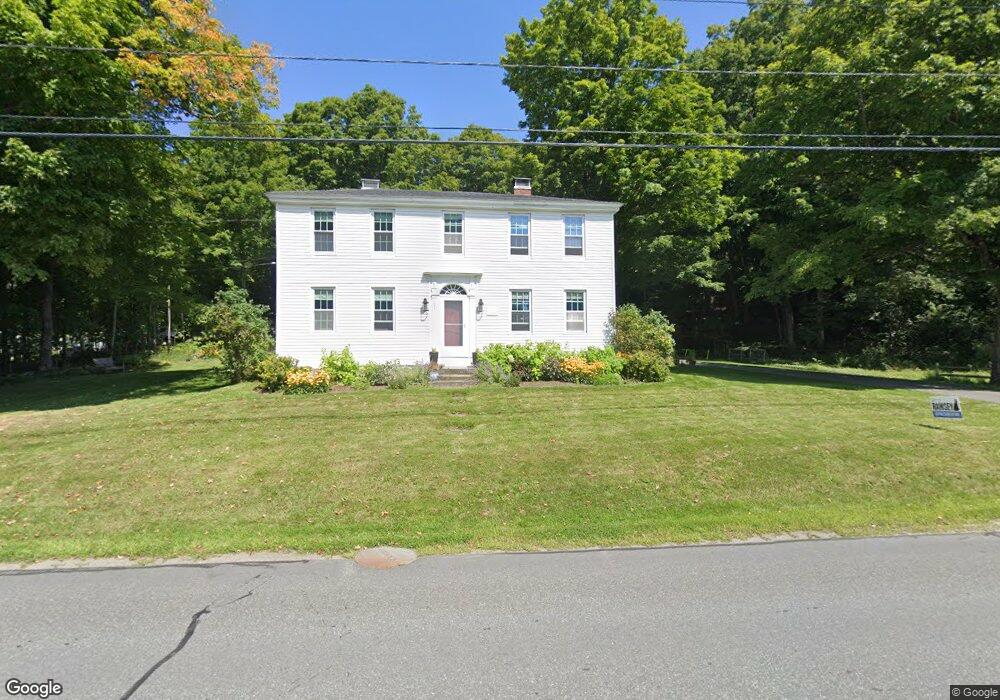
102 Main St Plainfield, NH 03781
Estimated Value: $483,000 - $742,000
3
Beds
2
Baths
2,497
Sq Ft
$234/Sq Ft
Est. Value
About This Home
This home is located at 102 Main St, Plainfield, NH 03781 and is currently estimated at $583,586, approximately $233 per square foot. 102 Main St is a home located in Sullivan County with nearby schools including Plainfield Elementary School, Lebanon High School, and Kimball Union Academy.
Ownership History
Date
Name
Owned For
Owner Type
Purchase Details
Closed on
Sep 13, 2017
Sold by
Boynton Ryan F and Boynton Emily R
Bought by
Ryan F & E R Boynton Ret
Current Estimated Value
Purchase Details
Closed on
Dec 15, 2010
Sold by
Demarest Christopher I and Gillespie Laura L
Bought by
Boynton Ryan F and Boynton Emily R
Home Financials for this Owner
Home Financials are based on the most recent Mortgage that was taken out on this home.
Original Mortgage
$151,300
Interest Rate
4.23%
Mortgage Type
Purchase Money Mortgage
Purchase Details
Closed on
Jul 7, 1998
Sold by
Salisbury Joseph M and Salisbury Julia M
Bought by
Demarest Christopher I
Home Financials for this Owner
Home Financials are based on the most recent Mortgage that was taken out on this home.
Original Mortgage
$101,500
Interest Rate
7.04%
Mortgage Type
Purchase Money Mortgage
Create a Home Valuation Report for This Property
The Home Valuation Report is an in-depth analysis detailing your home's value as well as a comparison with similar homes in the area
Home Values in the Area
Average Home Value in this Area
Purchase History
| Date | Buyer | Sale Price | Title Company |
|---|---|---|---|
| Ryan F & E R Boynton Ret | -- | -- | |
| Boynton Ryan F | $178,000 | -- | |
| Demarest Christopher I | $145,000 | -- |
Source: Public Records
Mortgage History
| Date | Status | Borrower | Loan Amount |
|---|---|---|---|
| Previous Owner | Demarest Christopher I | $167,000 | |
| Previous Owner | Demarest Christopher I | $20,000 | |
| Previous Owner | Demarest Christopher I | $151,300 | |
| Previous Owner | Demarest Christopher I | $101,500 |
Source: Public Records
Tax History
| Year | Tax Paid | Tax Assessment Tax Assessment Total Assessment is a certain percentage of the fair market value that is determined by local assessors to be the total taxable value of land and additions on the property. | Land | Improvement |
|---|---|---|---|---|
| 2023 | $8,105 | $514,600 | $157,800 | $356,800 |
| 2022 | $6,081 | $244,200 | $57,500 | $186,700 |
| 2021 | $6,409 | $241,400 | $54,700 | $186,700 |
| 2020 | $6,132 | $241,400 | $54,700 | $186,700 |
| 2019 | $6,276 | $241,400 | $54,700 | $186,700 |
| 2018 | $7,186 | $241,400 | $54,700 | $186,700 |
| 2017 | $6,899 | $249,000 | $57,100 | $191,900 |
| 2016 | $6,722 | $237,100 | $57,100 | $180,000 |
| 2015 | $6,505 | $238,700 | $57,100 | $181,600 |
| 2014 | $6,564 | $238,700 | $57,100 | $181,600 |
| 2013 | $6,564 | $238,700 | $57,100 | $181,600 |
Source: Public Records
Map
Nearby Homes
- 0 3.2 Bean Rd
- 0 Camp Rd Unit 7
- 22 King Dr
- 00 Willow Brook Rd Unit 5
- 1041 Stage Rd
- 94 Porter Rd
- 8 Laclair Dr
- 41 Foliage View Rd
- 846 Route 12a
- 00 New Hampshire 12a Unit 7
- 0 Hetzel Rd Unit 100
- 1106 Route 12a
- 00 Miller Pond Rd
- 19 Spruce Park Dr
- 15 Churchill Way
- 0 Meriden Rd Unit 5065034
- 49 Clay Hill Rd
- 48 Nottingham Cir
- 34 Meadow Brook Rd
- 116 Smith Pond Rd
- 133 Main St
- 147 Main St
- 109 Main St
- 101 Main St
- 155 Main St
- 0 Bonner Rd Lot B Unit 4311354
- 118 Main St
- 113 Main St
- 165 Main St
- 15 Mitchell Dr
- 126 Main St
- 134 Main St
- 21 Bonner Rd
- 52 Bonner Rd
- 135 Main St
- 146 Main St
- 8 Baynes Rd
- 0 Baynes Rd Unit 8 4501994
- 0 Baynes Rd Unit 7 4501981
- 0 Baynes Rd Unit 8 4779392
Your Personal Tour Guide
Ask me questions while you tour the home.