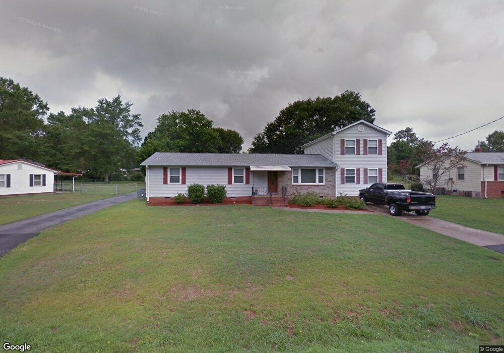
102 Mauldin Cir Mauldin, SC 29662
Estimated Value: $150,000 - $178,833
3
Beds
2
Baths
1,012
Sq Ft
$166/Sq Ft
Est. Value
About This Home
This home is located at 102 Mauldin Cir, Mauldin, SC 29662 and is currently estimated at $168,458, approximately $166 per square foot. 102 Mauldin Cir is a home located in Greenville County with nearby schools including Bethel Elementary School, Mauldin Middle School, and Mauldin High School.
Ownership History
Date
Name
Owned For
Owner Type
Purchase Details
Closed on
Mar 26, 2020
Sold by
Robinson Craig L
Bought by
Robinson Craig L
Current Estimated Value
Purchase Details
Closed on
May 28, 2008
Sold by
Wilson Jimmy R
Bought by
Robinson Craig Lee
Home Financials for this Owner
Home Financials are based on the most recent Mortgage that was taken out on this home.
Original Mortgage
$86,500
Interest Rate
6%
Mortgage Type
Purchase Money Mortgage
Create a Home Valuation Report for This Property
The Home Valuation Report is an in-depth analysis detailing your home's value as well as a comparison with similar homes in the area
Home Values in the Area
Average Home Value in this Area
Purchase History
| Date | Buyer | Sale Price | Title Company |
|---|---|---|---|
| Robinson Craig L | -- | None Available | |
| Robinson Craig L | -- | None Available | |
| Robinson Craig Lee | $64,900 | -- |
Source: Public Records
Mortgage History
| Date | Status | Borrower | Loan Amount |
|---|---|---|---|
| Closed | Robinson Craig Lee | $86,500 |
Source: Public Records
Tax History
| Year | Tax Paid | Tax Assessment Tax Assessment Total Assessment is a certain percentage of the fair market value that is determined by local assessors to be the total taxable value of land and additions on the property. | Land | Improvement |
|---|---|---|---|---|
| 2025 | $661 | $3,910 | $1,390 | $2,520 |
| 2024 | $661 | $3,400 | $970 | $2,430 |
| 2023 | $635 | $3,400 | $970 | $2,430 |
| 2022 | $599 | $3,400 | $970 | $2,430 |
| 2021 | $599 | $3,400 | $970 | $2,430 |
| 2020 | $562 | $2,960 | $840 | $2,120 |
| 2019 | $562 | $2,960 | $840 | $2,120 |
| 2018 | $561 | $2,960 | $840 | $2,120 |
| 2017 | $561 | $2,960 | $840 | $2,120 |
| 2016 | $532 | $73,890 | $21,000 | $52,890 |
| 2015 | $532 | $73,890 | $21,000 | $52,890 |
| 2014 | $517 | $72,252 | $17,684 | $54,568 |
Source: Public Records
Map
Nearby Homes
- 105 Mauldin Cir
- 242 Santorini Way
- 254 Santorini Way
- 123 Hyde Cir
- 145 Oak Park Dr
- 227 E Butler Rd
- 72 Ridgestone Cir
- 58 Ridgestone Cir
- 111 Oak Park Dr
- 48 Ridgestone Cir
- 212 Barrett Dr
- 120 Shadecrest Dr
- 201 Fern Hollow Way
- 113 Carlton Dr
- 9 Endeavor Cir
- 33 Endeavor Cir
- 312 Mimosa Dr
- 68 Endeavor Cir
- 702 Central Ave
- 311 Birchwood Ln
- 104 Mauldin Cir
- 100 Mauldin Cir
- 128 Sunrise Dr
- 106 Mauldin Cir
- 126 Sunrise Dr
- 130 Sunrise Dr
- 214 Hyde Cir
- 103 Mauldin Cir
- 107 Mauldin Cir
- 212 Hyde Cir
- 108 Mauldin Cir
- 101 Mauldin Cir
- 122 Mauldin Cir
- 122 Sunrise Dr
- 210 Hyde Cir
- 131 Sunrise Dr
- 216 Hyde Cir
- 110 Mauldin Cir
- 129 Sunrise Dr
- 120 Mauldin Cir
Your Personal Tour Guide
Ask me questions while you tour the home.