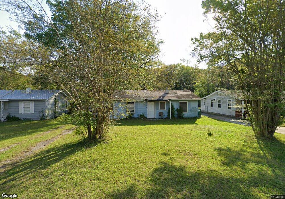
102 Phillips Ave Savannah, GA 31407
Estimated Value: $103,000 - $165,000
3
Beds
1
Bath
1,056
Sq Ft
$131/Sq Ft
Est. Value
About This Home
This home is located at 102 Phillips Ave, Savannah, GA 31407 and is currently estimated at $137,979, approximately $130 per square foot. 102 Phillips Ave is a home located in Chatham County with nearby schools including Otis J. Brock, III Elementary School and Groves High School.
Ownership History
Date
Name
Owned For
Owner Type
Purchase Details
Closed on
May 24, 2019
Sold by
Lowery Tommy Keith
Bought by
Oberry Michael Wade and Oberry Shannon Lee
Current Estimated Value
Purchase Details
Closed on
Sep 29, 2016
Sold by
Wade Michael
Bought by
Lowery Rachel Leah and Lowrey Tommy Keith
Home Financials for this Owner
Home Financials are based on the most recent Mortgage that was taken out on this home.
Original Mortgage
$55,000
Interest Rate
2.77%
Mortgage Type
New Conventional
Create a Home Valuation Report for This Property
The Home Valuation Report is an in-depth analysis detailing your home's value as well as a comparison with similar homes in the area
Home Values in the Area
Average Home Value in this Area
Purchase History
| Date | Buyer | Sale Price | Title Company |
|---|---|---|---|
| Oberry Michael Wade | -- | -- | |
| Lowery Rachel Leah | $55,000 | -- |
Source: Public Records
Mortgage History
| Date | Status | Borrower | Loan Amount |
|---|---|---|---|
| Previous Owner | Lowery Rachel Leah | $55,000 |
Source: Public Records
Tax History
| Year | Tax Paid | Tax Assessment Tax Assessment Total Assessment is a certain percentage of the fair market value that is determined by local assessors to be the total taxable value of land and additions on the property. | Land | Improvement |
|---|---|---|---|---|
| 2025 | $1,297 | $35,000 | $16,000 | $19,000 |
| 2024 | $9 | $19,520 | $8,000 | $11,520 |
| 2023 | $946 | $19,520 | $8,000 | $11,520 |
| 2022 | $793 | $32,680 | $8,000 | $24,680 |
| 2021 | $1,190 | $23,440 | $5,200 | $18,240 |
| 2020 | $373 | $21,720 | $5,200 | $16,520 |
| 2019 | $556 | $21,720 | $5,200 | $16,520 |
| 2018 | $510 | $18,200 | $5,200 | $13,000 |
| 2017 | $524 | $17,600 | $5,200 | $12,400 |
| 2016 | $524 | $16,000 | $5,480 | $10,520 |
| 2015 | $817 | $16,480 | $5,480 | $11,000 |
| 2014 | $846 | $17,000 | $0 | $0 |
Source: Public Records
Map
Nearby Homes
- 113 Commonwealth Ave
- 3 Turnberry St
- 5 Turnberry St
- 211 Osteen St
- 304 Turnberry St
- 208 Cantyre St
- 214 Cantyre St
- 111 Dixie St
- 405 Phillips Ave
- 106 Gordon St
- 410 Turnberry St
- 416 Pinehurst Place
- 414 Phillips Ave
- 1 Coleraine Dr
- 5 Holly St
- 0 Augusta Rd Unit 10689983
- 122 Smith Ave
- 104 Smith Ave
- 19 Smith Ave
- 55 Main St Unit 1, 2, 3, 4, 5, 6
- 100 Phillips Ave
- 104 Phillips Ave
- 106 Phillips Ave
- 4 Phillips Ave
- 108 Phillips Ave
- 2 Phillips Ave
- 3 Phillips Ave
- 101 Phillips Ave
- 103 Phillips Ave
- 110 Phillips Ave
- 105 Phillips Ave
- 107 Phillips Ave
- 112 Phillips Ave
- 1 Phillips Ave
- 109 Phillips Ave
- 100 Commonwealth Ave
- 102 Commonwealth Ave
- 104 Commonwealth Ave
- 6 Commonwealth Ave
- 116 Phillips Ave
Your Personal Tour Guide
Ask me questions while you tour the home.