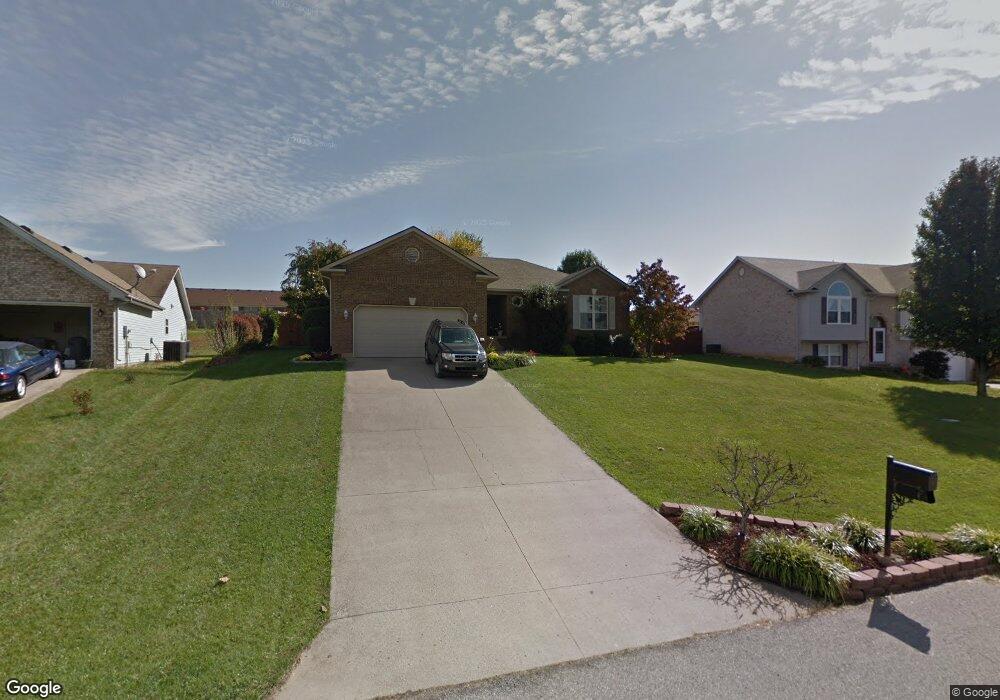
1020 Brookstone Ct Georgetown, IN 47122
Estimated Value: $306,330 - $388,000
3
Beds
2
Baths
1,531
Sq Ft
$225/Sq Ft
Est. Value
About This Home
This home is located at 1020 Brookstone Ct, Georgetown, IN 47122 and is currently estimated at $343,833, approximately $224 per square foot. 1020 Brookstone Ct is a home located in Floyd County with nearby schools including Georgetown Elementary School, Highland Hills Middle School, and Floyd Central High School.
Ownership History
Date
Name
Owned For
Owner Type
Purchase Details
Closed on
Sep 14, 2009
Sold by
Munford Kara and Lieber Joe
Bought by
Munford Kara
Current Estimated Value
Purchase Details
Closed on
Oct 24, 2007
Sold by
Munford Kara A
Bought by
Munford Kara
Home Financials for this Owner
Home Financials are based on the most recent Mortgage that was taken out on this home.
Original Mortgage
$154,400
Interest Rate
6.45%
Mortgage Type
New Conventional
Purchase Details
Closed on
Oct 27, 2006
Sold by
Belden Robert E and Belden Deborah D
Bought by
Munford Kara A
Home Financials for this Owner
Home Financials are based on the most recent Mortgage that was taken out on this home.
Original Mortgage
$143,920
Interest Rate
7%
Mortgage Type
Assumption
Create a Home Valuation Report for This Property
The Home Valuation Report is an in-depth analysis detailing your home's value as well as a comparison with similar homes in the area
Home Values in the Area
Average Home Value in this Area
Purchase History
| Date | Buyer | Sale Price | Title Company |
|---|---|---|---|
| Munford Kara | -- | None Available | |
| Munford Kara | -- | None Available | |
| Munford Kara A | -- | Agency Title |
Source: Public Records
Mortgage History
| Date | Status | Borrower | Loan Amount |
|---|---|---|---|
| Previous Owner | Munford Kara | $154,400 | |
| Previous Owner | Munford Kara A | $143,920 |
Source: Public Records
Tax History Compared to Growth
Tax History
| Year | Tax Paid | Tax Assessment Tax Assessment Total Assessment is a certain percentage of the fair market value that is determined by local assessors to be the total taxable value of land and additions on the property. | Land | Improvement |
|---|---|---|---|---|
| 2024 | $2,792 | $298,500 | $29,600 | $268,900 |
| 2023 | $2,395 | $267,800 | $29,600 | $238,200 |
| 2022 | $2,268 | $236,900 | $29,600 | $207,300 |
| 2021 | $2,044 | $217,900 | $29,600 | $188,300 |
| 2020 | $2,014 | $220,300 | $29,600 | $190,700 |
| 2019 | $1,824 | $207,700 | $29,600 | $178,100 |
| 2018 | $1,675 | $193,100 | $29,600 | $163,500 |
| 2017 | $1,535 | $172,500 | $29,600 | $142,900 |
| 2016 | $1,254 | $156,300 | $29,600 | $126,700 |
| 2014 | $1,496 | $158,700 | $29,600 | $129,100 |
| 2013 | -- | $156,000 | $29,600 | $126,400 |
Source: Public Records
Map
Nearby Homes
- 1034 Brookstone Ct
- 3006 Zachary Trail
- 4046 Oakstone Dr
- 2022 Brookstone Way
- 7014 Dylan Cir
- 491 Baylor Wissman Rd
- 1004 Carter Dr
- 1232 Walts Rd
- 8048 Hudson Ln
- Finch Bonus Plan at Knob Hill
- Haylyn 48' Plan at Knob Hill
- Model A Plan at Knob Hill
- Anniston Plan at Knob Hill
- Haylyn Plan at Knob Hill
- Maria Plan at Knob Hill
- Samantha Bonus Plan at Knob Hill
- Juliana Plan at Knob Hill
- Samantha Plan at Knob Hill
- Model F Plan at Knob Hill
- Juliana Bonus Plan at Knob Hill
- 1018 Brookstone Ct
- 1022 Brookstone Ct
- 3018 Brookhill Ct
- 1016 Brookstone Ct
- 3020 Brookhill Ct
- 1024 Brookstone Ct
- 3016 Brookhill Ct
- 1021 Brookstone Ct
- 1023 Brookstone Ct
- 1019 Brookstone Ct
- 3014 Brookhill Ct
- 1014 Brookstone Ct
- 3024 Brookhill Ct
- 1017 Brookstone Ct
- 1025 Brookstone Ct
- 3012 Brookhill Ct
- 1015 Brookstone Ct
- 1012 Brookstone Ct
- 3026 Brookhill Ct Unit 4001
- 1028 Brookstone Ct