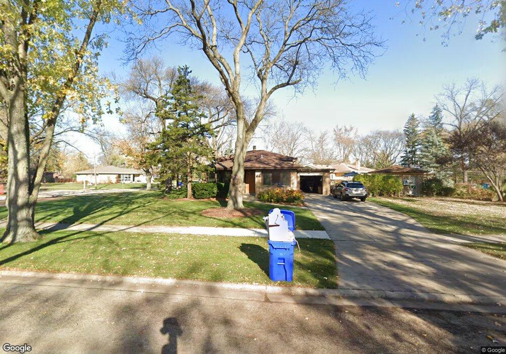
1020 Memory Ct Glen Ellyn, IL 60137
Estimated Value: $522,000 - $560,000
3
Beds
2
Baths
1,973
Sq Ft
$274/Sq Ft
Est. Value
About This Home
This home is located at 1020 Memory Ct, Glen Ellyn, IL 60137 and is currently estimated at $539,966, approximately $273 per square foot. 1020 Memory Ct is a home located in DuPage County with nearby schools including Benjamin Franklin Elementary School, Hadley Junior High School, and Glenbard West High School.
Ownership History
Date
Name
Owned For
Owner Type
Purchase Details
Closed on
Nov 13, 2017
Sold by
Stephanie L Zvirin Trust
Bought by
Fletcher Donald and Lando Laura L
Current Estimated Value
Home Financials for this Owner
Home Financials are based on the most recent Mortgage that was taken out on this home.
Original Mortgage
$323,815
Outstanding Balance
$270,621
Interest Rate
3.75%
Mortgage Type
VA
Estimated Equity
$269,345
Purchase Details
Closed on
Jul 5, 2017
Sold by
Zvirin Stephanie and Zvirin Michael S
Bought by
Zvirin Stephanie L and Stephanie L Zvirin Trust
Purchase Details
Closed on
May 29, 1995
Sold by
Cleereman James P and Cleereman Joanne R
Bought by
Zvirin Michael S and Zvirin Stephanie
Home Financials for this Owner
Home Financials are based on the most recent Mortgage that was taken out on this home.
Original Mortgage
$25,000
Interest Rate
8.26%
Mortgage Type
Purchase Money Mortgage
Create a Home Valuation Report for This Property
The Home Valuation Report is an in-depth analysis detailing your home's value as well as a comparison with similar homes in the area
Home Values in the Area
Average Home Value in this Area
Purchase History
| Date | Buyer | Sale Price | Title Company |
|---|---|---|---|
| Fletcher Donald | $320,000 | First American Title | |
| Zvirin Stephanie L | -- | None Available | |
| Zvirin Michael S | $158,000 | -- |
Source: Public Records
Mortgage History
| Date | Status | Borrower | Loan Amount |
|---|---|---|---|
| Open | Fletcher Donald | $323,815 | |
| Previous Owner | Zvirin Michael S | $25,000 |
Source: Public Records
Tax History
| Year | Tax Paid | Tax Assessment Tax Assessment Total Assessment is a certain percentage of the fair market value that is determined by local assessors to be the total taxable value of land and additions on the property. | Land | Improvement |
|---|---|---|---|---|
| 2024 | $9,272 | $137,788 | $48,475 | $89,313 |
| 2023 | $8,847 | $126,830 | $44,620 | $82,210 |
| 2022 | $8,525 | $119,860 | $42,170 | $77,690 |
| 2021 | $8,197 | $117,020 | $41,170 | $75,850 |
| 2020 | $8,033 | $115,930 | $40,790 | $75,140 |
| 2019 | $7,851 | $112,870 | $39,710 | $73,160 |
| 2018 | $7,455 | $106,670 | $46,230 | $60,440 |
| 2017 | $8,925 | $128,650 | $44,520 | $84,130 |
| 2016 | $9,025 | $123,510 | $42,740 | $80,770 |
| 2015 | $8,980 | $117,830 | $40,770 | $77,060 |
| 2014 | $8,107 | $103,950 | $24,030 | $79,920 |
| 2013 | $8,317 | $104,260 | $24,100 | $80,160 |
Source: Public Records
Map
Nearby Homes
- 326 Indian Dr
- 345 Woodstock Ave
- 882 Hillside Ave
- 255 Grandview Ave
- 476 Longfellow Ave
- 357 Bryant Ave
- 621 W Wilson Ave
- 490 Carleton Ave
- 102 Grove Ave
- 734 Highview Ave
- 134 Woodview Ct
- 554 S Edson Ave
- 877 Crescent Blvd
- 861 Crescent Blvd
- 579 Lee St
- 701 Willis St
- 320 W Harrison Rd
- 563 Taylor Ave
- 1053 S Finley Rd
- 312 W Ethel Ave
Your Personal Tour Guide
Ask me questions while you tour the home.