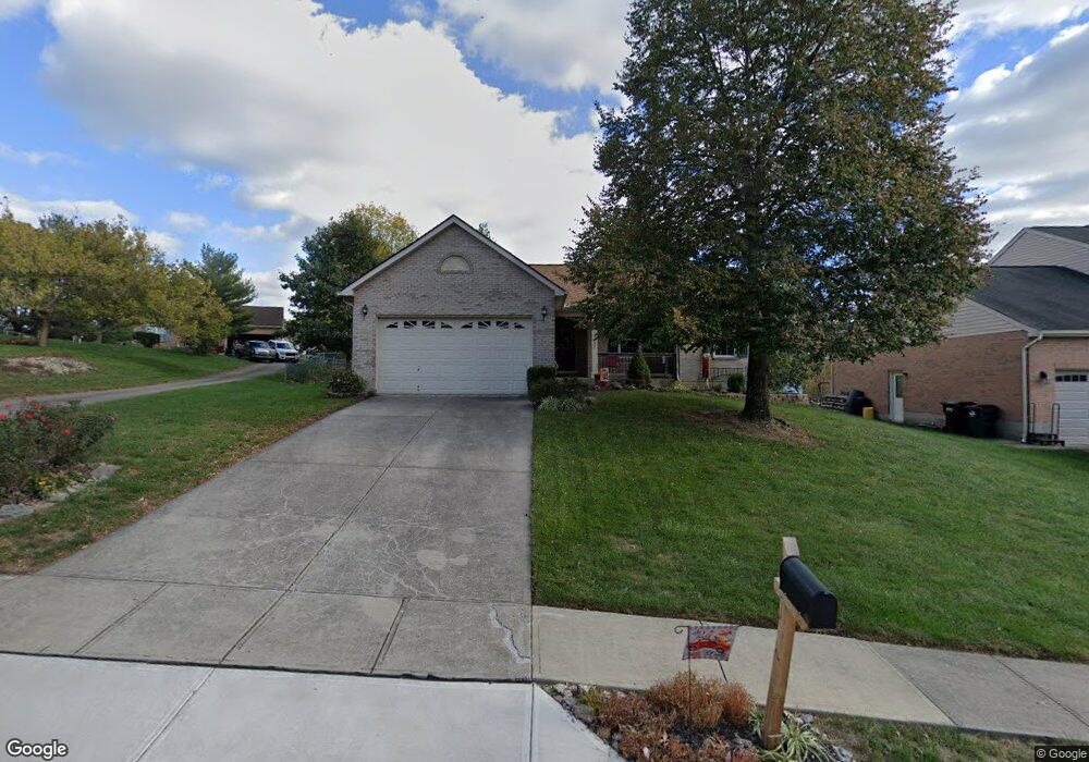
10201 Falcon Ridge Dr Independence, KY 41051
Estimated Value: $273,000 - $297,696
3
Beds
2
Baths
1,260
Sq Ft
$227/Sq Ft
Est. Value
About This Home
This home is located at 10201 Falcon Ridge Dr, Independence, KY 41051 and is currently estimated at $285,674, approximately $226 per square foot. 10201 Falcon Ridge Dr is a home located in Kenton County with nearby schools including Kenton Elementary School, Simon Kenton High School, and St. Cecilia Catholic School.
Ownership History
Date
Name
Owned For
Owner Type
Purchase Details
Closed on
Apr 5, 2019
Sold by
Rison Dorothy
Bought by
Roberts Melvin D and Roberts Dona S
Current Estimated Value
Home Financials for this Owner
Home Financials are based on the most recent Mortgage that was taken out on this home.
Original Mortgage
$157,500
Outstanding Balance
$141,303
Interest Rate
5.37%
Mortgage Type
Adjustable Rate Mortgage/ARM
Estimated Equity
$144,371
Purchase Details
Closed on
Jul 23, 1996
Sold by
Phil Duncan Builder Inc
Bought by
Rison Marion and Rison Dorothy
Purchase Details
Closed on
Jan 9, 1996
Sold by
Phil Duncan Builder Inc
Bought by
Duncan Phil T and Whitton Nancy
Create a Home Valuation Report for This Property
The Home Valuation Report is an in-depth analysis detailing your home's value as well as a comparison with similar homes in the area
Home Values in the Area
Average Home Value in this Area
Purchase History
| Date | Buyer | Sale Price | Title Company |
|---|---|---|---|
| Roberts Melvin D | $157,500 | Bridge Trust Title Group | |
| Rison Marion | $118,900 | -- | |
| Duncan Phil T | $22,000 | -- |
Source: Public Records
Mortgage History
| Date | Status | Borrower | Loan Amount |
|---|---|---|---|
| Open | Roberts Melvin D | $157,500 |
Source: Public Records
Tax History Compared to Growth
Tax History
| Year | Tax Paid | Tax Assessment Tax Assessment Total Assessment is a certain percentage of the fair market value that is determined by local assessors to be the total taxable value of land and additions on the property. | Land | Improvement |
|---|---|---|---|---|
| 2024 | $1,362 | $157,500 | $30,000 | $127,500 |
| 2023 | $1,402 | $157,500 | $30,000 | $127,500 |
| 2022 | $1,543 | $157,500 | $30,000 | $127,500 |
| 2021 | $1,565 | $157,500 | $30,000 | $127,500 |
| 2020 | $2,124 | $157,500 | $30,000 | $127,500 |
| 2019 | $1,454 | $145,000 | $30,000 | $115,000 |
| 2018 | $1,484 | $145,000 | $30,000 | $115,000 |
| 2017 | $1,444 | $145,000 | $30,000 | $115,000 |
| 2015 | $1,406 | $145,000 | $30,000 | $115,000 |
| 2014 | $1,398 | $145,000 | $30,000 | $115,000 |
Source: Public Records
Map
Nearby Homes
- 570 Old Bristow Rd
- 1095 Audas Ct
- 10311 Emancipation Place
- 1119 Brigade Rd
- 10452 Calvary Rd
- 10690 Melbury Ct Unit 305GL
- 10694 Melbury Ct Unit 306GL
- The Westchester Plan at The Greens of Glenhurst
- The Ella Marie Plan at The Greens of Glenhurst
- The Jefferson Plan at The Greens of Glenhurst
- The Leighann Plan at The Greens of Glenhurst
- The Waterson Plan at The Greens of Glenhurst
- The Lancaster Plan at The Greens of Glenhurst
- The Austin Plan at The Greens of Glenhurst
- The Morgan Plan at The Greens of Glenhurst
- The Marietta Plan at The Greens of Glenhurst
- The Camden Plan at The Greens of Glenhurst
- The Lincoln Plan at The Greens of Glenhurst
- The Bristol Plan at The Greens of Glenhurst
- The Livingston Plan at The Greens of Glenhurst
- 10205 Falcon Ridge Dr
- 10193 Falcon Ridge Dr
- 10199 Falcon Ridge Dr
- 10209 Falcon Ridge Dr
- 10189 Falcon Ridge Dr
- 10197 Falcon Ridge Dr
- 10200 Falcon Ridge Dr
- 10192 Falcon Ridge Dr
- 10213 Falcon Ridge Dr
- 10204 Falcon Ridge Dr
- 10190 Hiddenknoll Dr
- 10185 Falcon Ridge Dr
- 10194 Hiddenknoll Dr
- 10184 Falcon Ridge Dr
- 10208 Falcon Ridge Dr
- 10212 Falcon Ridge Dr
- 10217 Falcon Ridge Dr
- 10181 Falcon Ridge Dr
- 10186 Hiddenknoll Dr
- 10180 Falcon Ridge Dr