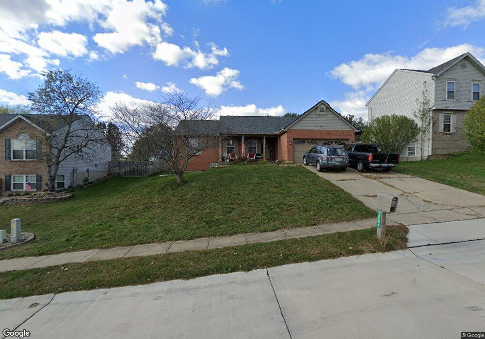
10204 Falcon Ridge Dr Independence, KY 41051
Estimated Value: $273,000 - $296,000
3
Beds
2
Baths
1,207
Sq Ft
$237/Sq Ft
Est. Value
About This Home
This home is located at 10204 Falcon Ridge Dr, Independence, KY 41051 and is currently estimated at $285,593, approximately $236 per square foot. 10204 Falcon Ridge Dr is a home located in Kenton County with nearby schools including Kenton Elementary School, Simon Kenton High School, and St. Cecilia Catholic School.
Ownership History
Date
Name
Owned For
Owner Type
Purchase Details
Closed on
Mar 31, 2011
Sold by
Steve Curley Construction Inc
Bought by
Mcdaniel Kevin G and Mcdaniel Jennifer L
Current Estimated Value
Home Financials for this Owner
Home Financials are based on the most recent Mortgage that was taken out on this home.
Original Mortgage
$124,755
Outstanding Balance
$86,362
Interest Rate
4.95%
Mortgage Type
FHA
Estimated Equity
$199,231
Purchase Details
Closed on
Sep 19, 1995
Sold by
Falcon Ridge Dev
Bought by
Steve Curley Const Inc
Create a Home Valuation Report for This Property
The Home Valuation Report is an in-depth analysis detailing your home's value as well as a comparison with similar homes in the area
Home Values in the Area
Average Home Value in this Area
Purchase History
| Date | Buyer | Sale Price | Title Company |
|---|---|---|---|
| Mcdaniel Kevin G | $128,000 | Springdale Title Llc | |
| Steve Curley Const Inc | $22,000 | -- |
Source: Public Records
Mortgage History
| Date | Status | Borrower | Loan Amount |
|---|---|---|---|
| Open | Mcdaniel Kevin G | $124,755 |
Source: Public Records
Tax History Compared to Growth
Tax History
| Year | Tax Paid | Tax Assessment Tax Assessment Total Assessment is a certain percentage of the fair market value that is determined by local assessors to be the total taxable value of land and additions on the property. | Land | Improvement |
|---|---|---|---|---|
| 2024 | $1,842 | $150,400 | $30,000 | $120,400 |
| 2023 | $1,898 | $150,400 | $30,000 | $120,400 |
| 2022 | $1,962 | $150,400 | $30,000 | $120,400 |
| 2021 | $1,990 | $150,400 | $30,000 | $120,400 |
| 2020 | $1,740 | $128,000 | $30,000 | $98,000 |
| 2019 | $1,745 | $128,000 | $30,000 | $98,000 |
| 2018 | $1,754 | $128,000 | $30,000 | $98,000 |
| 2017 | $1,707 | $128,000 | $30,000 | $98,000 |
| 2015 | $1,654 | $128,000 | $30,000 | $98,000 |
| 2014 | $1,631 | $128,000 | $30,000 | $98,000 |
Source: Public Records
Map
Nearby Homes
- 570 Old Bristow Rd
- 10311 Emancipation Place
- 1095 Audas Ct
- 1119 Brigade Rd
- 10452 Calvary Rd
- 10690 Melbury Ct Unit 305GL
- 10694 Melbury Ct Unit 306GL
- The Westchester Plan at The Greens of Glenhurst
- The Ella Marie Plan at The Greens of Glenhurst
- The Jefferson Plan at The Greens of Glenhurst
- The Leighann Plan at The Greens of Glenhurst
- The Waterson Plan at The Greens of Glenhurst
- The Lancaster Plan at The Greens of Glenhurst
- The Austin Plan at The Greens of Glenhurst
- The Morgan Plan at The Greens of Glenhurst
- The Marietta Plan at The Greens of Glenhurst
- The Camden Plan at The Greens of Glenhurst
- The Lincoln Plan at The Greens of Glenhurst
- The Bristol Plan at The Greens of Glenhurst
- The Livingston Plan at The Greens of Glenhurst
- 10200 Falcon Ridge Dr
- 10208 Falcon Ridge Dr
- 10192 Falcon Ridge Dr
- 10212 Falcon Ridge Dr
- 1033 Falcon Ct
- 10205 Falcon Ridge Dr
- 10209 Falcon Ridge Dr
- 10184 Falcon Ridge Dr
- 1039 Falcon Ct
- 1027 Falcon Ct
- 1039 Falcon C Ct
- 10201 Falcon Ridge Dr
- 10216 Falcon Ridge Dr
- 10213 Falcon Ridge Dr
- 10180 Falcon Ridge Dr
- 10193 Falcon Ridge Dr
- 10189 Falcon Ridge Dr
- 10217 Falcon Ridge Dr
- 10185 Falcon Ridge Dr
- 10199 Falcon Ridge Dr