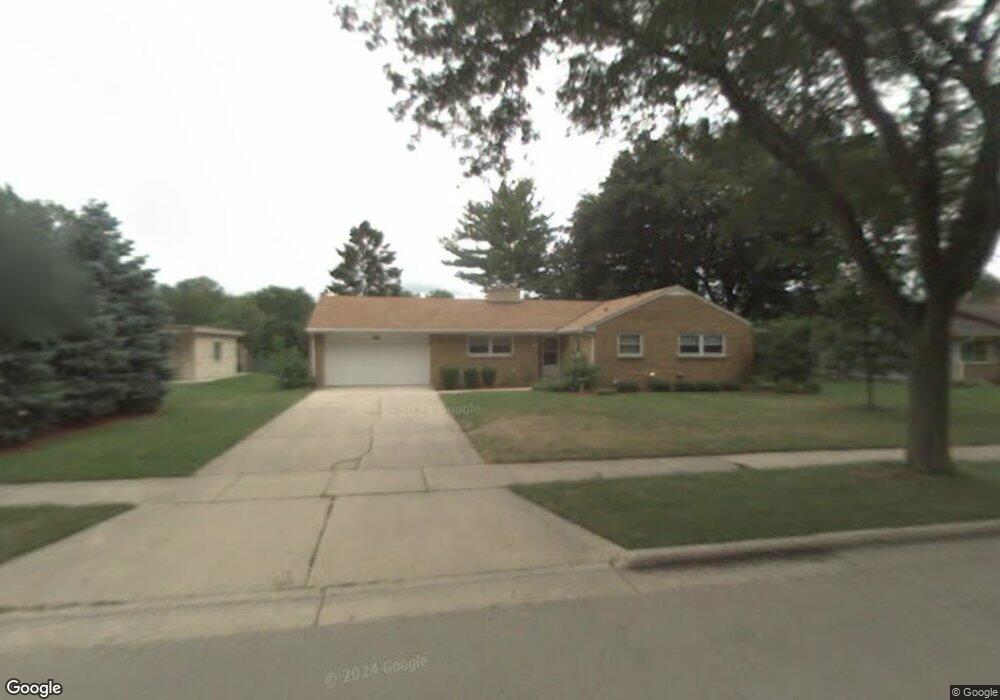
1021 Windsor Dr Waukesha, WI 53186
Estimated Value: $358,000 - $378,000
3
Beds
2
Baths
1,519
Sq Ft
$244/Sq Ft
Est. Value
About This Home
This home is located at 1021 Windsor Dr, Waukesha, WI 53186 and is currently estimated at $370,602, approximately $243 per square foot. 1021 Windsor Dr is a home located in Waukesha County with nearby schools including Waukesha STEM Academy, Les Paul Middle School - Central Campus, and South High School.
Ownership History
Date
Name
Owned For
Owner Type
Purchase Details
Closed on
Aug 2, 2012
Sold by
Woodburn Berniece M
Bought by
Silldorff Andy Robert and Silldorff Rebecca Ann
Current Estimated Value
Home Financials for this Owner
Home Financials are based on the most recent Mortgage that was taken out on this home.
Original Mortgage
$141,941
Outstanding Balance
$98,699
Interest Rate
3.75%
Mortgage Type
FHA
Estimated Equity
$271,903
Create a Home Valuation Report for This Property
The Home Valuation Report is an in-depth analysis detailing your home's value as well as a comparison with similar homes in the area
Home Values in the Area
Average Home Value in this Area
Purchase History
| Date | Buyer | Sale Price | Title Company |
|---|---|---|---|
| Silldorff Andy Robert | $154,900 | None Available |
Source: Public Records
Mortgage History
| Date | Status | Borrower | Loan Amount |
|---|---|---|---|
| Open | Silldorff Andy Robert | $141,941 |
Source: Public Records
Tax History Compared to Growth
Tax History
| Year | Tax Paid | Tax Assessment Tax Assessment Total Assessment is a certain percentage of the fair market value that is determined by local assessors to be the total taxable value of land and additions on the property. | Land | Improvement |
|---|---|---|---|---|
| 2024 | $4,301 | $291,600 | $75,000 | $216,600 |
| 2023 | $4,176 | $291,600 | $75,000 | $216,600 |
| 2022 | $4,125 | $216,400 | $69,000 | $147,400 |
| 2021 | $4,219 | $216,400 | $69,000 | $147,400 |
| 2020 | $4,082 | $216,400 | $69,000 | $147,400 |
| 2019 | $3,952 | $216,400 | $69,000 | $147,400 |
| 2018 | $3,735 | $200,400 | $65,100 | $135,300 |
| 2017 | $3,728 | $200,400 | $65,100 | $135,300 |
| 2016 | $3,712 | $187,300 | $65,100 | $122,200 |
| 2015 | $3,691 | $187,300 | $65,100 | $122,200 |
| 2014 | $3,771 | $183,600 | $65,100 | $118,500 |
| 2013 | $3,771 | $183,600 | $65,100 | $118,500 |
Source: Public Records
Map
Nearby Homes
- 1037 Windsor Dr
- 917 E Roberta Ave
- 1422 E Racine Ave
- 125 Tenny Ave
- 715 Cavalier Dr
- 1164 Downing Dr
- 1535 E Racine Ave
- W230S2425 Morningside Dr
- 400 Sheffield Rd Unit 5
- 1343 Hillside Dr
- S21W23079 Hillside Dr
- 403 Midland Ave
- LT1 Sunset View
- 113 Coolidge Ave
- 1432 Tenny Ave Unit 201
- 1337 Camden Way Unit 2
- 1430 Tenny Ave Unit 201
- The Sequoia Plan at Aspen Overlook
- The Sycamore Plan at Aspen Overlook
- 1436 Tenny Ave Unit 101
- 1025 Windsor Dr
- 1013 Windsor Dr
- 1020 Windsor Dr
- 1028 Windsor Dr
- 1012 Windsor Dr
- 1029 Windsor Dr
- 1036 Windsor Dr
- 1005 Windsor Dr
- 411 S Greenfield Ave
- 1022 Oxford Rd
- 1016 Oxford Rd
- 331 S Greenfield Ave
- 1010 Oxford Rd
- 1028 Oxford Rd
- 1104 Windsor Dr
- 412 S Greenfield Ave
- 334 S Greenfield Ave
- 1034 Oxford Rd
- 1002 Oxford Rd
- 1017 Oxford Rd