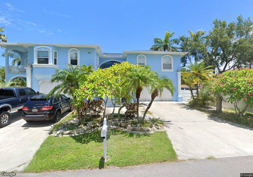
10211 46th Ave W Unit B Bradenton, FL 34210
Estimated Value: $597,000 - $847,860
2
Beds
2
Baths
930
Sq Ft
$805/Sq Ft
Est. Value
About This Home
This home is located at 10211 46th Ave W Unit B, Bradenton, FL 34210 and is currently estimated at $748,715, approximately $805 per square foot. 10211 46th Ave W Unit B is a home located in Manatee County with nearby schools including Sea Breeze Elementary School, W. D. Sugg Middle School, and Bayshore High School.
Ownership History
Date
Name
Owned For
Owner Type
Purchase Details
Closed on
Feb 21, 2022
Sold by
Martha Rinker
Bought by
Rinker Martha and Martin Angelia G
Current Estimated Value
Purchase Details
Closed on
Jul 10, 2020
Sold by
Parker Sharon L and Parker Kyle
Bought by
Rinker Martha
Purchase Details
Closed on
Oct 12, 2018
Sold by
Parker Sharon L
Bought by
Parker Sharon L and Parker Kyle
Purchase Details
Closed on
May 29, 2012
Sold by
Federal National Mortgage Association
Bought by
Parker Sharon L and Bowman James R
Home Financials for this Owner
Home Financials are based on the most recent Mortgage that was taken out on this home.
Original Mortgage
$260,000
Interest Rate
3.9%
Mortgage Type
New Conventional
Purchase Details
Closed on
Jun 1, 2011
Sold by
Henig Max and Henig Cheryl
Bought by
Federal National Mortgage Association
Purchase Details
Closed on
May 9, 2008
Sold by
Henig Max and Henig Cheryl
Bought by
Henig Max and Henig Cheryl
Home Financials for this Owner
Home Financials are based on the most recent Mortgage that was taken out on this home.
Original Mortgage
$489,750
Interest Rate
5.84%
Mortgage Type
New Conventional
Purchase Details
Closed on
Mar 10, 2005
Sold by
Henig Henig Max Max and Henig Laikin J Nell
Bought by
Henig Max and Henig Cheryl
Home Financials for this Owner
Home Financials are based on the most recent Mortgage that was taken out on this home.
Original Mortgage
$443,500
Interest Rate
1%
Mortgage Type
New Conventional
Purchase Details
Closed on
Nov 12, 2004
Sold by
Snyder Earl L and Snyder Michelle L
Bought by
Henig Henig Max Max and Henig Laikin J Nell Tina
Home Financials for this Owner
Home Financials are based on the most recent Mortgage that was taken out on this home.
Original Mortgage
$428,700
Interest Rate
7.25%
Mortgage Type
Purchase Money Mortgage
Purchase Details
Closed on
Jun 8, 2000
Sold by
Brandt Rose M
Bought by
Snyder Earl L
Home Financials for this Owner
Home Financials are based on the most recent Mortgage that was taken out on this home.
Original Mortgage
$152,000
Interest Rate
8.11%
Create a Home Valuation Report for This Property
The Home Valuation Report is an in-depth analysis detailing your home's value as well as a comparison with similar homes in the area
Home Values in the Area
Average Home Value in this Area
Purchase History
| Date | Buyer | Sale Price | Title Company |
|---|---|---|---|
| Rinker Martha | -- | Currin Peter T | |
| Rinker Martha | $475,000 | Attorney | |
| Parker Sharon L | $115,050 | Integrity Title Services Inc | |
| Parker Sharon L | $325,000 | Attorney | |
| Federal National Mortgage Association | $476,300 | Attorney | |
| Henig Max | -- | First American Title Ins Co | |
| Henig Max | -- | First American Title Ins Co | |
| Henig Henig Max Max | $675,000 | Executive Title Ins Svcs Inc | |
| Snyder Earl L | $45,000 | -- |
Source: Public Records
Mortgage History
| Date | Status | Borrower | Loan Amount |
|---|---|---|---|
| Previous Owner | Parker Sharon L | $260,000 | |
| Previous Owner | Henig Max | $489,750 | |
| Previous Owner | Henig Max | $443,500 | |
| Previous Owner | Henig Henig Max Max | $428,700 | |
| Previous Owner | Snyder Earl L | $152,000 |
Source: Public Records
Tax History
| Year | Tax Paid | Tax Assessment Tax Assessment Total Assessment is a certain percentage of the fair market value that is determined by local assessors to be the total taxable value of land and additions on the property. | Land | Improvement |
|---|---|---|---|---|
| 2025 | $10,310 | $627,289 | -- | -- |
| 2023 | $9,271 | $787,047 | $85,000 | $702,047 |
| 2022 | $8,471 | $582,879 | $70,000 | $512,879 |
| 2021 | $7,038 | $428,447 | $65,000 | $363,447 |
| 2020 | $5,769 | $358,113 | $0 | $0 |
| 2019 | $5,660 | $350,124 | $0 | $0 |
| 2018 | $5,546 | $340,940 | $0 | $0 |
| 2017 | $5,071 | $321,820 | $0 | $0 |
| 2016 | $5,035 | $313,816 | $0 | $0 |
| 2015 | $4,945 | $309,348 | $0 | $0 |
| 2014 | $4,945 | $300,133 | $0 | $0 |
| 2013 | $5,681 | $360,708 | $31,481 | $329,227 |
Source: Public Records
Map
Nearby Homes
- 4503 102nd St W
- 10216 46th Ave W
- 4420 101st St W
- 10011 46th Ave W
- 4603 103rd St W
- 10004 Cortez Rd W Unit 209
- 4704 Independence Dr Unit 4704
- 9718 Hernando Ct
- 9811 Hernando Ct
- 9821 Hernando Ct Unit 31A
- 9612 Santa Maria Ct Unit 52-A
- 4515 106th St W
- 9722 Hernando Ct
- 4524 106th St W
- 9820 Royal Palm Dr
- 10777 Cortez Rd W
- 4753 Independence Dr
- 4216 Royal Palm Dr
- 9604 Cortez Rd W Unit 421
- 9604 Cortez Rd W Unit 136
- 10211 46th Ave W
- 10203 46th Ave W Unit A
- 4518 102nd St W
- 4516 102nd St W
- 10217 46th Ave W
- 4512 102nd St W Unit A
- 10121 46th Ave W
- 4506 102nd St W
- 4515 102nd St W
- 4510 102nd St W
- 4510 102nd St W Unit B
- 4510 102nd St W Unit N
- 10119 46th Ave W
- 10305 46th Ave W
- 4513 102nd St W
- 10218 46th Ave W
- 4511 102nd St W
- 4504 102nd St W
- 10111 46th Ave W
- 4507 102nd St W
Your Personal Tour Guide
Ask me questions while you tour the home.