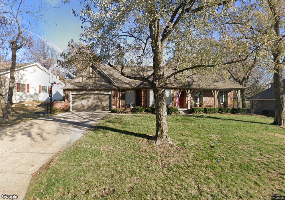
10227 Briar Dr Overland Park, KS 66207
Central Overland Park NeighborhoodEstimated Value: $513,000 - $602,000
4
Beds
3
Baths
2,123
Sq Ft
$260/Sq Ft
Est. Value
About This Home
This home is located at 10227 Briar Dr, Overland Park, KS 66207 and is currently estimated at $551,708, approximately $259 per square foot. 10227 Briar Dr is a home located in Johnson County with nearby schools including Trailwood Elementary School, Shawnee Mission South High School, and Indian Woods Middle School.
Ownership History
Date
Name
Owned For
Owner Type
Purchase Details
Closed on
Oct 23, 2024
Sold by
Scott Michael Richard
Bought by
Scott Kathryn
Current Estimated Value
Purchase Details
Closed on
Sep 18, 2006
Sold by
Rode John P and Rode Sally A
Bought by
Scott Michael R and Scott Kathryn
Home Financials for this Owner
Home Financials are based on the most recent Mortgage that was taken out on this home.
Original Mortgage
$229,600
Interest Rate
6.51%
Mortgage Type
New Conventional
Purchase Details
Closed on
May 12, 2006
Sold by
Reichenbach Mary
Bought by
Rode John P and Rode Sally A
Purchase Details
Closed on
May 30, 2001
Sold by
Howard Robert C and Howard Grace C
Bought by
Howard Robert C and Howard Grace C
Create a Home Valuation Report for This Property
The Home Valuation Report is an in-depth analysis detailing your home's value as well as a comparison with similar homes in the area
Home Values in the Area
Average Home Value in this Area
Purchase History
| Date | Buyer | Sale Price | Title Company |
|---|---|---|---|
| Scott Kathryn | -- | None Listed On Document | |
| Scott Michael R | -- | Chicago Title Ins Co | |
| Rode John P | -- | Chicago Title Ins Co | |
| Howard Robert C | -- | -- |
Source: Public Records
Mortgage History
| Date | Status | Borrower | Loan Amount |
|---|---|---|---|
| Previous Owner | Scott Michael R | $229,600 |
Source: Public Records
Tax History Compared to Growth
Tax History
| Year | Tax Paid | Tax Assessment Tax Assessment Total Assessment is a certain percentage of the fair market value that is determined by local assessors to be the total taxable value of land and additions on the property. | Land | Improvement |
|---|---|---|---|---|
| 2024 | $5,449 | $56,016 | $10,758 | $45,258 |
| 2023 | $5,524 | $56,189 | $9,775 | $46,414 |
| 2022 | $4,995 | $51,187 | $9,775 | $41,412 |
| 2021 | $4,460 | $43,643 | $8,148 | $35,495 |
| 2020 | $4,392 | $43,010 | $6,793 | $36,217 |
| 2019 | $4,305 | $42,194 | $4,850 | $37,344 |
| 2018 | $4,208 | $41,067 | $4,850 | $36,217 |
| 2017 | $4,132 | $39,664 | $4,850 | $34,814 |
| 2016 | $3,861 | $36,467 | $4,850 | $31,617 |
| 2015 | $3,526 | $33,960 | $4,850 | $29,110 |
| 2013 | -- | $32,304 | $4,850 | $27,454 |
Source: Public Records
Map
Nearby Homes
- 10200 Granada Ln
- 9943 Linden St
- 5428 W 102nd St
- 10310 Nall Ave
- 10207 Reeds Dr
- 10240 Catalina St
- 10318 Alhambra St
- 5608 W 100th St
- 9711 Roe Ave
- 5212 W 98th Terrace
- 5507 W 98th Terrace
- 5917 W 101st Terrace
- 9710 Catalina St
- 6109 W 102nd Ct
- 10408 Howe Ln
- 5711 W 98th St
- 5616 W 98th St
- 4120 W 97th Terrace
- 10016 Horton Dr
- 4924 W 96th St
- 10223 Briar Dr
- 10231 Briar Dr
- 10206 Cedar Dr
- 10212 Cedar Dr
- 10212 Cedar St
- 10215 Briar Dr
- 10226 Briar Dr
- 10200 Cedar Dr
- 10235 Briar Dr
- 10222 Briar Dr
- 10230 Briar Dr
- 10218 Briar Dr
- 10218 Cedar Dr
- 10209 Briar Dr
- 10234 Briar Dr
- 5000 W 102nd Terrace
- 10201 Cedar Dr
- 5009 W 102nd Terrace
- 10209 Cedar Dr
- 10215 Cedar Dr