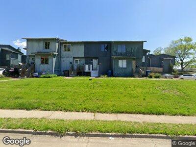
1023 11th St Unit 10 Des Moines, IA 50314
Cheatom Park NeighborhoodEstimated Value: $78,000 - $170,000
2
Beds
1
Bath
976
Sq Ft
$123/Sq Ft
Est. Value
About This Home
This home is located at 1023 11th St Unit 10, Des Moines, IA 50314 and is currently estimated at $120,339, approximately $123 per square foot. 1023 11th St Unit 10 is a home located in Polk County with nearby schools including Moulton Elementary School, Harding Middle School, and North High School.
Ownership History
Date
Name
Owned For
Owner Type
Purchase Details
Closed on
May 19, 2023
Sold by
Outhouse Investments Llc
Bought by
Jaimes Sahori Ali
Current Estimated Value
Purchase Details
Closed on
Jan 11, 2023
Sold by
Brown Brian C
Bought by
Outhouse Investments Llc
Home Financials for this Owner
Home Financials are based on the most recent Mortgage that was taken out on this home.
Original Mortgage
$42,218
Interest Rate
6.49%
Mortgage Type
Construction
Purchase Details
Closed on
Apr 29, 2005
Sold by
Brown Patricia A
Bought by
Brown Brian C
Home Financials for this Owner
Home Financials are based on the most recent Mortgage that was taken out on this home.
Original Mortgage
$51,500
Interest Rate
6.06%
Mortgage Type
Fannie Mae Freddie Mac
Create a Home Valuation Report for This Property
The Home Valuation Report is an in-depth analysis detailing your home's value as well as a comparison with similar homes in the area
Home Values in the Area
Average Home Value in this Area
Purchase History
| Date | Buyer | Sale Price | Title Company |
|---|---|---|---|
| Jaimes Sahori Ali | $58,000 | None Listed On Document | |
| Outhouse Investments Llc | $45,000 | -- | |
| Brown Brian C | $51,000 | -- |
Source: Public Records
Mortgage History
| Date | Status | Borrower | Loan Amount |
|---|---|---|---|
| Previous Owner | Outhouse Investments Llc | $42,218 | |
| Previous Owner | Brown Brian C | $51,500 |
Source: Public Records
Tax History Compared to Growth
Tax History
| Year | Tax Paid | Tax Assessment Tax Assessment Total Assessment is a certain percentage of the fair market value that is determined by local assessors to be the total taxable value of land and additions on the property. | Land | Improvement |
|---|---|---|---|---|
| 2024 | $988 | $50,200 | $16,000 | $34,200 |
| 2023 | $1,062 | $50,200 | $16,000 | $34,200 |
| 2022 | $1,054 | $45,100 | $14,400 | $30,700 |
| 2021 | $1,054 | $45,100 | $14,400 | $30,700 |
| 2020 | $1,094 | $42,200 | $13,500 | $28,700 |
| 2019 | $1,032 | $42,200 | $13,500 | $28,700 |
| 2018 | $1,022 | $38,400 | $12,300 | $26,100 |
| 2017 | $1,038 | $38,400 | $12,300 | $26,100 |
| 2016 | $1,012 | $38,400 | $12,300 | $26,100 |
| 2015 | $1,012 | $38,400 | $12,300 | $26,100 |
| 2014 | $998 | $39,000 | $12,500 | $26,500 |
Source: Public Records
Map
Nearby Homes
- 1116 9th St
- 1343 Keosauqua Way
- 1327 Keosauqua Way
- 1201 Center St Unit C101
- 1201 Center St Unit D101
- 1201 Center St Unit E106
- 1201 Center St Unit B103
- 1201 Center St Unit B102
- 1201 Center St Unit F103
- 1311 10th St
- 1313 13th St
- 1212 15th St
- 930 Forest Ave
- 1203 15th Place
- 1221 Forest Ave
- 1415 11th St
- 842 16th St Unit 4
- 1419 8th St
- 1421 11th St
- 1424 7th St
- 1035 11th St Unit 15
- 1033 11th St Unit 14
- 1031 11th St Unit 13
- 1027 11th St Unit 12
- 1023 11th St Unit 10
- 1021 11th St Unit 9
- 1017 Day St Unit 8
- 1015 Day St Unit 7
- 1013 Day St Unit 6
- 1011 Day St Unit 5
- 1023 11th St Unit 10
- 1025 11th St Unit 11
- 1037 11th St Unit 16
- 1006 Laurel St Unit 17
- 1004 Laurel St Unit 18
- 1002 Laurel St Unit 19
- 1007 Day St Unit 21
- 1000 Laurel St Unit 20
- 1005 Day St Unit 22
- 1003 Day St Unit 23