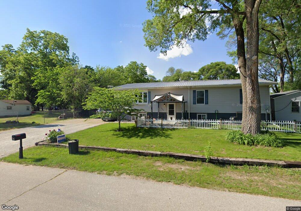
1023 Calhoun St Evansdale, IA 50707
Maywood NeighborhoodEstimated Value: $153,000 - $282,000
3
Beds
2
Baths
1,512
Sq Ft
$155/Sq Ft
Est. Value
About This Home
This home is located at 1023 Calhoun St, Evansdale, IA 50707 and is currently estimated at $234,658, approximately $155 per square foot. 1023 Calhoun St is a home located in Black Hawk County with nearby schools including Highland Elementary School, Bunger Middle School, and East High School.
Ownership History
Date
Name
Owned For
Owner Type
Purchase Details
Closed on
Feb 4, 2022
Sold by
Bierman Holdings Llc
Bought by
Cummings Timothy S and Cummings Kimberli K
Current Estimated Value
Home Financials for this Owner
Home Financials are based on the most recent Mortgage that was taken out on this home.
Original Mortgage
$55,434
Interest Rate
3.45%
Mortgage Type
Credit Line Revolving
Create a Home Valuation Report for This Property
The Home Valuation Report is an in-depth analysis detailing your home's value as well as a comparison with similar homes in the area
Home Values in the Area
Average Home Value in this Area
Purchase History
| Date | Buyer | Sale Price | Title Company |
|---|---|---|---|
| Cummings Timothy S | $55,000 | None Listed On Document |
Source: Public Records
Mortgage History
| Date | Status | Borrower | Loan Amount |
|---|---|---|---|
| Closed | Cummings Timothy S | $55,434 |
Source: Public Records
Tax History Compared to Growth
Tax History
| Year | Tax Paid | Tax Assessment Tax Assessment Total Assessment is a certain percentage of the fair market value that is determined by local assessors to be the total taxable value of land and additions on the property. | Land | Improvement |
|---|---|---|---|---|
| 2024 | $5,034 | $242,320 | $23,250 | $219,070 |
| 2023 | $3,720 | $232,030 | $23,250 | $208,780 |
| 2022 | $3,620 | $178,280 | $23,250 | $155,030 |
| 2021 | $3,484 | $178,280 | $23,250 | $155,030 |
| 2020 | $3,424 | $162,460 | $17,440 | $145,020 |
| 2019 | $3,424 | $162,460 | $17,440 | $145,020 |
| 2018 | $3,122 | $148,710 | $17,440 | $131,270 |
| 2017 | $3,220 | $148,710 | $17,440 | $131,270 |
| 2016 | $3,176 | $148,710 | $17,440 | $131,270 |
| 2015 | $3,176 | $148,710 | $17,440 | $131,270 |
| 2014 | $3,190 | $148,710 | $17,440 | $131,270 |
Source: Public Records
Map
Nearby Homes
- 924 Creston Ave
- 108 Ogden Ave
- 1022 Short St
- 47 Zuma St
- 427 Adrian St
- 1865 Independence Ave
- 1446 Ruth St
- 0 Madison Monroe Unit NBR20253026
- 312 Glendale St
- 1235 Independence Ave
- 0 Skyview Rd Unit NBR20251892
- 2836 Independence Ave
- 312 Skyview Rd
- 211 Madison St
- 1127 Independence Ave
- 1912 Sycamore St
- 326 Highland Blvd
- 244 Wema Ave
- 137 Rhey St
- 421 Miner Dr
- 1035 Calhoun St
- 1228 Dearborn Ave
- 1236 Dearborn Ave
- 1043 Calhoun St
- 1022 Calhoun St
- 1009 Calhoun St
- 719 Gilbert St
- 1010 Calhoun St
- 722 Creston Ave
- 0 Creston Ave
- 1027 Shultz St
- 703 Creston Ave
- 1221 Dearborn Ave
- 605 Gilbert St
- 1109 Calhoun St
- LOT 8 Dearborn St
- 801 Gilbert St
- 724 Gilbert St
- 1213 Dearborn Ave
- 1207 Dearborn Ave