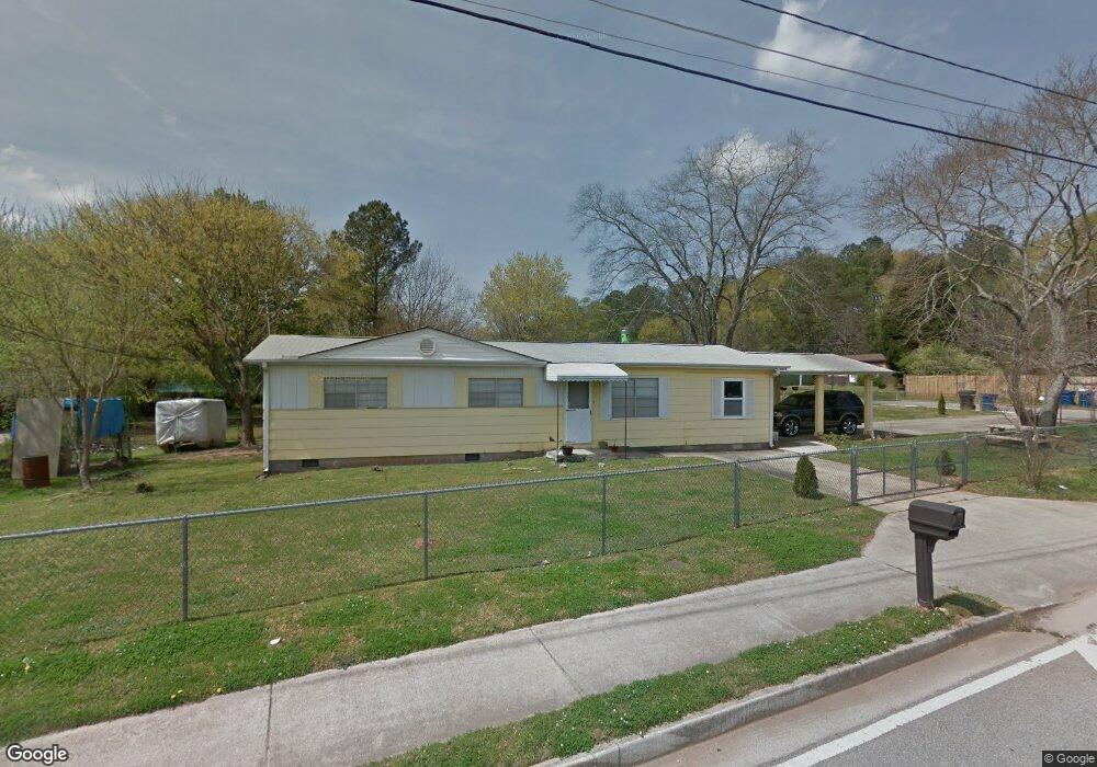
1023 Maxham Rd Austell, GA 30168
Estimated Value: $147,000 - $265,000
2
Beds
1
Bath
1,344
Sq Ft
$160/Sq Ft
Est. Value
About This Home
This home is located at 1023 Maxham Rd, Austell, GA 30168 and is currently estimated at $215,434, approximately $160 per square foot. 1023 Maxham Rd is a home located in Cobb County with nearby schools including Austell Elementary School, Garrett Middle School, and South Cobb High School.
Ownership History
Date
Name
Owned For
Owner Type
Purchase Details
Closed on
Feb 21, 2020
Sold by
Hunt Jessica
Bought by
Medina Cesar Oceana and Montes Stefany Ponce
Current Estimated Value
Purchase Details
Closed on
Jun 27, 2013
Sold by
James Jesse
Bought by
Hunt Jessica
Create a Home Valuation Report for This Property
The Home Valuation Report is an in-depth analysis detailing your home's value as well as a comparison with similar homes in the area
Home Values in the Area
Average Home Value in this Area
Purchase History
| Date | Buyer | Sale Price | Title Company |
|---|---|---|---|
| Medina Cesar Oceana | $50,000 | None Available | |
| Hunt Jessica | -- | -- |
Source: Public Records
Tax History
| Year | Tax Paid | Tax Assessment Tax Assessment Total Assessment is a certain percentage of the fair market value that is determined by local assessors to be the total taxable value of land and additions on the property. | Land | Improvement |
|---|---|---|---|---|
| 2025 | $2,278 | $83,884 | $18,000 | $65,884 |
| 2024 | $2,278 | $83,884 | $18,000 | $65,884 |
| 2023 | $2,278 | $83,884 | $18,000 | $65,884 |
Source: Public Records
Map
Nearby Homes
- 2173 Apple Orchard Way
- 1138 Pontiac Cir Unit 23
- 6083 Oak Hill Dr
- 1045 Elowen Dr
- 1155 Elowen Dr
- 3023 Creekside Overlook Way
- 2090 Old Alabama Rd
- 5790 Maxham Rd
- 2390 Ravencliff Dr Unit 140
- 2390 Ravencliff Dr
- 2370 Ravencliff Dr
- 2370 Ravencliff Dr Unit 138
- 2360 Ravencliff Dr Unit 137
- 2360 Ravencliff Dr
- 2310 Ravencliff Dr
- 2115 Venesa Cir
- 1984 Brenda Dr
- 2414 Old Alabama Rd
- 110 Creekway Dr
- 5818 Eastside Dr
- 1103 Pontiac Cir
- 1021 Maxham Rd
- 2259 Polder Way Unit 95
- 2259 Polder Way
- 1019 Maxham Rd
- 6136 Glade Ct
- 6136 Glade Ct Unit 92
- 1105 Pontiac Cir
- 1025 Maxham Rd
- 1222 Hiawatha Ln
- 6106 Glade Ct Unit 82
- 6106 Glade Ct
- 1104 Pontiac Cir
- 2253 Polder Way
- 1220 Hiawatha Ln
- 6130 Glade Ct
- 1017 Maxham Rd
- 1106 Pontiac Cir
- 6100 Glade Ct Unit 94
- 1218 Hiawatha Ln
Your Personal Tour Guide
Ask me questions while you tour the home.