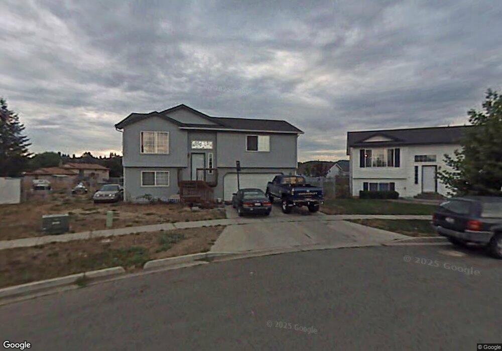
1025 N Townsend Loop Post Falls, ID 83854
Post Falls East NeighborhoodEstimated Value: $420,000 - $448,000
4
Beds
2
Baths
1,561
Sq Ft
$275/Sq Ft
Est. Value
About This Home
This home is located at 1025 N Townsend Loop, Post Falls, ID 83854 and is currently estimated at $429,905, approximately $275 per square foot. 1025 N Townsend Loop is a home with nearby schools including Prairie View Elementary School, Post Falls Middle School, and Post Falls High School.
Ownership History
Date
Name
Owned For
Owner Type
Purchase Details
Closed on
Mar 21, 2025
Sold by
Knapp Craig Richard and Knapp Diana Linn
Bought by
Knapp Family Trust and Knapp
Current Estimated Value
Home Financials for this Owner
Home Financials are based on the most recent Mortgage that was taken out on this home.
Original Mortgage
$40,000
Outstanding Balance
$39,690
Interest Rate
6.87%
Mortgage Type
Credit Line Revolving
Estimated Equity
$390,215
Purchase Details
Closed on
Oct 23, 2024
Sold by
Knapp Craig R and Knapp Diana L
Bought by
Knapp Family Trust and Knapp
Purchase Details
Closed on
Jan 7, 2010
Sold by
Morris John J and Knapp Diana L
Bought by
Knapp Craig R and Knapp Diana L
Home Financials for this Owner
Home Financials are based on the most recent Mortgage that was taken out on this home.
Original Mortgage
$128,001
Interest Rate
4.77%
Mortgage Type
FHA
Create a Home Valuation Report for This Property
The Home Valuation Report is an in-depth analysis detailing your home's value as well as a comparison with similar homes in the area
Home Values in the Area
Average Home Value in this Area
Purchase History
| Date | Buyer | Sale Price | Title Company |
|---|---|---|---|
| Knapp Family Trust | -- | Alliance Title | |
| Knapp Craig Richard | -- | Alliance Title | |
| Knapp Family Trust | -- | None Listed On Document | |
| Knapp Craig R | -- | -- |
Source: Public Records
Mortgage History
| Date | Status | Borrower | Loan Amount |
|---|---|---|---|
| Open | Knapp Craig Richard | $40,000 | |
| Previous Owner | Knapp Craig R | $128,001 |
Source: Public Records
Tax History
| Year | Tax Paid | Tax Assessment Tax Assessment Total Assessment is a certain percentage of the fair market value that is determined by local assessors to be the total taxable value of land and additions on the property. | Land | Improvement |
|---|---|---|---|---|
| 2025 | $1,403 | $379,957 | $178,537 | $201,420 |
| 2024 | $1,323 | $356,910 | $155,250 | $201,660 |
| 2023 | $1,323 | $386,260 | $172,500 | $213,760 |
| 2022 | $1,780 | $408,443 | $172,500 | $235,943 |
| 2021 | $1,452 | $264,130 | $115,000 | $149,130 |
| 2020 | $1,319 | $211,210 | $90,000 | $121,210 |
| 2019 | $1,277 | $193,930 | $80,000 | $113,930 |
| 2018 | $1,252 | $171,900 | $68,000 | $103,900 |
| 2017 | $1,192 | $149,460 | $48,000 | $101,460 |
| 2016 | $1,151 | $136,290 | $40,000 | $96,290 |
| 2015 | $1,105 | $127,590 | $32,000 | $95,590 |
| 2013 | $1,119 | $120,530 | $31,000 | $89,530 |
Source: Public Records
Map
Nearby Homes
- 3683 E Mullan Ave
- NNA E Mullan Ave
- 3414 E 12th Ave
- 3270 E Quad Park Ct
- 1253 N Monticello St
- 1366 N Brookhaven Ln
- 926 N Goldenrod Ct
- 1356 N Highway 41 Unit 6
- 4764 E Seltice Way
- 940 N Harlequin Dr
- 1049 N Bainbridge St
- 352 N Promenade Loop Unit 103
- 3755 E 16th Ave
- 828 N Doryport Ct
- 4502 E Savea Ln
- 4451 E Davin Dr
- 4422 E Savea Ln
- 4519 E Savea Ln
- 4497 E Savea Ln
- 4477 E Davin Dr
- 1035 N Townsend Loop
- 1015 N Townsend Loop
- 1030 N Townsend Loop
- 995 N Townsend Loop
- 1093 N Monarch Ave
- 1099 N Monarch Ave
- 3553 E Jordan Dr
- 3589 E Jordan Dr
- 1010 N Townsend Loop
- 1079 N Monarch Ave
- 1055 N Townsend Loop
- 3605 E Jordan Dr
- 1101 N Monarch Ave
- 0 Townsend Loop
- 1071 N Monarch Ave
- 1080 N Townsend Loop
- 985 N Townsend Loop
- 3545 E Jordan Dr
- 3615 E Jordan Dr
- 1107 N Monarch Ave