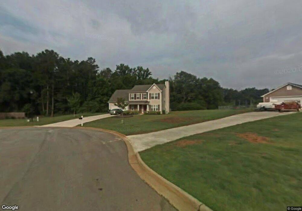
1025 Solomon Ct Winder, GA 30680
Estimated Value: $354,566 - $384,000
3
Beds
3
Baths
2,174
Sq Ft
$172/Sq Ft
Est. Value
About This Home
This home is located at 1025 Solomon Ct, Winder, GA 30680 and is currently estimated at $372,892, approximately $171 per square foot. 1025 Solomon Ct is a home located in Barrow County with nearby schools including Statham Elementary School, Bear Creek Middle School, and Winder-Barrow High School.
Ownership History
Date
Name
Owned For
Owner Type
Purchase Details
Closed on
Sep 23, 2004
Sold by
Valuecraft Hms Inc
Bought by
Mcnamara Lance J and Mcnamara Pamela
Current Estimated Value
Home Financials for this Owner
Home Financials are based on the most recent Mortgage that was taken out on this home.
Original Mortgage
$105,600
Outstanding Balance
$51,967
Interest Rate
5.78%
Mortgage Type
New Conventional
Estimated Equity
$320,925
Purchase Details
Closed on
May 5, 2004
Sold by
Double Brdg Farms Inc
Bought by
Valuecraft Hms Inc
Home Financials for this Owner
Home Financials are based on the most recent Mortgage that was taken out on this home.
Original Mortgage
$99,750
Interest Rate
5.49%
Purchase Details
Closed on
Jan 13, 2003
Bought by
Double Bridges Farms Inc
Create a Home Valuation Report for This Property
The Home Valuation Report is an in-depth analysis detailing your home's value as well as a comparison with similar homes in the area
Home Values in the Area
Average Home Value in this Area
Purchase History
| Date | Buyer | Sale Price | Title Company |
|---|---|---|---|
| Mcnamara Lance J | $130,200 | -- | |
| Valuecraft Hms Inc | $35,100 | -- | |
| Double Bridges Farms Inc | -- | -- |
Source: Public Records
Mortgage History
| Date | Status | Borrower | Loan Amount |
|---|---|---|---|
| Open | Mcnamara Lance J | $105,600 | |
| Closed | Mcnamara Lance J | $26,265 | |
| Previous Owner | Valuecraft Hms Inc | $99,750 |
Source: Public Records
Tax History Compared to Growth
Tax History
| Year | Tax Paid | Tax Assessment Tax Assessment Total Assessment is a certain percentage of the fair market value that is determined by local assessors to be the total taxable value of land and additions on the property. | Land | Improvement |
|---|---|---|---|---|
| 2024 | $2,810 | $113,461 | $22,000 | $91,461 |
| 2023 | $3,228 | $114,061 | $22,000 | $92,061 |
| 2022 | $2,591 | $90,863 | $22,000 | $68,863 |
| 2021 | $2,242 | $74,361 | $16,000 | $58,361 |
| 2020 | $2,243 | $74,361 | $16,000 | $58,361 |
| 2019 | $2,280 | $74,361 | $16,000 | $58,361 |
| 2018 | $2,200 | $72,586 | $11,600 | $60,986 |
| 2017 | $1,824 | $62,638 | $11,600 | $51,038 |
| 2016 | $1,430 | $48,418 | $11,600 | $36,818 |
| 2015 | $1,449 | $48,820 | $11,600 | $37,220 |
| 2014 | $1,331 | $44,483 | $6,860 | $37,623 |
| 2013 | -- | $42,102 | $6,860 | $35,242 |
Source: Public Records
Map
Nearby Homes
- 1023 Solomon Ct
- 1453 Solomon Dr
- 1431 Solomon Dr
- 385 Finch Landing Rd
- 212 Rainbow Ln
- 330 Anchors Way
- 1415 Red Oak Way
- 1212 Highway 211 NE
- 1226 Highway 211 NE
- 1642 White Oak Dr
- 1295 Double Bridges Rd
- 315 Paige Way
- 1593 Highway 82
- 1914 Hearthstone Ct
- 670 Cedar Grove Church Rd
- 207 Cedar Grove Church Rd
- 1206 Corkybrooke Ln
- 670 Cedar Grove Church Rd
- 113 Platte St
- 917 Justin Dr Unit 3
- 1026 Solomon Ct
- 1024 Solomon Ct
- 1443 Solomon Dr Unit 21
- 1443 Solomon Dr
- 1439 Solomon Dr
- 1447 Solomon Dr
- 1451 Solomon Dr
- 1437 Solomon Dr
- 1004 Solomon Way
- 1002 Solomon Way
- 0 Solomon Dr Unit 8202216
- 0 Solomon Dr Unit 7490162
- 0 Solomon Dr Unit 3260794
- 0 Solomon Dr Unit 7151726
- 0 Solomon Dr
- 1435 Solomon Dr
- 1006 Solomon Way
- 1444 Solomon Dr
- 1442 Solomon Dr
- 1446 Solomon Dr