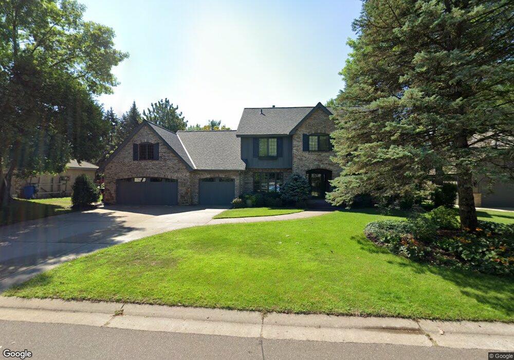
1026 Sherwood Rd Saint Paul, MN 55126
Estimated Value: $692,000 - $712,000
5
Beds
4
Baths
2,878
Sq Ft
$244/Sq Ft
Est. Value
About This Home
This home is located at 1026 Sherwood Rd, Saint Paul, MN 55126 and is currently estimated at $702,700, approximately $244 per square foot. 1026 Sherwood Rd is a home located in Ramsey County with nearby schools including Turtle Lake Elementary School, Chippewa Middle School, and Mounds View Senior High School.
Ownership History
Date
Name
Owned For
Owner Type
Purchase Details
Closed on
Jul 13, 2020
Sold by
Ellis Gary W and Kozlak Diane R
Bought by
Torson Terry C and Torson Marlo K
Current Estimated Value
Home Financials for this Owner
Home Financials are based on the most recent Mortgage that was taken out on this home.
Original Mortgage
$404,000
Outstanding Balance
$358,240
Interest Rate
3.1%
Mortgage Type
New Conventional
Estimated Equity
$344,460
Create a Home Valuation Report for This Property
The Home Valuation Report is an in-depth analysis detailing your home's value as well as a comparison with similar homes in the area
Home Values in the Area
Average Home Value in this Area
Purchase History
| Date | Buyer | Sale Price | Title Company |
|---|---|---|---|
| Torson Terry C | $505,000 | Titlenexus Llc |
Source: Public Records
Mortgage History
| Date | Status | Borrower | Loan Amount |
|---|---|---|---|
| Open | Torson Terry C | $404,000 |
Source: Public Records
Tax History Compared to Growth
Tax History
| Year | Tax Paid | Tax Assessment Tax Assessment Total Assessment is a certain percentage of the fair market value that is determined by local assessors to be the total taxable value of land and additions on the property. | Land | Improvement |
|---|---|---|---|---|
| 2025 | $7,760 | $649,800 | $111,300 | $538,500 |
| 2023 | $7,760 | $584,100 | $111,300 | $472,800 |
| 2022 | $6,904 | $566,100 | $111,300 | $454,800 |
| 2021 | $6,602 | $485,700 | $104,900 | $380,800 |
| 2020 | $7,076 | $474,300 | $104,900 | $369,400 |
| 2019 | $6,422 | $472,900 | $104,900 | $368,000 |
| 2018 | $6,300 | $455,900 | $104,900 | $351,000 |
| 2017 | $6,168 | $433,100 | $104,900 | $328,200 |
| 2016 | $7,064 | $0 | $0 | $0 |
| 2015 | $6,286 | $461,300 | $104,900 | $356,400 |
| 2014 | $6,130 | $0 | $0 | $0 |
Source: Public Records
Map
Nearby Homes
- 5657 Chatsworth St N
- 1089 Serene Ct
- 1130 Lois Ct
- 870 Sherwood Rd
- 868 Sherwood Rd
- 5940 Fernwood St
- 800 County Road I W
- 5986 Pheasant Dr
- 5919 Carlson St
- 5591 Albert St
- 5860 Hodgson Rd
- 592X Hodgson Rd
- 5920 Hodgson Rd
- 5680 Donegal Dr
- 5245 Oxford St N
- 56XX Heather Ridge Ct
- 548 Doris Ave
- 510 Elaine Ave
- 8718 Ghia St NE
- 5700 Willow Trail
- 1018 Sherwood Rd
- 1034 Sherwood Rd
- 1025 Lois Dr
- 1015 Lois Dr
- 1010 Sherwood Rd
- 1044 Sherwood Rd
- 5765 Oxford St N
- 1033 Lois Dr
- 5768 Churchill St
- 5768 Oxford St N
- 1041 Lois Dr
- 1050 Sherwood Rd
- 5775 Oxford St N
- 5742 Royal Oaks Dr
- 5744 Royal Oaks Dr
- 1049 Lois Dr
- 5776 Churchill St
- 5776 Oxford St N
- 5765 Royal Oaks Dr
- 1009 Hill Ct