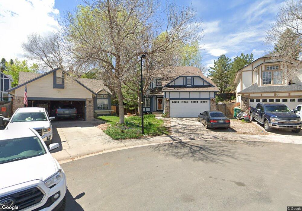
10266 Dusk Ct Littleton, CO 80125
Estimated Value: $529,064 - $554,000
4
Beds
3
Baths
1,861
Sq Ft
$291/Sq Ft
Est. Value
About This Home
This home is located at 10266 Dusk Ct, Littleton, CO 80125 and is currently estimated at $542,016, approximately $291 per square foot. 10266 Dusk Ct is a home located in Douglas County with nearby schools including Roxborough Elementary School, Roxborough Intermediate School, and Ranch View Middle School.
Ownership History
Date
Name
Owned For
Owner Type
Purchase Details
Closed on
May 18, 2017
Sold by
Broome James Jefferson
Bought by
Smith Paul and Smith Bessie
Current Estimated Value
Home Financials for this Owner
Home Financials are based on the most recent Mortgage that was taken out on this home.
Original Mortgage
$345,624
Outstanding Balance
$284,627
Interest Rate
3.75%
Mortgage Type
FHA
Estimated Equity
$257,389
Purchase Details
Closed on
Apr 5, 2012
Sold by
Broome Kelley Nearhood and Broome James Jefferson
Bought by
Broome James Jefferson
Purchase Details
Closed on
Apr 20, 2006
Sold by
Hemstreet Matthew A and Lingle Stacy M
Bought by
Nearhood Broome James Jefferson and Nearhood Broome Kelley
Home Financials for this Owner
Home Financials are based on the most recent Mortgage that was taken out on this home.
Original Mortgage
$189,680
Interest Rate
6.33%
Mortgage Type
Fannie Mae Freddie Mac
Purchase Details
Closed on
May 3, 2004
Sold by
Massengale Terri and Massengale Robert L
Bought by
Hemstreet Matthew A and Lingle Stacy M
Home Financials for this Owner
Home Financials are based on the most recent Mortgage that was taken out on this home.
Original Mortgage
$223,278
Interest Rate
5.38%
Mortgage Type
VA
Purchase Details
Closed on
Mar 7, 2001
Sold by
Mullikin Terri and Massengale Robert L
Bought by
Massengale Terri and Massengale Robert L
Home Financials for this Owner
Home Financials are based on the most recent Mortgage that was taken out on this home.
Original Mortgage
$171,000
Interest Rate
7.13%
Purchase Details
Closed on
Mar 24, 1997
Sold by
Paul Gale Daniel and Lynn Lizabeth Lynn
Bought by
Mullikin Terri and Massengale Robert L
Home Financials for this Owner
Home Financials are based on the most recent Mortgage that was taken out on this home.
Original Mortgage
$135,481
Interest Rate
7.74%
Mortgage Type
FHA
Purchase Details
Closed on
Jan 27, 1993
Sold by
Andersen Timothy S and Andersen Andrea
Bought by
Gale Daniel Paul and Gale Lizabeth Lyn
Purchase Details
Closed on
Dec 29, 1989
Sold by
Us Home Corp
Bought by
Andersen Timothy S and Andersen Andrea L
Purchase Details
Closed on
Apr 29, 1987
Sold by
Roxborough Village Joint Venture
Bought by
Us Home Corp
Create a Home Valuation Report for This Property
The Home Valuation Report is an in-depth analysis detailing your home's value as well as a comparison with similar homes in the area
Home Values in the Area
Average Home Value in this Area
Purchase History
| Date | Buyer | Sale Price | Title Company |
|---|---|---|---|
| Smith Paul | $352,000 | None Available | |
| Broome James Jefferson | -- | None Available | |
| Nearhood Broome James Jefferson | $237,100 | Guardian Title | |
| Hemstreet Matthew A | $218,900 | -- | |
| Massengale Terri | -- | -- | |
| Mullikin Terri | $137,500 | First American Heritage Titl | |
| Gale Daniel Paul | $99,000 | -- | |
| Andersen Timothy S | $80,000 | -- | |
| Us Home Corp | $264,000 | -- |
Source: Public Records
Mortgage History
| Date | Status | Borrower | Loan Amount |
|---|---|---|---|
| Open | Smith Paul | $345,624 | |
| Previous Owner | Nearhood Broome James Jefferson | $189,680 | |
| Previous Owner | Hemstreet Matthew A | $223,278 | |
| Previous Owner | Massengale Terri | $171,000 | |
| Previous Owner | Mullikin Terri | $135,481 |
Source: Public Records
Tax History Compared to Growth
Tax History
| Year | Tax Paid | Tax Assessment Tax Assessment Total Assessment is a certain percentage of the fair market value that is determined by local assessors to be the total taxable value of land and additions on the property. | Land | Improvement |
|---|---|---|---|---|
| 2024 | $3,299 | $35,240 | $6,550 | $28,690 |
| 2023 | $3,321 | $35,240 | $6,550 | $28,690 |
| 2022 | $2,598 | $24,830 | $4,890 | $19,940 |
| 2021 | $2,715 | $24,830 | $4,890 | $19,940 |
| 2020 | $2,846 | $24,550 | $5,680 | $18,870 |
| 2019 | $2,891 | $24,550 | $5,680 | $18,870 |
| 2018 | $3,020 | $20,940 | $4,050 | $16,890 |
| 2017 | $2,901 | $20,940 | $4,050 | $16,890 |
| 2016 | $2,555 | $18,210 | $3,980 | $14,230 |
| 2015 | $1,320 | $18,210 | $3,980 | $14,230 |
| 2014 | $2,420 | $15,530 | $3,580 | $11,950 |
Source: Public Records
Map
Nearby Homes
- 7653 Kyle Way
- 7627 Halleys Dr
- 7719 Jared Way
- 7888 Canvasback Cir
- 7217 Red Mesa Ct
- 8129 Locust Dr
- 7191 Red Mesa Dr
- 7832 Elmwood St
- 7597 Bison Ct
- 8176 Locust Dr
- 8032 Mount Ouray Rd
- 10441 Beech St
- 10538 Pony Cart Place
- 8109 Mount Ouray Rd
- 10388 Stable Ln
- 7680 Elmwood St
- 7912 Raphael Ln
- 7208 Raphael Ln
- 7911 Raphael Ln
- 7188 Raphael Ln