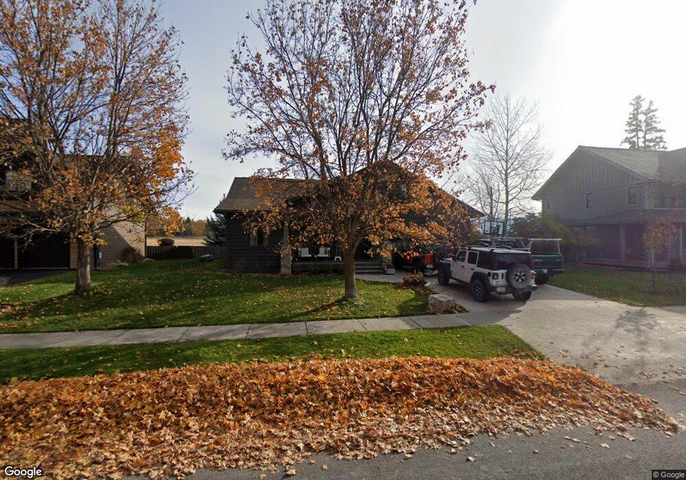
1027 Creekview Dr Whitefish, MT 59937
Estimated Value: $1,418,118 - $1,536,000
4
Beds
4
Baths
3,104
Sq Ft
$477/Sq Ft
Est. Value
About This Home
This home is located at 1027 Creekview Dr, Whitefish, MT 59937 and is currently estimated at $1,480,039, approximately $476 per square foot. 1027 Creekview Dr is a home located in Flathead County with nearby schools including L.A. Muldown School, Whitefish Middle School, and Whitefish High School.
Ownership History
Date
Name
Owned For
Owner Type
Purchase Details
Closed on
Jul 7, 2022
Sold by
Burt Losee George and Burt Rene Lisa
Bought by
Burt Loose Revocable Trust and Lisa Rene Losee Revocable Trust
Current Estimated Value
Purchase Details
Closed on
Nov 19, 2020
Sold by
Smith Caroline Saunders
Bought by
Losee George Burt and Losee Lisa Rene
Home Financials for this Owner
Home Financials are based on the most recent Mortgage that was taken out on this home.
Original Mortgage
$510,400
Interest Rate
2.8%
Mortgage Type
New Conventional
Purchase Details
Closed on
May 28, 2009
Sold by
Joseph George J
Bought by
Wells Kevin D
Home Financials for this Owner
Home Financials are based on the most recent Mortgage that was taken out on this home.
Original Mortgage
$375,250
Interest Rate
4.8%
Mortgage Type
New Conventional
Create a Home Valuation Report for This Property
The Home Valuation Report is an in-depth analysis detailing your home's value as well as a comparison with similar homes in the area
Home Values in the Area
Average Home Value in this Area
Purchase History
| Date | Buyer | Sale Price | Title Company |
|---|---|---|---|
| Burt Loose Revocable Trust | -- | None Listed On Document | |
| Losee George Burt | -- | First American Title Company | |
| Wells Kevin D | -- | Sterling Title Services Inc |
Source: Public Records
Mortgage History
| Date | Status | Borrower | Loan Amount |
|---|---|---|---|
| Previous Owner | Losee George Burt | $510,400 | |
| Previous Owner | Wells Kevin D | $375,250 |
Source: Public Records
Tax History Compared to Growth
Tax History
| Year | Tax Paid | Tax Assessment Tax Assessment Total Assessment is a certain percentage of the fair market value that is determined by local assessors to be the total taxable value of land and additions on the property. | Land | Improvement |
|---|---|---|---|---|
| 2025 | $6,094 | $1,536,700 | $0 | $0 |
| 2024 | $4,467 | $1,064,000 | $0 | $0 |
| 2023 | $5,689 | $1,064,000 | $0 | $0 |
| 2022 | $5,517 | $714,100 | $0 | $0 |
| 2021 | $5,696 | $714,100 | $0 | $0 |
| 2020 | $5,493 | $639,800 | $0 | $0 |
| 2019 | $5,899 | $639,800 | $0 | $0 |
| 2018 | $6,019 | $644,200 | $0 | $0 |
| 2017 | $4,843 | $598,000 | $0 | $0 |
| 2016 | $3,863 | $425,500 | $0 | $0 |
| 2015 | $3,899 | $425,500 | $0 | $0 |
| 2014 | $3,444 | $221,752 | $0 | $0 |
Source: Public Records
Map
Nearby Homes
- 1017 Creekview Dr
- 410 Trailview Way
- 402 Trailview Way
- 824 10th St
- 919 Columbia Ave Unit A
- 9 Shore View Ct
- 710 Riverside Ave
- 533 Park Ave
- 4 Swift Creek Ln
- 625 Columbia Ave
- 704 13th St E
- 162 Armory Rd
- 169 Mountain Brook Ln
- 633 Kalispell Ave
- 1319 3rd St
- 1958/1966 Whitefish Ave
- 1918 Whitefish Ave
- 1942 Whitefish Ave
- 424 Somers Ave
- 1950 Whitefish Ave
- 1027 Creek View Dr
- 1025 Creekview Dr
- 1029 Creekview Dr
- 1061 Creekwood Dr
- 1030 Creekview Dr
- 1030 Creekview Dr
- LOT 39 Creekwood Park
- 1031 Creekview Dr
- 1063 Creekwood Dr
- 1032 Creekview Dr
- 1033 Creekview Dr
- 1060 Creekwood Dr
- 1060 Creekwood Dr
- 1065 Creekwood Dr
- 1021 Creekview Dr
- 1034 Creekview Dr
- 1034 Creekview Dr
- 1062 Creekwood Dr
- 1067 Creekwood Dr