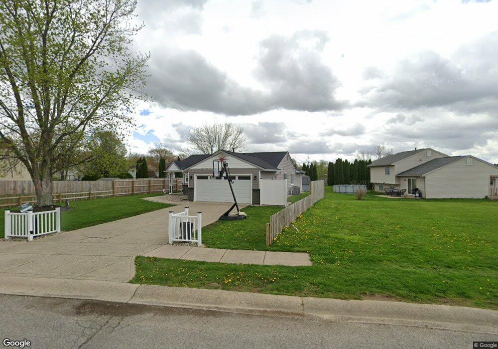
1027 Fox Trace Dr Anderson, IN 46013
Estimated Value: $188,656 - $204,000
3
Beds
2
Baths
1,232
Sq Ft
$159/Sq Ft
Est. Value
About This Home
This home is located at 1027 Fox Trace Dr, Anderson, IN 46013 and is currently estimated at $195,914, approximately $159 per square foot. 1027 Fox Trace Dr is a home located in Madison County with nearby schools including Erskine Elementary School, Highland Middle School, and Anderson High School.
Ownership History
Date
Name
Owned For
Owner Type
Purchase Details
Closed on
Jun 28, 2021
Sold by
Hollen Jamie
Bought by
Hollen Jamie and Hollen Tho Joshua
Current Estimated Value
Purchase Details
Closed on
Oct 30, 2007
Sold by
Madison Coumty Fedeeral Credit Union
Bought by
Hollen Jamie N
Home Financials for this Owner
Home Financials are based on the most recent Mortgage that was taken out on this home.
Original Mortgage
$57,937
Outstanding Balance
$36,154
Interest Rate
6.38%
Mortgage Type
New Conventional
Estimated Equity
$159,760
Purchase Details
Closed on
Nov 3, 2006
Sold by
Richardson Douglas A and Richardson Marsha
Bought by
Federal Credit Union
Create a Home Valuation Report for This Property
The Home Valuation Report is an in-depth analysis detailing your home's value as well as a comparison with similar homes in the area
Home Values in the Area
Average Home Value in this Area
Purchase History
| Date | Buyer | Sale Price | Title Company |
|---|---|---|---|
| Hollen Jamie | -- | None Available | |
| Hollen Jamie N | -- | -- | |
| Federal Credit Union | $94,420 | -- |
Source: Public Records
Mortgage History
| Date | Status | Borrower | Loan Amount |
|---|---|---|---|
| Open | Hollen Jamie N | $57,937 |
Source: Public Records
Tax History
| Year | Tax Paid | Tax Assessment Tax Assessment Total Assessment is a certain percentage of the fair market value that is determined by local assessors to be the total taxable value of land and additions on the property. | Land | Improvement |
|---|---|---|---|---|
| 2025 | $1,124 | $114,000 | $10,200 | $103,800 |
| 2024 | $1,124 | $104,500 | $10,200 | $94,300 |
| 2023 | $1,046 | $95,500 | $9,700 | $85,800 |
| 2022 | $1,024 | $96,200 | $9,600 | $86,600 |
| 2021 | $907 | $85,700 | $9,500 | $76,200 |
| 2020 | $858 | $81,400 | $9,000 | $72,400 |
| 2019 | $1,107 | $81,100 | $9,000 | $72,100 |
| 2018 | $812 | $74,200 | $9,000 | $65,200 |
| 2017 | $752 | $73,400 | $9,000 | $64,400 |
| 2016 | $813 | $71,700 | $9,000 | $62,700 |
| 2014 | $629 | $66,100 | $8,200 | $57,900 |
| 2013 | $629 | $67,600 | $8,200 | $59,400 |
Source: Public Records
Map
Nearby Homes
- 1217 Squirrel Ridge Rd
- 5835 Granite Dr
- 827 Country Ln
- 1408 W 60th St
- 814 Rustic Rd
- 6120 Rocky Rd
- 1021 Sandra Dr
- 328 W 53rd St Unit 51
- 328 W 53rd St Unit 34
- 328 W 53rd St Unit 10
- 328 W 53rd St Unit 17
- 202 Asbury Dr
- 4413 Brenda Dr
- 4408 Brenda Dr
- 154 Asbury Dr
- 150 Appian Way
- 4328 Rutgers Dr
- 4826 Main St
- 902 Stoner Dr
- 5828 Oak Ln
- 0 Fox Trace Dr Unit MBR21922717
- 0 Fox Trace Dr Unit 21615064
- 0 Fox Trace Dr Unit 21615067
- 5610 Red Fox Ct
- 1015 Fox Trace Dr
- 5618 Red Fox Ct
- 1024 Squirrel Ridge Rd
- 1026 Fox Trace Dr
- 1018 Squirrel Ridge Rd
- 1032 Fox Trace Dr
- 1009 Fox Trace Dr
- 0 Red Fox Ct
- 1012 Squirrel Ridge Rd
- 1020 Fox Trace Dr
- 1038 Fox Trace Dr
- 1003 Fox Trace Dr
- 5626 Red Fox Ct
- 1014 Fox Trace Dr
- 1006 Squirrel Ridge Rd
- 1104 Fox Trace Dr
Your Personal Tour Guide
Ask me questions while you tour the home.