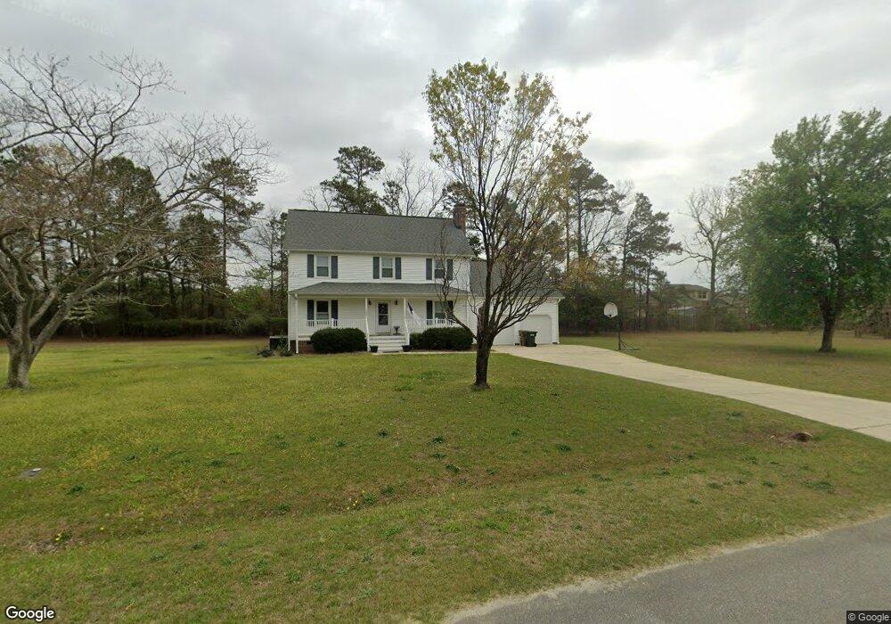
1027 Lake Path Rd Willow Spring, NC 27592
Pleasant Grove NeighborhoodEstimated Value: $353,000 - $402,000
3
Beds
3
Baths
1,724
Sq Ft
$219/Sq Ft
Est. Value
About This Home
This home is located at 1027 Lake Path Rd, Willow Spring, NC 27592 and is currently estimated at $376,710, approximately $218 per square foot. 1027 Lake Path Rd is a home located in Johnston County with nearby schools including Dixon Road Elementary School, McGee's Crossroads Middle School, and West Johnston High School.
Ownership History
Date
Name
Owned For
Owner Type
Purchase Details
Closed on
Mar 15, 2011
Sold by
Peters Beverly S and Peters William
Bought by
Peters Beverly S and Peters William
Current Estimated Value
Purchase Details
Closed on
Mar 17, 2006
Sold by
Baker David B
Bought by
Baker Beverly S
Purchase Details
Closed on
May 16, 2005
Sold by
Baker David Benton and Baker Beverly Stephenson
Bought by
Baker David Benton
Create a Home Valuation Report for This Property
The Home Valuation Report is an in-depth analysis detailing your home's value as well as a comparison with similar homes in the area
Home Values in the Area
Average Home Value in this Area
Purchase History
| Date | Buyer | Sale Price | Title Company |
|---|---|---|---|
| Peters Beverly S | -- | None Available | |
| Baker Beverly S | -- | None Available | |
| Baker David Benton | -- | None Available |
Source: Public Records
Tax History
| Year | Tax Paid | Tax Assessment Tax Assessment Total Assessment is a certain percentage of the fair market value that is determined by local assessors to be the total taxable value of land and additions on the property. | Land | Improvement |
|---|---|---|---|---|
| 2025 | $2,100 | $330,760 | $83,900 | $246,860 |
| 2024 | $1,622 | $200,210 | $54,290 | $145,920 |
| 2023 | $1,572 | $200,210 | $54,290 | $145,920 |
| 2022 | $1,622 | $200,210 | $54,290 | $145,920 |
| 2021 | $1,622 | $200,210 | $54,290 | $145,920 |
| 2020 | $1,682 | $200,210 | $54,290 | $145,920 |
| 2019 | $1,642 | $200,210 | $54,290 | $145,920 |
| 2018 | $1,354 | $161,160 | $31,580 | $129,580 |
| 2017 | $1,354 | $161,160 | $31,580 | $129,580 |
| 2016 | $1,354 | $161,160 | $31,580 | $129,580 |
| 2015 | $1,354 | $161,160 | $31,580 | $129,580 |
| 2014 | $1,354 | $161,160 | $31,580 | $129,580 |
Source: Public Records
Map
Nearby Homes
- 3002 Red Cir
- 2004 Little Pond Place
- 15973 N Carolina 210
- 369 Everland Pkwy
- 444 Everland Pkwy
- 376 Everland Pkwy
- 16 Keystone Ct
- 71 Suzanne Dr
- 55 Edward Ct
- 40 Broadhead Ct
- 197 Silverside Dr
- 127 Wagon Trail
- 33 Cabin Grove Ct
- 106 S Bream Ct Unit Lot 10
- 106 S Bream Ct
- 72 S Bream Ct
- 72 S Bream Ct Unit Lot 11
- 420 Beulah Milton Dr
- 410 Penwood Rd
- 18 N Bream Ct
- 1028 Lake Path Rd
- 177 Warriors Way
- 177 Warriors Way
- 1030 Lake Path Rd
- 1029 Lake Path Rd
- 1026 Lake Path Rd
- 155 Warriors Way
- 178 Warriors Way
- 1020 Lake Path Rd
- 129 Warriors Way
- 156 Warriors Way
- 128 Warriors Way
- 76 Deep Clay Cir
- 48 Deep Clay Cir
- 116 Deep Clay Cir
- 20 Deep Clay Cir
- 1018 Lake Path Rd
- 103 Warrior Way
- 51 Plateau
- 96 Warriors Way
Your Personal Tour Guide
Ask me questions while you tour the home.