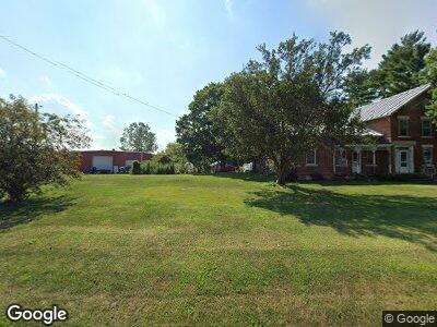
1027 State Route 99 Monroeville, OH 44847
Estimated Value: $159,000 - $310,000
3
Beds
2
Baths
2,240
Sq Ft
$116/Sq Ft
Est. Value
About This Home
This home is located at 1027 State Route 99, Monroeville, OH 44847 and is currently estimated at $260,842, approximately $116 per square foot. 1027 State Route 99 is a home located in Huron County with nearby schools including Monroeville Elementary School and Monroeville High School.
Ownership History
Date
Name
Owned For
Owner Type
Purchase Details
Closed on
Jun 4, 2024
Sold by
Herner Arthur C and Herner Rosa M
Bought by
Arthur C Herner And Rosa M Herner Joint Revoc and Herner
Current Estimated Value
Purchase Details
Closed on
Jan 5, 2001
Sold by
Herner James F
Bought by
Scheid Harold and Scheid Patricia
Home Financials for this Owner
Home Financials are based on the most recent Mortgage that was taken out on this home.
Original Mortgage
$50,000
Interest Rate
7.77%
Mortgage Type
New Conventional
Purchase Details
Closed on
Nov 4, 1993
Bought by
Herner Arthur C and Herner Rosa M
Create a Home Valuation Report for This Property
The Home Valuation Report is an in-depth analysis detailing your home's value as well as a comparison with similar homes in the area
Home Values in the Area
Average Home Value in this Area
Purchase History
| Date | Buyer | Sale Price | Title Company |
|---|---|---|---|
| Arthur C Herner And Rosa M Herner Joint Revoc | -- | None Listed On Document | |
| Scheid Harold | $47,762 | -- | |
| Herner Arthur C | $78,000 | -- |
Source: Public Records
Mortgage History
| Date | Status | Borrower | Loan Amount |
|---|---|---|---|
| Previous Owner | Scheid Harold | $50,000 |
Source: Public Records
Tax History Compared to Growth
Tax History
| Year | Tax Paid | Tax Assessment Tax Assessment Total Assessment is a certain percentage of the fair market value that is determined by local assessors to be the total taxable value of land and additions on the property. | Land | Improvement |
|---|---|---|---|---|
| 2024 | $3,589 | $90,240 | $14,650 | $75,590 |
| 2023 | $3,589 | $72,690 | $11,960 | $60,730 |
| 2022 | $3,100 | $72,690 | $11,960 | $60,730 |
| 2021 | $3,029 | $72,690 | $11,960 | $60,730 |
| 2020 | $2,839 | $65,270 | $11,010 | $54,260 |
| 2019 | $2,822 | $65,270 | $11,010 | $54,260 |
| 2018 | $2,707 | $65,270 | $11,010 | $54,260 |
| 2017 | $2,590 | $63,810 | $10,520 | $53,290 |
| 2016 | $2,539 | $63,810 | $10,520 | $53,290 |
| 2015 | $2,596 | $63,810 | $10,520 | $53,290 |
| 2014 | $2,126 | $57,930 | $9,140 | $48,790 |
| 2013 | $2,272 | $57,930 | $9,140 | $48,790 |
Source: Public Records
Map
Nearby Homes
- 644 State Route 99
- 1362 State Route 99 S
- 424 N Ridge Rd
- 354 Big Bass Rd
- 1255 Ramona Dr
- 407 Monroe St
- 871 Birchbark Dr
- 60 Manchester St
- 121 North St
- 133 North St
- 129 North St
- 10 Eagle View Dr
- 670 Timothy Dr
- 588 Lake Shore Dr
- 144 Sycamore Dr
- 10 Par Ct
- 0 Valley Park Dr Unit 5098529
- 0 Valley Park Dr Unit 20250398
- 0 Valley Park Lot #4
- 0 Valley Park Lot #6
- 1027 State Route 99
- 3741 Snyder Rd
- 1083 State Route 99
- 1125 State Route 99
- 0 Peru West Sectionline Rd
- 1169 State Route 99
- 1176 State Route 99
- 1189 State Route 99
- 3795 Peru West Section Line Rd
- 3761 Peru West Section Line Rd
- 3875 Peru West Section Line Rd
- 3808 Peru West Section Line Rd
- 3878 Peru West Section Line Rd
- 3452 Snyder Rd
- 644 Ohio 99
- 3485 Peru West Section Line Rd
- 3485 Peru West Section Line Rd
- 4004 Peru West Section Line Rd
- 3490 Peru West Section Line Rd
- 4071 Peru West Section Line Rd