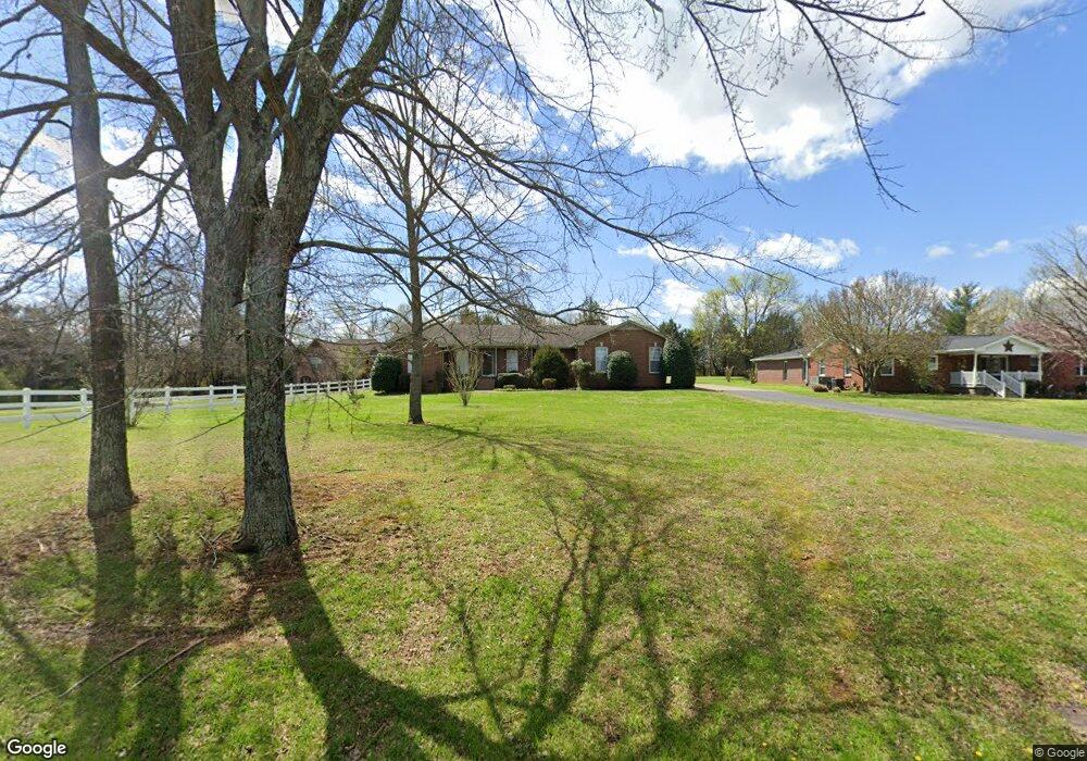
1029 Maple Hill Rd Lebanon, TN 37087
Estimated Value: $496,579 - $640,000
--
Bed
3
Baths
2,392
Sq Ft
$227/Sq Ft
Est. Value
About This Home
This home is located at 1029 Maple Hill Rd, Lebanon, TN 37087 and is currently estimated at $541,895, approximately $226 per square foot. 1029 Maple Hill Rd is a home located in Wilson County with nearby schools including Walter J. Baird Middle School, Lebanon High School, and Friendship Christian School.
Ownership History
Date
Name
Owned For
Owner Type
Purchase Details
Closed on
Nov 8, 2021
Sold by
Crook Angela L and Haynes Karen A
Bought by
Calles Michael and Calles Amber
Current Estimated Value
Home Financials for this Owner
Home Financials are based on the most recent Mortgage that was taken out on this home.
Original Mortgage
$351,920
Outstanding Balance
$322,563
Interest Rate
3.01%
Mortgage Type
New Conventional
Estimated Equity
$219,332
Purchase Details
Closed on
Aug 2, 2011
Sold by
Young William F
Bought by
Reynolds Jimmy Ray and Reynolds Elizabeth
Purchase Details
Closed on
Dec 14, 2007
Sold by
Corley Michael G
Bought by
Young William F
Purchase Details
Closed on
Apr 4, 1904
Bought by
Gentry Noel Edward and Gentry Thelma
Create a Home Valuation Report for This Property
The Home Valuation Report is an in-depth analysis detailing your home's value as well as a comparison with similar homes in the area
Home Values in the Area
Average Home Value in this Area
Purchase History
| Date | Buyer | Sale Price | Title Company |
|---|---|---|---|
| Calles Michael | $439,900 | Birgthright Title Llc | |
| Reynolds Jimmy Ray | $230,000 | -- | |
| Young William F | $227,900 | -- | |
| Gentry Noel Edward | -- | -- |
Source: Public Records
Mortgage History
| Date | Status | Borrower | Loan Amount |
|---|---|---|---|
| Open | Calles Michael | $351,920 |
Source: Public Records
Tax History Compared to Growth
Tax History
| Year | Tax Paid | Tax Assessment Tax Assessment Total Assessment is a certain percentage of the fair market value that is determined by local assessors to be the total taxable value of land and additions on the property. | Land | Improvement |
|---|---|---|---|---|
| 2024 | $1,768 | $80,125 | $13,725 | $66,400 |
| 2022 | $1,768 | $80,125 | $13,725 | $66,400 |
| 2021 | $1,768 | $80,125 | $13,725 | $66,400 |
| 2020 | $2,079 | $80,125 | $13,725 | $66,400 |
| 2019 | $2,079 | $71,675 | $11,000 | $60,675 |
| 2018 | $2,079 | $71,675 | $11,000 | $60,675 |
| 2017 | $2,079 | $71,675 | $11,000 | $60,675 |
| 2016 | $2,079 | $71,675 | $11,000 | $60,675 |
| 2015 | $1,842 | $71,675 | $11,000 | $60,675 |
| 2014 | $1,581 | $61,512 | $0 | $0 |
Source: Public Records
Map
Nearby Homes
- 811 Brook Trail
- 1009 Stone Creek Ln
- 1102 Collin Dr #206
- 129 Springfield Dr
- 849 Brook Trail
- 1003 Stone Creek Ln #221
- 0 Trice Rd
- 15 Juniper Ln
- 854 Brook Trail
- 1107 Collin Dr
- 848 Brook Trail
- 121 Springfield Dr
- 1108 Collin Dr #209
- 113 Springfield Dr
- 101 Pekka Dr
- Woodruff Plan at Carver Creek
- Fillmore II Plan at Carver Creek
- 283 Subban Ct
- 1 Maple Hill Rd
- 758 Holt Rd
- 1031 Maple Hill Rd
- 1007 Maple Hill Rd
- 1016 Maple Hill Rd
- 1034 Maple Hill Rd
- 1001 Maple Hill Rd
- 1035 Maple Hill Rd
- 1033 Maple Hill Rd
- 944 Maple Hill Rd
- 934 Maple Hill Rd
- 895 Maple Hill Rd
- 809 Brook Trail
- 903 Maple Hill Rd
- 398 Huntington Dr
- 400 Huntington Dr
- 400 Huntington Dr
- 402 Huntington Dr
- 813 Brook Trail
- 404 Huntington Dr
- 406 Huntington Dr
- 408 Huntington Dr