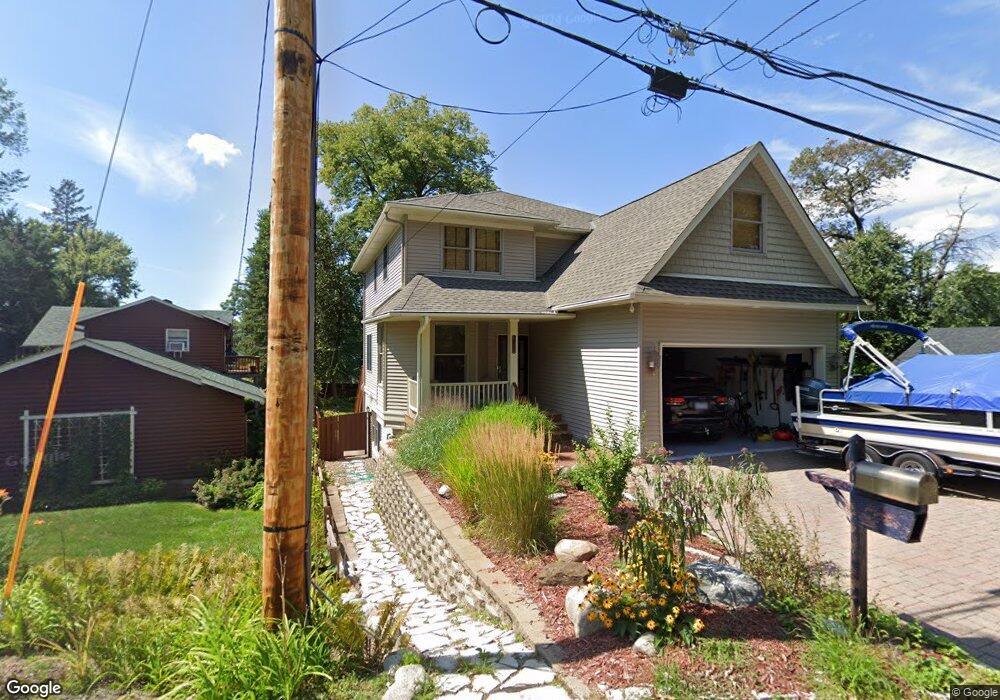
1029 Summit Ave Saint Paul, MN 55115
Estimated Value: $635,748 - $781,000
5
Beds
4
Baths
3,204
Sq Ft
$227/Sq Ft
Est. Value
About This Home
This home is located at 1029 Summit Ave, Saint Paul, MN 55115 and is currently estimated at $727,187, approximately $226 per square foot. 1029 Summit Ave is a home located in Washington County with nearby schools including O.H. Anderson Elementary School, Wildwood Elementary School, and Mahtomedi Middle School.
Ownership History
Date
Name
Owned For
Owner Type
Purchase Details
Closed on
Oct 2, 2020
Sold by
Jones Tracy L
Bought by
Stivland Timothy M
Current Estimated Value
Home Financials for this Owner
Home Financials are based on the most recent Mortgage that was taken out on this home.
Original Mortgage
$469,600
Interest Rate
2.8%
Mortgage Type
New Conventional
Purchase Details
Closed on
Feb 22, 2005
Sold by
Mielke Daniel J and Mielke Lynn M
Bought by
Jones Tracy L
Purchase Details
Closed on
Jan 3, 2003
Sold by
Mielke Steven G
Bought by
Homefront Inc
Create a Home Valuation Report for This Property
The Home Valuation Report is an in-depth analysis detailing your home's value as well as a comparison with similar homes in the area
Home Values in the Area
Average Home Value in this Area
Purchase History
| Date | Buyer | Sale Price | Title Company |
|---|---|---|---|
| Stivland Timothy M | $587,000 | Burnet Title | |
| Jones Tracy L | $440,000 | -- | |
| Homefront Inc | $70,000 | -- | |
| Stivland Timothy Timothy | $587,000 | -- |
Source: Public Records
Mortgage History
| Date | Status | Borrower | Loan Amount |
|---|---|---|---|
| Previous Owner | Stivland Timothy M | $469,600 | |
| Closed | Stivland Timothy Timothy | $469,600 |
Source: Public Records
Tax History
| Year | Tax Paid | Tax Assessment Tax Assessment Total Assessment is a certain percentage of the fair market value that is determined by local assessors to be the total taxable value of land and additions on the property. | Land | Improvement |
|---|---|---|---|---|
| 2024 | $6,480 | $576,800 | $176,800 | $400,000 |
| 2023 | $6,480 | $578,200 | $189,800 | $388,400 |
| 2022 | $5,990 | $576,300 | $193,000 | $383,300 |
| 2021 | $5,744 | $460,700 | $157,500 | $303,200 |
| 2020 | $6,790 | $457,400 | $165,000 | $292,400 |
| 2019 | $6,794 | $485,000 | $171,100 | $313,900 |
| 2018 | $6,286 | $458,900 | $150,500 | $308,400 |
| 2017 | $6,176 | $444,500 | $140,500 | $304,000 |
| 2016 | $6,390 | $409,700 | $162,000 | $247,700 |
| 2015 | $6,454 | $409,600 | $133,400 | $276,200 |
| 2013 | -- | $386,100 | $119,800 | $266,300 |
Source: Public Records
Map
Nearby Homes
- 939 Park Ave
- 1025 Mahtomedi Ave
- 177 Kale St
- 195 Iris St
- 800 Griffin Ave
- 1130 Griffin Ave
- 138 Dahlia St
- 820 Hallam Ave N
- 1610 Briarwood Ave
- 209 Quail St
- xxx Bryant Ave
- 115 Glenmar Ave
- TBD Glenmar Ave
- 12 Forest Trail
- 4072 Birch Knoll Dr
- 223 Old Wildwood Rd
- 235 Old Wildwood Rd
- 4172 Summit Ln
- 3734 Stacy Cir
- 268 Shamrock Dr
- 1032 Park Ave
- 1033 Summit Ave
- 1036 Park Ave
- 1022 Park Ave
- 1036 Park Ave
- 1040 Park Ave
- 1028 Park Ave
- 1028 Park Ave
- 1021 Summit Ave
- 1020 Summit Ave
- 1044 Park Ave
- 1024 Summit Ave
- 67 Juniper St
- 1030 Summit Ave
- 1028 1028 Park-Avenue-
- 1040 Summit Ave
- 1018 Park Ave
- 1032 Summit Ave
- 1040 Summit Ave
- 47 47 Juniper St
Your Personal Tour Guide
Ask me questions while you tour the home.