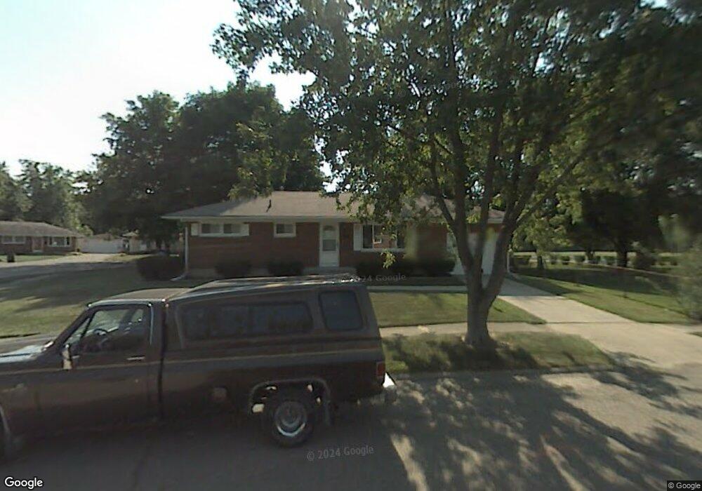
1029 Westmont Dr Springfield, OH 45503
Estimated Value: $183,133 - $198,000
3
Beds
1
Bath
1,025
Sq Ft
$185/Sq Ft
Est. Value
About This Home
This home is located at 1029 Westmont Dr, Springfield, OH 45503 and is currently estimated at $190,033, approximately $185 per square foot. 1029 Westmont Dr is a home located in Clark County with nearby schools including Northridge Elementary School, Kenton Ridge Middle & High School, and Emmanuel Christian Academy.
Ownership History
Date
Name
Owned For
Owner Type
Purchase Details
Closed on
Sep 1, 1995
Sold by
Smedley Jerry K
Bought by
Adams Steven M and Adams Marty
Current Estimated Value
Home Financials for this Owner
Home Financials are based on the most recent Mortgage that was taken out on this home.
Original Mortgage
$68,858
Interest Rate
7.55%
Mortgage Type
New Conventional
Purchase Details
Closed on
Jan 30, 1995
Sold by
Smith Lance N
Bought by
Smedley Jerry R and Smedley Sue
Create a Home Valuation Report for This Property
The Home Valuation Report is an in-depth analysis detailing your home's value as well as a comparison with similar homes in the area
Home Values in the Area
Average Home Value in this Area
Purchase History
| Date | Buyer | Sale Price | Title Company |
|---|---|---|---|
| Adams Steven M | $76,500 | -- | |
| Smedley Jerry R | $76,000 | -- |
Source: Public Records
Mortgage History
| Date | Status | Borrower | Loan Amount |
|---|---|---|---|
| Closed | Adams Steven M | $68,858 |
Source: Public Records
Tax History
| Year | Tax Paid | Tax Assessment Tax Assessment Total Assessment is a certain percentage of the fair market value that is determined by local assessors to be the total taxable value of land and additions on the property. | Land | Improvement |
|---|---|---|---|---|
| 2025 | $1,778 | $58,310 | $15,310 | $43,000 |
| 2024 | $1,720 | $40,670 | $8,890 | $31,780 |
| 2023 | $1,720 | $40,670 | $8,890 | $31,780 |
| 2022 | $1,726 | $40,670 | $8,890 | $31,780 |
| 2021 | $1,785 | $35,560 | $6,580 | $28,980 |
| 2020 | $1,786 | $35,560 | $6,580 | $28,980 |
| 2019 | $1,820 | $35,560 | $6,580 | $28,980 |
| 2018 | $1,576 | $29,590 | $8,410 | $21,180 |
| 2017 | $1,351 | $28,442 | $8,411 | $20,031 |
| 2016 | $1,342 | $28,442 | $8,411 | $20,031 |
| 2015 | $1,355 | $28,116 | $8,085 | $20,031 |
| 2014 | $1,355 | $28,116 | $8,085 | $20,031 |
| 2013 | $1,323 | $28,116 | $8,085 | $20,031 |
Source: Public Records
Map
Nearby Homes
- 4733 Curtis Dr
- 4741 Cullen Ave
- 4802 Willowbrook Dr
- 1341 Student Ave
- 4322 Midfield St Unit 15
- 4446 Ridgewood Rd E Unit 3
- 5300 Brookshire Ln
- 4256 Midfield St Unit 9
- 5235 W Ridgewood Rd
- 5033 Ridgewood Rd E
- 4577 Reno Ln Unit 2
- 4652 Reno Ln Unit 15
- 1521 Erika Dr
- 4732 Lehigh Dr
- 1644 Delmar Dr
- 3942 Harris Ln
- 1162 Kingsgate Rd
- 1495 Victorian Way
- 1201 Kingsgate Rd
- 4890 Brannan Dr W Unit 4890
- 1031 Westmont Cir
- 4735 Curtis Dr
- 1028 Westmont Dr
- 1039 Westmont Dr
- 1034 Westmont Dr
- 4737 Curtis Dr
- 1037 Westmont Cir
- 1040 Westmont Dr
- 1035 Westmont Cir
- 1041 Westmont Dr
- 4739 Curtis Dr
- 1044 Westmont Dr
- 4741 Curtis Dr
- 1048 Westmont Dr
- 4738 Curtis Dr
- 4749 Westmont Dr
- 1047 Westmont Dr
- 4734 Curtis Dr
- 4740 Curtis Dr
- 4743 Curtis Dr
Your Personal Tour Guide
Ask me questions while you tour the home.