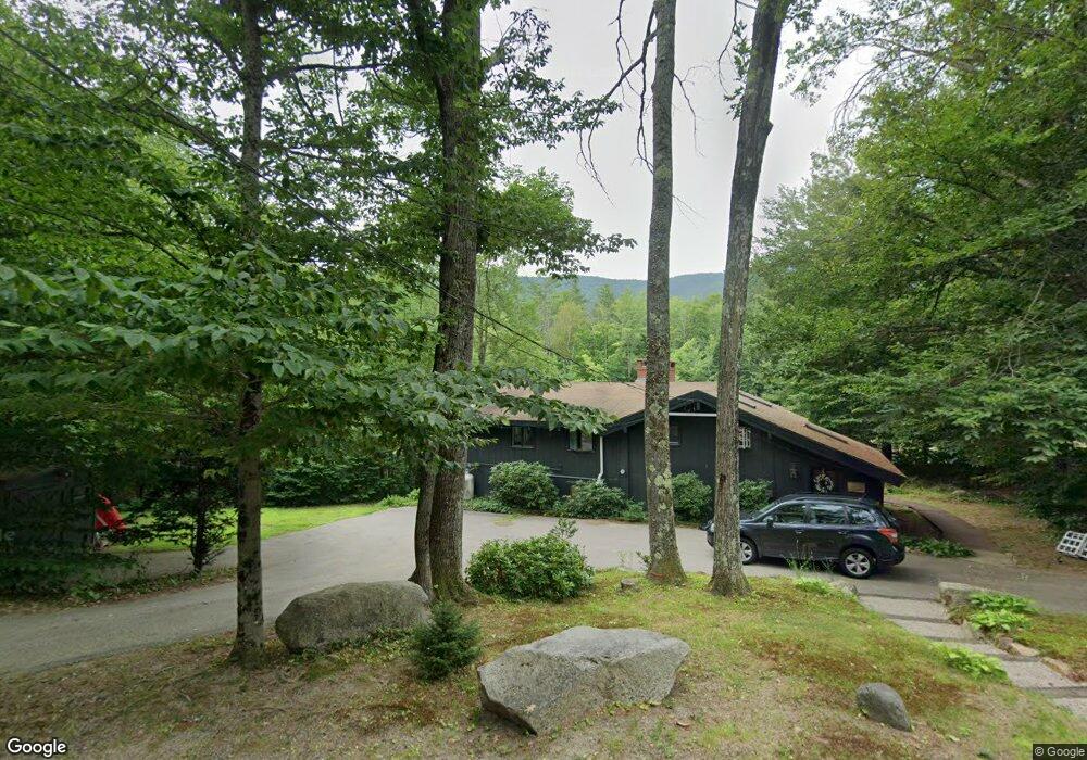
103 Covered Bridge Ln Bartlett, NH 03812
Estimated Value: $465,000 - $675,000
3
Beds
2
Baths
2,006
Sq Ft
$283/Sq Ft
Est. Value
About This Home
This home is located at 103 Covered Bridge Ln, Bartlett, NH 03812 and is currently estimated at $568,333, approximately $283 per square foot. 103 Covered Bridge Ln is a home located in Carroll County with nearby schools including Josiah Bartlett Elementary School.
Ownership History
Date
Name
Owned For
Owner Type
Purchase Details
Closed on
Oct 30, 2020
Sold by
Lawson Philip C
Bought by
Goodspeed Brendan S and Morin Elizabeth
Current Estimated Value
Home Financials for this Owner
Home Financials are based on the most recent Mortgage that was taken out on this home.
Original Mortgage
$168,000
Outstanding Balance
$149,496
Interest Rate
2.8%
Mortgage Type
New Conventional
Estimated Equity
$418,837
Create a Home Valuation Report for This Property
The Home Valuation Report is an in-depth analysis detailing your home's value as well as a comparison with similar homes in the area
Home Values in the Area
Average Home Value in this Area
Purchase History
| Date | Buyer | Sale Price | Title Company |
|---|---|---|---|
| Goodspeed Brendan S | $210,000 | None Available |
Source: Public Records
Mortgage History
| Date | Status | Borrower | Loan Amount |
|---|---|---|---|
| Open | Goodspeed Brendan S | $168,000 |
Source: Public Records
Tax History Compared to Growth
Tax History
| Year | Tax Paid | Tax Assessment Tax Assessment Total Assessment is a certain percentage of the fair market value that is determined by local assessors to be the total taxable value of land and additions on the property. | Land | Improvement |
|---|---|---|---|---|
| 2024 | $2,717 | $487,000 | $202,500 | $284,500 |
| 2023 | $2,513 | $487,000 | $202,500 | $284,500 |
| 2022 | $2,420 | $487,000 | $202,500 | $284,500 |
| 2021 | $2,707 | $284,000 | $145,400 | $138,600 |
| 2020 | $2,743 | $284,000 | $145,400 | $138,600 |
| 2019 | $2,653 | $284,000 | $145,400 | $138,600 |
| 2018 | $2,593 | $284,000 | $145,400 | $138,600 |
| 2016 | $2,186 | $230,100 | $90,200 | $139,900 |
| 2015 | $2,195 | $230,100 | $90,200 | $139,900 |
| 2014 | $2,253 | $230,100 | $90,200 | $139,900 |
| 2010 | $2,264 | $247,400 | $88,500 | $158,900 |
Source: Public Records
Map
Nearby Homes
- 4 Seasons at Attitash Rd Unit D
- 12G Seasons at Attitash Rd
- 791 W Side Rd
- 1 Seasons at Attitash Rd
- 2 Seasons at Attitash Rd
- 17 Pickering Rd
- 31 Cave Mountain Rd
- 41 Linden Rd
- 30 Top Notch Rd Unit 30
- 17 The Meadows Rd
- 46 Ammonoosuc Dr
- 166 U S 302
- 2E/F River Run Dr Unit E/F
- 8 River Run Dr Unit J
- 8 River Run Dr Unit H
- 8 River Run Dr Unit G
- 10 River Run Dr Unit G
- 419 Glen Ledge Rd
- 00 Tall Woods Loop Unit 9
- N2 Sandtrap Loop Unit 2
- 99 Covered Bridge Ln
- 100 Covered Bridge Ln
- 98 Covered Bridge Ln
- 109 Covered Bridge Ln
- 106 Covered Bridge Ln
- 109 Covered Bridge Ln
- 94 Covered Bridge Ln
- 113 Covered Bridge Ln
- 114 Covered Bridge Ln
- 33 Oak Ridge Rd
- 29 Bartlett Place Rd Unit 29
- 85 Covered Bridge Ln
- 19 Bartlett Place Rd Unit 19
- 119 Covered Bridge Ln
- 27 Oak Ridge Rd
- 12 Attitash Loop
- 122 Covered Bridge Ln
- 28 Bartlett Place Rd
- 28 Bartlett Place Rd Unit 28
- 14 Attitash Loop