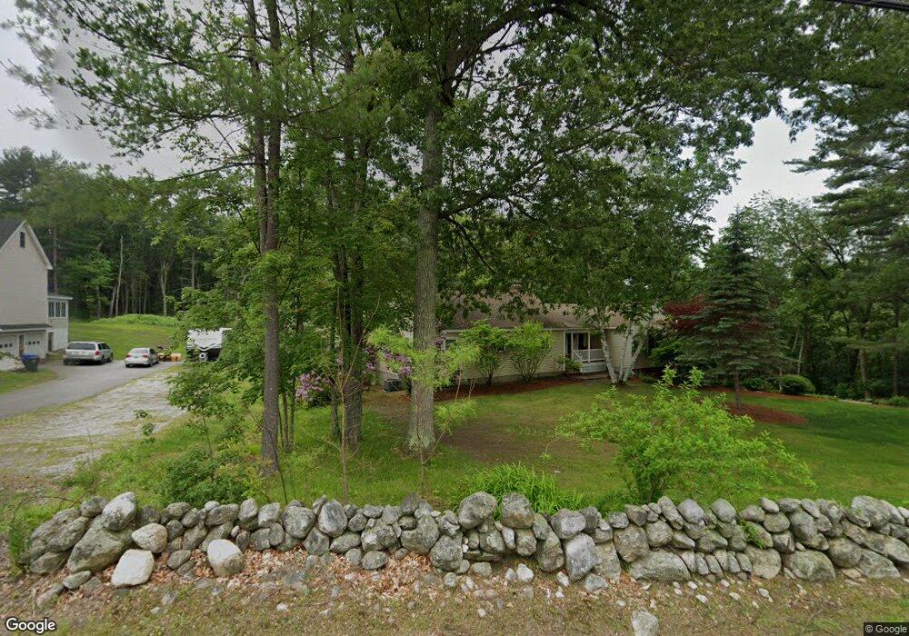
103 High Range Rd Londonderry, NH 03053
Estimated Value: $772,630 - $794,000
4
Beds
4
Baths
3,305
Sq Ft
$237/Sq Ft
Est. Value
About This Home
This home is located at 103 High Range Rd, Londonderry, NH 03053 and is currently estimated at $782,408, approximately $236 per square foot. 103 High Range Rd is a home with nearby schools including Matthew Thornton Elementary School, Londonderry Middle School, and Londonderry Senior High School.
Ownership History
Date
Name
Owned For
Owner Type
Purchase Details
Closed on
Nov 15, 2004
Sold by
Curro Joseph A and Curro Antonette D
Bought by
Curro Vincent and Curro Jeannine A
Current Estimated Value
Home Financials for this Owner
Home Financials are based on the most recent Mortgage that was taken out on this home.
Original Mortgage
$152,000
Interest Rate
5.75%
Mortgage Type
Purchase Money Mortgage
Create a Home Valuation Report for This Property
The Home Valuation Report is an in-depth analysis detailing your home's value as well as a comparison with similar homes in the area
Home Values in the Area
Average Home Value in this Area
Purchase History
| Date | Buyer | Sale Price | Title Company |
|---|---|---|---|
| Curro Vincent | $315,000 | -- |
Source: Public Records
Mortgage History
| Date | Status | Borrower | Loan Amount |
|---|---|---|---|
| Open | Curro Vincent | $306,000 | |
| Closed | Curro Vincent | $40,000 | |
| Closed | Curro Vincent | $330,000 | |
| Closed | Curro Vincent | $152,000 |
Source: Public Records
Tax History Compared to Growth
Tax History
| Year | Tax Paid | Tax Assessment Tax Assessment Total Assessment is a certain percentage of the fair market value that is determined by local assessors to be the total taxable value of land and additions on the property. | Land | Improvement |
|---|---|---|---|---|
| 2024 | $9,984 | $618,600 | $180,300 | $438,300 |
| 2023 | $9,681 | $618,600 | $180,300 | $438,300 |
| 2022 | $9,131 | $494,100 | $135,200 | $358,900 |
| 2021 | $9,082 | $494,100 | $135,200 | $358,900 |
| 2020 | $8,412 | $418,300 | $115,300 | $303,000 |
| 2019 | $8,111 | $418,300 | $115,300 | $303,000 |
| 2018 | $8,149 | $373,800 | $95,300 | $278,500 |
| 2017 | $8,078 | $373,800 | $95,300 | $278,500 |
| 2016 | $8,037 | $373,800 | $95,300 | $278,500 |
| 2015 | $7,857 | $373,800 | $95,300 | $278,500 |
| 2014 | $7,883 | $373,800 | $95,300 | $278,500 |
| 2011 | -- | $376,600 | $95,300 | $281,300 |
Source: Public Records
Map
Nearby Homes
- 90 High Range Rd
- 88 High Range Rd
- 6 Wiley Hill Rd
- 12 Wiley Hill Rd
- 3 Chandler Dr
- 10 Jason Dr
- 4 Delphi Way
- 5 Delphi Way
- 3 Delphi Way
- 7 Delphi Way
- 1 Delphi Way
- 1 Delphi Way Unit 10
- 5 Hickory Hill Dr
- 11 Elise Ave Unit Lot 91
- 17 Lily Ln
- 19 Lily Ln
- 1 Lily Ln
- 69 Bayberry Ln
- 31 Midridge Cir
- 27 Midridge Cir
- 101 High Range Rd
- 1 Carousel Ct
- 99 High Range Rd
- 3 Carousel Ct
- 4 Carousel Ct
- 2 Carousel Ct
- 97 High Range Rd
- 109 High Range Rd
- 6 Carousel Ct
- 84 High Range Rd
- 98 High Range Rd
- 5 Carousel Ct
- 93 High Range Rd
- 82 High Range Rd
- 8 Carousel Ct
- 10 Carousel Ct
- 100 High Range Rd
- 1 Wiley Hill Rd
- 7 Carousel Ct
- 8 Wiley Hill Rd