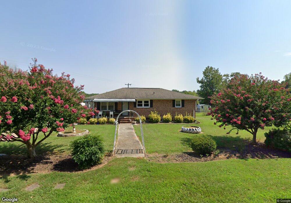
103 Knowlandwood Cir Anderson, SC 29624
Estimated Value: $116,606 - $223,000
--
Bed
--
Bath
1,134
Sq Ft
$152/Sq Ft
Est. Value
About This Home
This home is located at 103 Knowlandwood Cir, Anderson, SC 29624 and is currently estimated at $172,902, approximately $152 per square foot. 103 Knowlandwood Cir is a home located in Anderson County with nearby schools including Crescent High School and Anderson Five Charter School.
Ownership History
Date
Name
Owned For
Owner Type
Purchase Details
Closed on
Jun 13, 2006
Sold by
Grove Grady L and Grove Tommy Glen
Bought by
Grove Ricky E
Current Estimated Value
Home Financials for this Owner
Home Financials are based on the most recent Mortgage that was taken out on this home.
Original Mortgage
$36,000
Interest Rate
6.57%
Mortgage Type
New Conventional
Purchase Details
Closed on
Apr 12, 2006
Sold by
Grove Ricky Eugene
Bought by
Grove Grady L and Grove Tommy Glen
Create a Home Valuation Report for This Property
The Home Valuation Report is an in-depth analysis detailing your home's value as well as a comparison with similar homes in the area
Home Values in the Area
Average Home Value in this Area
Purchase History
| Date | Buyer | Sale Price | Title Company |
|---|---|---|---|
| Grove Ricky E | $36,000 | None Available | |
| Grove Grady L | -- | None Available |
Source: Public Records
Mortgage History
| Date | Status | Borrower | Loan Amount |
|---|---|---|---|
| Closed | Grove Ricky E | $36,000 |
Source: Public Records
Tax History Compared to Growth
Tax History
| Year | Tax Paid | Tax Assessment Tax Assessment Total Assessment is a certain percentage of the fair market value that is determined by local assessors to be the total taxable value of land and additions on the property. | Land | Improvement |
|---|---|---|---|---|
| 2024 | $460 | $2,670 | $380 | $2,290 |
| 2023 | $454 | $2,670 | $380 | $2,290 |
| 2022 | $426 | $2,670 | $380 | $2,290 |
| 2021 | $410 | $2,400 | $240 | $2,160 |
| 2020 | $405 | $2,400 | $240 | $2,160 |
| 2019 | $405 | $2,400 | $240 | $2,160 |
| 2018 | $405 | $2,400 | $240 | $2,160 |
| 2017 | -- | $2,400 | $240 | $2,160 |
| 2016 | $406 | $2,400 | $240 | $2,160 |
| 2015 | $413 | $2,400 | $240 | $2,160 |
| 2014 | $415 | $2,400 | $240 | $2,160 |
Source: Public Records
Map
Nearby Homes
- 00 Clinkscales Rd
- 623 Clinkscales Rd
- 1111 Kay Dr
- 105 Combine Ln
- 300 Clinkscales Rd
- 304 Clinkscales Rd
- Jodeco FP Plan at Gleneddie Acres
- 307 Clinkscales Rd
- 126 Elrod Rd
- 134 Elrod Rd
- 303 Clinkscales Rd
- ESSEX Plan at Creekside
- DUPONT Plan at Creekside
- 293 Harry Dr
- 1123 Airline Rd
- 144 Cloverhill Dr
- 117 Gleneddie Rd
- 116 Gleneddie Rd
- 216 Cloverhill Dr
- 107 Knowlandwood Cir
- 104 Knowlandwood Cir
- 1802 Airline Rd
- 113 Knowlandwood Cir
- 112 Knowlandwood Cir
- 1810 Airline Rd
- 1809 Airline Rd
- 119 Knowlandwood Cir
- 120 Knowlandwood Cir
- 124 Knowlandwood Cir
- 123 Knowlandwood Cir
- 128 Knowlandwood Cir
- 127 Knowlandwood Cir
- 1824 Airline Rd
- 130 Knowlandwood Cir
- 133 Knowlandwood Cir
- 1834 Airline Rd
- 138 Knowlandwood Cir
- 10.26 ACRES Hayes Rd
- 00 Hayes Rd