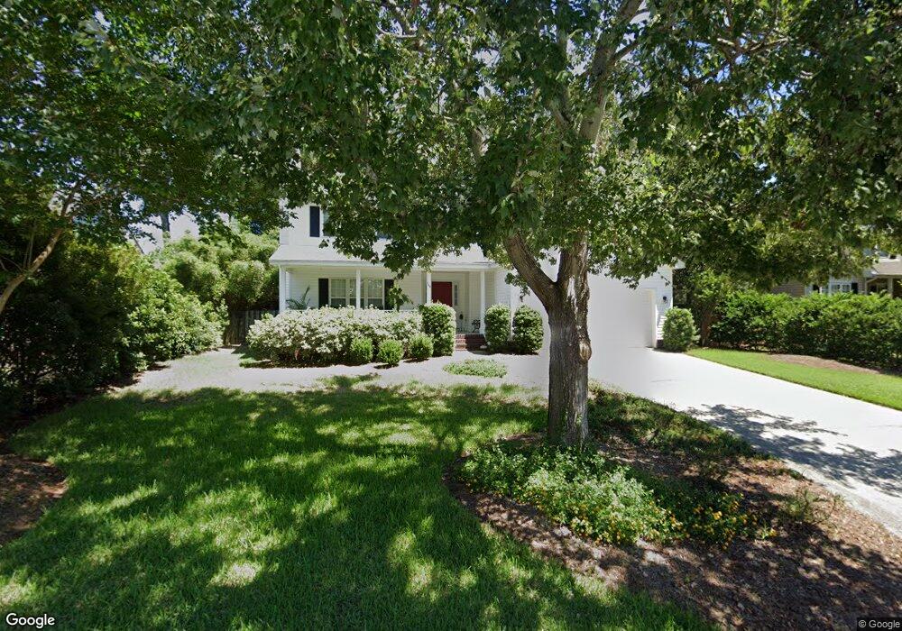
103 Oyster Point Row Charleston, SC 29412
James Island NeighborhoodEstimated Value: $614,479 - $670,000
3
Beds
3
Baths
1,710
Sq Ft
$379/Sq Ft
Est. Value
About This Home
This home is located at 103 Oyster Point Row, Charleston, SC 29412 and is currently estimated at $647,620, approximately $378 per square foot. 103 Oyster Point Row is a home located in Charleston County with nearby schools including Harbor View Elementary School, Camp Road Middle, and James Island Charter High School.
Ownership History
Date
Name
Owned For
Owner Type
Purchase Details
Closed on
Aug 23, 2021
Sold by
Miller Byron D
Bought by
Miller Byron D and Miller Kimberly S
Current Estimated Value
Purchase Details
Closed on
Aug 25, 2000
Sold by
Joe Ford Construction
Bought by
Miller Byron D and Miller Kimberly S
Purchase Details
Closed on
Oct 8, 1999
Sold by
Ford William J
Bought by
Joe Ford Construction
Home Financials for this Owner
Home Financials are based on the most recent Mortgage that was taken out on this home.
Original Mortgage
$479,600
Interest Rate
7.85%
Mortgage Type
Purchase Money Mortgage
Create a Home Valuation Report for This Property
The Home Valuation Report is an in-depth analysis detailing your home's value as well as a comparison with similar homes in the area
Home Values in the Area
Average Home Value in this Area
Purchase History
| Date | Buyer | Sale Price | Title Company |
|---|---|---|---|
| Miller Byron D | -- | None Listed On Document | |
| Miller Byron D | $176,900 | -- | |
| Joe Ford Construction | $98,000 | -- |
Source: Public Records
Mortgage History
| Date | Status | Borrower | Loan Amount |
|---|---|---|---|
| Previous Owner | Joe Ford Construction | $479,600 |
Source: Public Records
Tax History Compared to Growth
Tax History
| Year | Tax Paid | Tax Assessment Tax Assessment Total Assessment is a certain percentage of the fair market value that is determined by local assessors to be the total taxable value of land and additions on the property. | Land | Improvement |
|---|---|---|---|---|
| 2024 | $1,618 | $11,900 | $0 | $0 |
| 2023 | $1,618 | $11,900 | $0 | $0 |
| 2022 | $1,493 | $11,900 | $0 | $0 |
| 2021 | $1,564 | $11,900 | $0 | $0 |
| 2020 | $1,621 | $11,900 | $0 | $0 |
| 2019 | $1,446 | $10,350 | $0 | $0 |
| 2017 | $1,397 | $10,350 | $0 | $0 |
| 2016 | $1,340 | $10,350 | $0 | $0 |
| 2015 | $1,384 | $10,350 | $0 | $0 |
| 2014 | $1,325 | $0 | $0 | $0 |
| 2011 | -- | $0 | $0 | $0 |
Source: Public Records
Map
Nearby Homes
- 9 Maplecrest Dr
- 14 Maplecrest Dr
- 1 Maplecrest Dr
- 50 Held Cir Unit C
- 17 S Anderson Ave Unit A,B,C, D
- 35 Rivers Point Row Unit A
- 1 S Anderson Ave
- 36 Forde Row
- 1453 Camp Rd
- 14 Clam Shell Row
- 27 Brockman Dr Unit 27B
- 27 Brockman Dr Unit 27C
- 10 Bass Ln Unit D
- 21 Rivers Point Row Unit 11 C
- 21 Rivers Point Row Unit 3C
- 1402 Camp Rd Unit 5E
- 1402 Camp Rd Unit 6E
- 1402 Camp Rd Unit 1H
- 1402 Camp Rd Unit 8B
- 1402 Camp Rd Unit 9C
- 99 Oyster Point Row
- 105 Oyster Point Row
- 29 Maplecrest Dr
- 27 Maplecrest Dr
- 19 Maplecrest Dr
- 31 Maplecrest Dr
- 21 Maplecrest Dr
- 17 Maplecrest Dr
- 95 Oyster Point Row
- 33 Maplecrest Dr
- 107 Oyster Point Row
- 25 Maplecrest Dr
- 104 Oyster Point Row
- 39 Maplecrest Dr
- 23 Maplecrest Dr
- 15 Maplecrest Dr
- 41 Maplecrest Dr
- 35 Maplecrest Dr
- 68 Rivers Point Row
- 100 Oyster Point Row