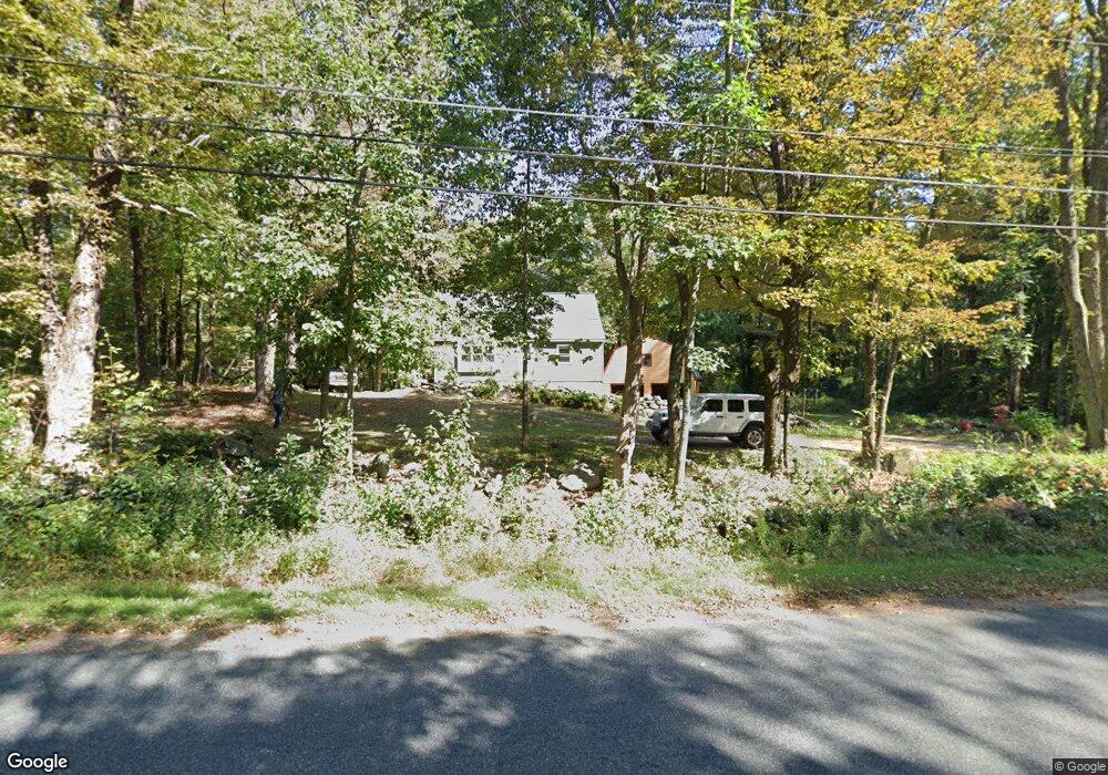
103 Pierce Rd West Brookfield, MA 01585
Estimated Value: $377,040 - $422,000
4
Beds
2
Baths
1,209
Sq Ft
$333/Sq Ft
Est. Value
About This Home
This home is located at 103 Pierce Rd, West Brookfield, MA 01585 and is currently estimated at $402,010, approximately $332 per square foot. 103 Pierce Rd is a home located in Worcester County with nearby schools including Quaboag Regional High School.
Ownership History
Date
Name
Owned For
Owner Type
Purchase Details
Closed on
Jul 30, 2010
Sold by
Swank Thomas P
Bought by
Hay Timothy R and Booz Regina K
Current Estimated Value
Home Financials for this Owner
Home Financials are based on the most recent Mortgage that was taken out on this home.
Original Mortgage
$171,000
Outstanding Balance
$114,411
Interest Rate
4.78%
Mortgage Type
Purchase Money Mortgage
Estimated Equity
$287,599
Create a Home Valuation Report for This Property
The Home Valuation Report is an in-depth analysis detailing your home's value as well as a comparison with similar homes in the area
Home Values in the Area
Average Home Value in this Area
Purchase History
| Date | Buyer | Sale Price | Title Company |
|---|---|---|---|
| Hay Timothy R | $174,000 | -- |
Source: Public Records
Mortgage History
| Date | Status | Borrower | Loan Amount |
|---|---|---|---|
| Open | Hay Timothy R | $171,000 |
Source: Public Records
Tax History
| Year | Tax Paid | Tax Assessment Tax Assessment Total Assessment is a certain percentage of the fair market value that is determined by local assessors to be the total taxable value of land and additions on the property. | Land | Improvement |
|---|---|---|---|---|
| 2025 | $2,787 | $258,500 | $34,700 | $223,800 |
| 2024 | $2,903 | $258,500 | $34,700 | $223,800 |
| 2023 | $2,838 | $236,700 | $31,600 | $205,100 |
| 2022 | $3,007 | $227,300 | $30,100 | $197,200 |
| 2021 | $3,906 | $208,600 | $30,100 | $178,500 |
| 2020 | $3,644 | $173,900 | $30,100 | $143,800 |
| 2019 | $3,478 | $173,900 | $30,100 | $143,800 |
| 2018 | $3,474 | $168,500 | $30,100 | $138,400 |
| 2017 | $2,448 | $152,400 | $38,100 | $114,300 |
| 2016 | $2,364 | $152,400 | $38,100 | $114,300 |
| 2015 | $2,283 | $152,400 | $38,100 | $114,300 |
Source: Public Records
Map
Nearby Homes
- 34 Whispering Pine Dr
- 207 Shoreline Dr
- 138 Ragged Hill Rd
- 221 Pierce Rd
- 9 John Gilbert Rd
- 233 Ragged Hill Rd
- 260 Wickaboag Valley Rd
- 0 Gilbertville Rd Unit 73387398
- 22 Beach Dr
- 25 Highland Trail
- 940 Old West Brookfield Rd
- 431 Coy Hill Rd
- 234 Wickaboag
- 5 Canal St
- 51 Church St
- 14 Pleasant St
- 22 Church St
- Lot 2 Brimfield Rd
- Lot 1 Brimfield Rd
- 25 Prospect St
- 97 Pierce Rd
- 7 Hemlock St
- 15 Hemlock St
- 91 Pierce Rd
- 68 Juniper St
- 264 &265 Shoreline Dr
- 264 Shoreline Dr
- 85 Pierce Rd
- 123 Pierce Rd
- 40 White Birch Dr
- 33 Juniper St
- 126 Pierce Rd
- 256 Shoreline Dr
- 279 Shoreline Dr
- 16 White Birch Dr
- 255 Shoreline Dr
- 131 Pierce Rd
- 12 White Birch Dr
- 21 White Birch Dr
- 135 Pierce Rd