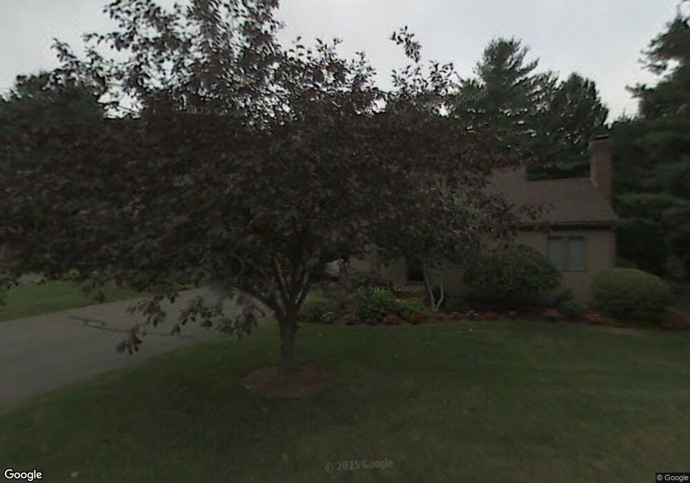
103 the Laurels Enfield, CT 06082
Estimated Value: $375,201 - $390,000
2
Beds
3
Baths
1,328
Sq Ft
$286/Sq Ft
Est. Value
About This Home
This home is located at 103 the Laurels, Enfield, CT 06082 and is currently estimated at $380,050, approximately $286 per square foot. 103 the Laurels is a home located in Hartford County with nearby schools including Prudence Crandall Elementary School, Nathan Hale Elementary School, and John F. Kennedy Middle School.
Ownership History
Date
Name
Owned For
Owner Type
Purchase Details
Closed on
Feb 4, 2025
Sold by
Bynum James Est and Casey
Bought by
Moran James F and Moran Kathleen A
Current Estimated Value
Purchase Details
Closed on
Dec 11, 1998
Sold by
Niss Andrew and Niss Lydia
Bought by
Bynum James and Bynum Constance
Purchase Details
Closed on
May 13, 1994
Sold by
Meyers Michael and Meyers Linda
Bought by
Niss Lydia
Home Financials for this Owner
Home Financials are based on the most recent Mortgage that was taken out on this home.
Original Mortgage
$75,000
Interest Rate
5.5%
Mortgage Type
Unknown
Purchase Details
Closed on
Sep 9, 1992
Sold by
Eytel Arthur and Eytel Roslyn
Bought by
Meyers Linda and Meyers Michael
Create a Home Valuation Report for This Property
The Home Valuation Report is an in-depth analysis detailing your home's value as well as a comparison with similar homes in the area
Home Values in the Area
Average Home Value in this Area
Purchase History
| Date | Buyer | Sale Price | Title Company |
|---|---|---|---|
| Moran James F | $375,000 | None Available | |
| Moran James F | $375,000 | None Available | |
| Bynum James | $190,000 | -- | |
| Bynum James | $190,000 | -- | |
| Niss Lydia | $190,000 | -- | |
| Niss Lydia | $190,000 | -- | |
| Meyers Linda | $150,000 | -- | |
| Meyers Linda | $150,000 | -- |
Source: Public Records
Mortgage History
| Date | Status | Borrower | Loan Amount |
|---|---|---|---|
| Previous Owner | Meyers Linda | $75,000 |
Source: Public Records
Tax History Compared to Growth
Tax History
| Year | Tax Paid | Tax Assessment Tax Assessment Total Assessment is a certain percentage of the fair market value that is determined by local assessors to be the total taxable value of land and additions on the property. | Land | Improvement |
|---|---|---|---|---|
| 2025 | $5,694 | $160,400 | $0 | $160,400 |
| 2024 | $5,543 | $160,400 | $0 | $160,400 |
| 2023 | $5,511 | $160,400 | $0 | $160,400 |
| 2022 | $5,075 | $160,400 | $0 | $160,400 |
| 2021 | $5,401 | $139,810 | $0 | $139,810 |
| 2020 | $5,345 | $139,810 | $0 | $139,810 |
| 2019 | $5,205 | $139,810 | $0 | $139,810 |
| 2018 | $5,089 | $139,810 | $0 | $139,810 |
| 2017 | $4,814 | $139,810 | $0 | $139,810 |
| 2016 | $4,463 | $134,590 | $0 | $134,590 |
| 2015 | $4,332 | $134,590 | $0 | $134,590 |
| 2014 | $4,230 | $134,590 | $0 | $134,590 |
Source: Public Records
Map
Nearby Homes
- 12 the Laurels Unit 12
- 11 Brook Rd
- 42 Candlewood Dr Unit 42
- 181 Candlewood Dr Unit 181
- 6 Jondot Dr
- 90 Cottage Rd
- 5 Cranberry Hollow Unit 5
- 176 Cottage Rd
- 18 Cranberry Hollow Unit 18
- 7 Oakwood St
- 14 W Forrest Dr
- 39 Liberty Ln
- 50 Liberty Ln
- 41 Liberty Ln
- 43 Liberty Ln
- 20 Gary Rd
- 65 W Shore Dr
- 21 Grove Rd
- 102 N Maple St Unit 1A
- 12 Concord Terrace
- 107 the Laurels
- 107 the Laurels Unit B
- 107 the Laurels Unit 107
- 105 the Laurels
- 105 the Laurels Unit 105
- 101 the Laurels
- 113 the Laurels
- 115 the Laurels
- 115 the Laurels Unit 115
- 117 the Laurels
- 123 the Laurels
- 123 the Laurels Unit 123
- 123 the Laurels Unit E 24
- 125 the Laurels
- 125 the Laurels Unit 125
- 127 the Laurels
- 127 the Laurels Unit 127
- 129 the Laurels
- 70 the Laurels
- 70 the Laurels Unit 70