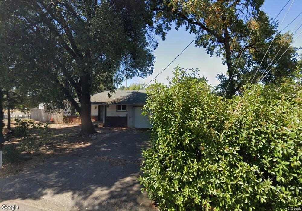
1030 Ledell Dr Redding, CA 96002
Enterprise NeighborhoodEstimated Value: $321,000 - $382,000
4
Beds
2
Baths
1,900
Sq Ft
$186/Sq Ft
Est. Value
About This Home
This home is located at 1030 Ledell Dr, Redding, CA 96002 and is currently estimated at $353,040, approximately $185 per square foot. 1030 Ledell Dr is a home located in Shasta County with nearby schools including Lassen View Elementary School, Parsons Junior High School, and Enterprise High School.
Ownership History
Date
Name
Owned For
Owner Type
Purchase Details
Closed on
Mar 16, 2012
Sold by
Romero Beverly C
Bought by
Romero Esteban and Romero Begley Carlita C
Current Estimated Value
Purchase Details
Closed on
Oct 21, 1998
Sold by
Foster Lawrence E & M Tr
Bought by
Huebner Robert J and Hueber Janis L
Home Financials for this Owner
Home Financials are based on the most recent Mortgage that was taken out on this home.
Original Mortgage
$59,200
Interest Rate
6.61%
Mortgage Type
Balloon
Create a Home Valuation Report for This Property
The Home Valuation Report is an in-depth analysis detailing your home's value as well as a comparison with similar homes in the area
Home Values in the Area
Average Home Value in this Area
Purchase History
| Date | Buyer | Sale Price | Title Company |
|---|---|---|---|
| Romero Esteban | -- | None Available | |
| Huebner Robert J | $74,000 | Chicago Title Co |
Source: Public Records
Mortgage History
| Date | Status | Borrower | Loan Amount |
|---|---|---|---|
| Previous Owner | Huebner Robert J | $59,200 |
Source: Public Records
Tax History
| Year | Tax Paid | Tax Assessment Tax Assessment Total Assessment is a certain percentage of the fair market value that is determined by local assessors to be the total taxable value of land and additions on the property. | Land | Improvement |
|---|---|---|---|---|
| 2025 | $1,209 | $115,984 | $37,610 | $78,374 |
| 2024 | $1,190 | $113,711 | $36,873 | $76,838 |
| 2023 | $1,190 | $111,482 | $36,150 | $75,332 |
| 2022 | $1,155 | $109,297 | $35,442 | $73,855 |
| 2021 | $1,114 | $107,155 | $34,748 | $72,407 |
| 2020 | $1,108 | $106,057 | $34,392 | $71,665 |
| 2019 | $1,097 | $103,978 | $33,718 | $70,260 |
| 2018 | $1,083 | $101,940 | $33,057 | $68,883 |
| 2017 | $1,100 | $99,942 | $32,409 | $67,533 |
| 2016 | $1,028 | $97,983 | $31,774 | $66,209 |
| 2015 | $1,018 | $96,512 | $31,297 | $65,215 |
| 2014 | $1,010 | $94,622 | $30,684 | $63,938 |
Source: Public Records
Map
Nearby Homes
- 4323 Churn Crk Rd
- 751 Woodacre Dr
- 607 Woodacre Dr
- 4302 Paulson Ln
- 737 Estate St
- 1354 Harpole Rd
- 688 Julie Way
- 3708 Traverse St
- 3689 Suzanne Way
- 1513 Harpole Rd
- 3527 Adams Ln
- 1209 C St
- 3428 Adams Ln
- 3650 Cheryl Dr
- 4724 Squirrel Run Ct
- 1289 Arizona St
- 3360 Lawrence Rd
- 1091 Del Sol Place
- 4877 Squirrel Run Ct
- 3857 Eagle Pkwy
- 1046 Ledell Dr
- 1015 Lorraine Dr
- 1064 Ledell Dr
- 1029 Lorraine Dr
- 1031 Ledell Dr
- 4046 Churn Creek Rd
- 1043 Lorraine Dr
- 1078 Ledell Dr
- 1063 Ledell Dr
- 4030 Churn Creek Rd
- 1057 Lorraine Dr
- 4129 Churn Creek Rd
- 1079 Ledell Dr
- 1094 Ledell Dr
- 1030 Denton Way
- 1071 Lorraine Dr
- 1046 Denton Way
- 1014 Lorraine Dr
- 1095 Ledell Dr
- 1028 Lorraine Dr
Your Personal Tour Guide
Ask me questions while you tour the home.