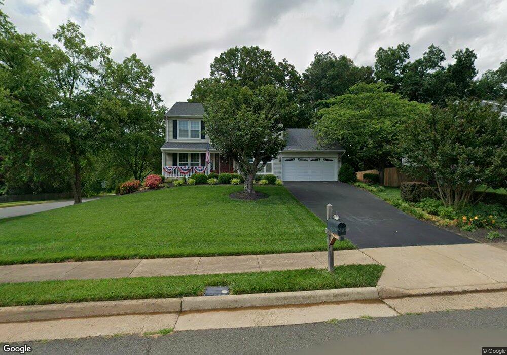
10300 Cedar Ridge Dr Manassas, VA 20110
Old Town Manassas NeighborhoodEstimated Value: $624,812 - $693,000
4
Beds
3
Baths
2,279
Sq Ft
$289/Sq Ft
Est. Value
About This Home
This home is located at 10300 Cedar Ridge Dr, Manassas, VA 20110 and is currently estimated at $658,953, approximately $289 per square foot. 10300 Cedar Ridge Dr is a home located in Manassas City with nearby schools including George Carr Round Elementary School, Mayfield Intermediate School, and Grace E. Metz Middle School.
Ownership History
Date
Name
Owned For
Owner Type
Purchase Details
Closed on
Jan 28, 2000
Sold by
Duggene John W
Bought by
Skoczylas Mark R
Current Estimated Value
Home Financials for this Owner
Home Financials are based on the most recent Mortgage that was taken out on this home.
Original Mortgage
$172,000
Outstanding Balance
$55,487
Interest Rate
7.83%
Estimated Equity
$603,466
Create a Home Valuation Report for This Property
The Home Valuation Report is an in-depth analysis detailing your home's value as well as a comparison with similar homes in the area
Home Values in the Area
Average Home Value in this Area
Purchase History
| Date | Buyer | Sale Price | Title Company |
|---|---|---|---|
| Skoczylas Mark R | $215,000 | -- |
Source: Public Records
Mortgage History
| Date | Status | Borrower | Loan Amount |
|---|---|---|---|
| Open | Skoczylas Mark R | $172,000 |
Source: Public Records
Tax History Compared to Growth
Tax History
| Year | Tax Paid | Tax Assessment Tax Assessment Total Assessment is a certain percentage of the fair market value that is determined by local assessors to be the total taxable value of land and additions on the property. | Land | Improvement |
|---|---|---|---|---|
| 2024 | $6,675 | $529,800 | $167,000 | $362,800 |
| 2023 | $6,315 | $501,200 | $162,000 | $339,200 |
| 2022 | $6,101 | $454,600 | $141,000 | $313,600 |
| 2021 | $5,740 | $401,700 | $125,500 | $276,200 |
| 2020 | $5,405 | $370,200 | $121,500 | $248,700 |
| 2019 | $5,245 | $354,400 | $118,000 | $236,400 |
| 2018 | $5,084 | $348,200 | $112,500 | $235,700 |
| 2017 | -- | $340,500 | $112,500 | $228,000 |
| 2016 | $4,777 | $340,500 | $0 | $0 |
| 2015 | -- | $344,500 | $112,500 | $232,000 |
| 2014 | -- | $0 | $0 | $0 |
Source: Public Records
Map
Nearby Homes
- 10269 Cedar Ridge Dr
- 10102 Queens Way
- 10106 Queens Way
- 10114 Queens Way
- 10118 Queens Way
- 10177 Queens Way
- 9518 Sandy Ct
- 10173 Queens Way
- 10165 Queens Way
- 10161 Queens Way
- 10157 Queens Way
- 10130 Queens Way
- 10153 Queens Way
- BALMORAL Plan at Kings Landing
- HIGHGROVE Plan at Kings Landing
- 10170 Queens Way
- 10166 Queens Way
- 9444 Corey Dr
- 9521 Vinnia Ct
- 10073 Loblolly Trail
- 10302 Cedar Ridge Dr
- 9651 Shannon Ln
- 10298 Cedar Ridge Dr
- 10304 Cedar Ridge Dr
- 10301 Cedar Ridge Dr
- 10303 Cedar Ridge Dr
- 10306 Cedar Ridge Dr
- 9660 Shannon Ln
- 10296 Cedar Ridge Dr
- 10305 Cedar Ridge Dr
- 9663 Shannon Ln
- 10294 Cedar Ridge Dr
- 10297 Cedar Ridge Dr
- 10307 Cedar Ridge Dr
- 9662 Shannon Ln
- 10308 Cedar Ridge Dr
- 10314 Lee Manor Dr
- 10312 Lee Manor Dr
- 9649 Shannon Ln
- 10295 Cedar Ridge Dr