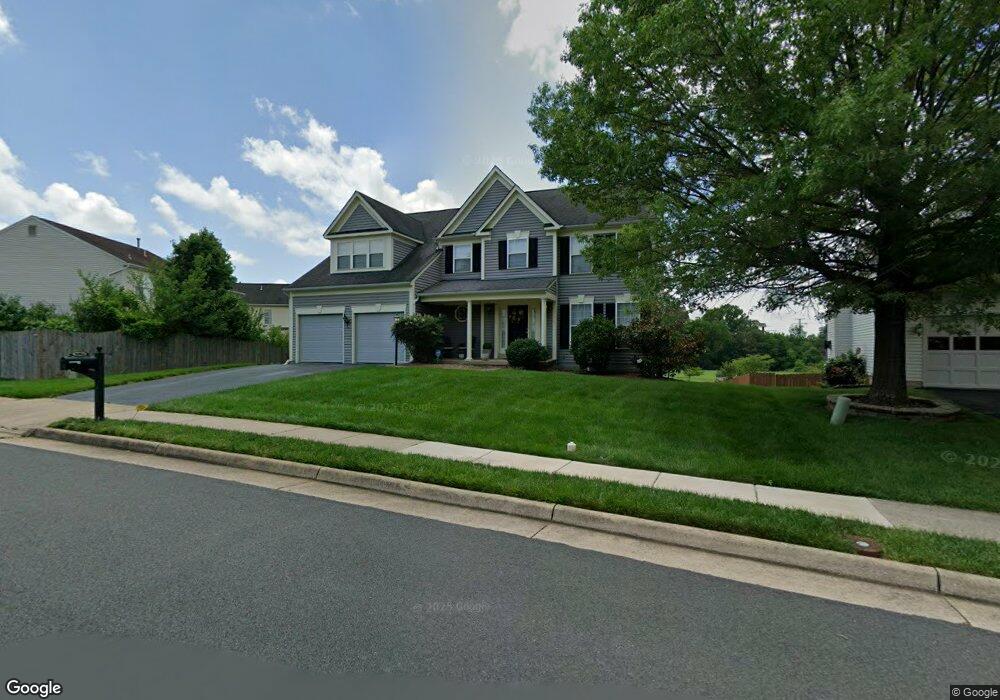
10304 Winged Elm Cir Manassas, VA 20110
Estimated Value: $700,618 - $763,000
4
Beds
4
Baths
2,532
Sq Ft
$290/Sq Ft
Est. Value
About This Home
This home is located at 10304 Winged Elm Cir, Manassas, VA 20110 and is currently estimated at $733,155, approximately $289 per square foot. 10304 Winged Elm Cir is a home located in Prince William County with nearby schools including Bennett Elementary School, Parkside Middle School, and Brentsville District High School.
Ownership History
Date
Name
Owned For
Owner Type
Purchase Details
Closed on
Nov 7, 1995
Sold by
Foster Bros Inc
Bought by
Piry Frederic M
Current Estimated Value
Home Financials for this Owner
Home Financials are based on the most recent Mortgage that was taken out on this home.
Original Mortgage
$200,000
Outstanding Balance
$2,792
Interest Rate
7.58%
Estimated Equity
$730,363
Create a Home Valuation Report for This Property
The Home Valuation Report is an in-depth analysis detailing your home's value as well as a comparison with similar homes in the area
Home Values in the Area
Average Home Value in this Area
Purchase History
| Date | Buyer | Sale Price | Title Company |
|---|---|---|---|
| Piry Frederic M | $220,000 | -- |
Source: Public Records
Mortgage History
| Date | Status | Borrower | Loan Amount |
|---|---|---|---|
| Open | Piry Frederic M | $200,000 |
Source: Public Records
Tax History Compared to Growth
Tax History
| Year | Tax Paid | Tax Assessment Tax Assessment Total Assessment is a certain percentage of the fair market value that is determined by local assessors to be the total taxable value of land and additions on the property. | Land | Improvement |
|---|---|---|---|---|
| 2025 | $6,043 | $650,300 | $189,400 | $460,900 |
| 2024 | $6,043 | $607,600 | $180,300 | $427,300 |
| 2023 | $5,970 | $573,800 | $165,000 | $408,800 |
| 2022 | $6,110 | $541,400 | $153,800 | $387,600 |
| 2021 | $5,817 | $476,600 | $130,100 | $346,500 |
| 2020 | $6,973 | $449,900 | $119,300 | $330,600 |
| 2019 | $6,966 | $449,400 | $119,300 | $330,100 |
| 2018 | $5,144 | $426,000 | $113,600 | $312,400 |
| 2017 | $5,093 | $413,000 | $113,600 | $299,400 |
| 2016 | $4,863 | $397,800 | $113,600 | $284,200 |
| 2015 | $4,711 | $393,800 | $113,600 | $280,200 |
| 2014 | $4,711 | $376,900 | $110,300 | $266,600 |
Source: Public Records
Map
Nearby Homes
- 10170 Queens Way
- 10166 Queens Way
- BALMORAL Plan at Kings Landing
- HIGHGROVE Plan at Kings Landing
- 10102 Queens Way
- 10106 Queens Way
- 10114 Queens Way
- 10118 Queens Way
- 10130 Queens Way
- 9541 Justin Ln
- 10569 Speiden Trail
- 10338 Ratcliffe Trail
- 9725 Cheshire Ridge Cir
- 10878 Peachwood Dr
- 9521 Country Roads Ln
- 9521 Vinnia Ct
- 9444 Corey Dr
- 10123 Erin Ct
- 9348 Amaryllis Ave
- 9432 Deschamp Ct
- 10100 Chokecherry Ct
- 10104 Chokecherry Ct
- 10292 Winged Elm Cir
- 10305 Winged Elm Cir
- 10096 Loblolly Trail
- 10108 Chokecherry Ct
- 10293 Winged Elm Cir
- 10105 Chokecherry Ct
- 10288 Winged Elm Cir
- 10112 Chokecherry Ct
- 10289 Winged Elm Cir
- 10097 Loblolly Trail
- 10313 Winged Elm Cir
- 10392 Lime Tree Ct
- 10109 Chokecherry Ct
- 10284 Winged Elm Cir
- 10396 Lime Tree Ct
- 10316 Winged Elm Cir
- 10285 Winged Elm Cir
- 10116 Chokecherry Ct