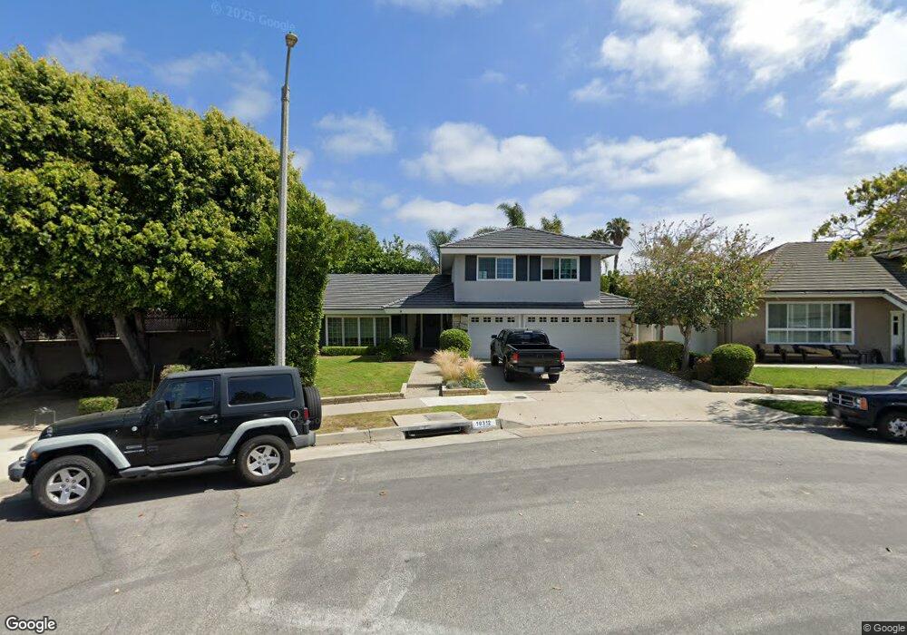
10312 Meredith Dr Huntington Beach, CA 92646
Southeast NeighborhoodEstimated Value: $1,940,408 - $2,106,000
5
Beds
3
Baths
2,524
Sq Ft
$814/Sq Ft
Est. Value
About This Home
This home is located at 10312 Meredith Dr, Huntington Beach, CA 92646 and is currently estimated at $2,053,852, approximately $813 per square foot. 10312 Meredith Dr is a home located in Orange County with nearby schools including Ralph E. Hawes Elementary School, Isaac L. Sowers Middle School, and Edison High School.
Ownership History
Date
Name
Owned For
Owner Type
Purchase Details
Closed on
Apr 17, 2024
Sold by
Brown Linda R
Bought by
Brown Linda R and Brown Mark L
Current Estimated Value
Home Financials for this Owner
Home Financials are based on the most recent Mortgage that was taken out on this home.
Original Mortgage
$1,131,500
Outstanding Balance
$1,114,139
Interest Rate
6.74%
Mortgage Type
New Conventional
Estimated Equity
$939,713
Purchase Details
Closed on
May 8, 2013
Sold by
Hammond Le Roy and Hammond Petra
Bought by
Hammond Le Roy and Hammond Petra
Create a Home Valuation Report for This Property
The Home Valuation Report is an in-depth analysis detailing your home's value as well as a comparison with similar homes in the area
Home Values in the Area
Average Home Value in this Area
Purchase History
| Date | Buyer | Sale Price | Title Company |
|---|---|---|---|
| Brown Linda R | -- | Fidelity National Title | |
| Hammond Le Roy | -- | None Available |
Source: Public Records
Mortgage History
| Date | Status | Borrower | Loan Amount |
|---|---|---|---|
| Open | Brown Linda R | $1,131,500 |
Source: Public Records
Tax History Compared to Growth
Tax History
| Year | Tax Paid | Tax Assessment Tax Assessment Total Assessment is a certain percentage of the fair market value that is determined by local assessors to be the total taxable value of land and additions on the property. | Land | Improvement |
|---|---|---|---|---|
| 2025 | $1,911 | $660,348 | $481,660 | $178,688 |
| 2024 | $1,911 | $137,822 | $31,528 | $106,294 |
| 2023 | $379 | $135,120 | $30,910 | $104,210 |
| 2022 | $367 | $132,471 | $30,304 | $102,167 |
| 2021 | $363 | $129,874 | $29,710 | $100,164 |
| 2020 | $359 | $128,543 | $29,406 | $99,137 |
| 2019 | $359 | $126,023 | $28,829 | $97,194 |
| 2018 | $354 | $123,552 | $28,263 | $95,289 |
| 2017 | $350 | $121,130 | $27,709 | $93,421 |
| 2016 | $346 | $118,755 | $27,165 | $91,590 |
| 2015 | $340 | $116,972 | $26,757 | $90,215 |
| 2014 | $333 | $114,681 | $26,233 | $88,448 |
Source: Public Records
Map
Nearby Homes
- 10172 Stonybrook Dr
- 2741 Sandpiper Dr
- 20442 Craimer Ln
- 2761 Sandpiper Dr
- 19941 Carmania Ln
- 19922 Carmania Ln
- 2055 Calvert Ave
- 2036 Mandarin Dr
- 19867 Piccadilly Ln
- 20392 Redwood Ln
- 10101 Theseus Dr
- 19880 Berkshire Ln
- 1944 Flamingo Dr
- 19860 Claremont Ln
- 19774 Cambridge Ln
- 9831 Continental Dr
- 9745 Cornwall Dr
- 19843 Coventry Ln
- 9695 Adams Ave
- 9667 Durham Dr
- 10302 Meredith Dr
- 10301 Jon Day Dr
- 20242 Ravenwood Ln
- 20182 Midland Ln
- 10292 Meredith Dr
- 10291 Jon Day Dr
- 10301 Meredith Dr
- 20172 Midland Ln
- 10282 Meredith Dr
- 20252 Ravenwood Ln
- 10281 Jon Day Dr
- 10291 Meredith Dr
- 20162 Midland Ln
- 20161 Midland Ln
- 10262 Meredith Dr
- 10281 Meredith Dr
- 10261 Jon Day Dr
- 20262 Ravenwood Ln
- 20251 Ravenwood Ln
- 20152 Midland Ln