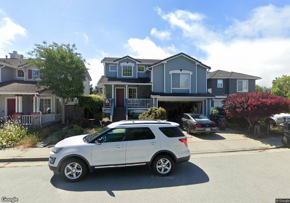
1033 Aviator Ct Scotts Valley, CA 95066
Estimated Value: $1,156,000 - $1,356,000
3
Beds
3
Baths
1,587
Sq Ft
$813/Sq Ft
Est. Value
About This Home
This home is located at 1033 Aviator Ct, Scotts Valley, CA 95066 and is currently estimated at $1,290,549, approximately $813 per square foot. 1033 Aviator Ct is a home located in Santa Cruz County with nearby schools including Vine Hill Elementary School, Scotts Valley Middle School, and Scotts Valley High School.
Ownership History
Date
Name
Owned For
Owner Type
Purchase Details
Closed on
Sep 19, 1995
Sold by
Kaufman & Broad Monterey Bay Inc
Bought by
Knight Henry R and Knight Stephanie A
Current Estimated Value
Home Financials for this Owner
Home Financials are based on the most recent Mortgage that was taken out on this home.
Original Mortgage
$219,350
Interest Rate
7.41%
Mortgage Type
Seller Take Back
Create a Home Valuation Report for This Property
The Home Valuation Report is an in-depth analysis detailing your home's value as well as a comparison with similar homes in the area
Home Values in the Area
Average Home Value in this Area
Purchase History
| Date | Buyer | Sale Price | Title Company |
|---|---|---|---|
| Knight Henry R | $274,500 | First American Title Co |
Source: Public Records
Mortgage History
| Date | Status | Borrower | Loan Amount |
|---|---|---|---|
| Previous Owner | Knight Henry R | $219,350 |
Source: Public Records
Tax History Compared to Growth
Tax History
| Year | Tax Paid | Tax Assessment Tax Assessment Total Assessment is a certain percentage of the fair market value that is determined by local assessors to be the total taxable value of land and additions on the property. | Land | Improvement |
|---|---|---|---|---|
| 2025 | $6,093 | $455,542 | $199,354 | $256,188 |
| 2024 | $6,093 | $446,610 | $195,445 | $251,165 |
| 2023 | $5,908 | $437,853 | $191,613 | $246,240 |
| 2022 | $5,774 | $429,268 | $187,856 | $241,412 |
| 2021 | $5,641 | $420,850 | $184,172 | $236,678 |
| 2020 | $5,556 | $416,535 | $182,284 | $234,251 |
| 2019 | $5,486 | $408,368 | $178,710 | $229,658 |
| 2018 | $5,147 | $400,360 | $175,205 | $225,155 |
| 2017 | $5,060 | $392,511 | $171,770 | $220,741 |
| 2016 | $4,838 | $384,815 | $168,402 | $216,413 |
| 2015 | $4,829 | $379,034 | $165,872 | $213,162 |
| 2014 | $4,653 | $371,609 | $162,623 | $208,986 |
Source: Public Records
Map
Nearby Homes
- 4 Sterling Ln
- 201 Lockewood Ln
- 268 Bluebonnet Ln Unit 124
- 552 Bean Creek Rd Unit 94
- 552 Bean Creek Rd Unit 37
- 552 Bean Creek Rd Unit 130
- 225 Mount Hermon #81 Rd Unit 81
- 111 Bean Creek Rd Unit 39
- 111 Bean Creek Rd Unit 43
- 111 Bean Creek Rd Unit 97
- 111 Bean Creek Rd Unit 146
- 111 Bean Creek Rd Unit 186
- 444 Whispering Pines Dr Unit 68
- 444 Whispering Pines Dr Unit 14
- 423 Nelson Rd
- 304 Thomas Terrace
- 22 Quien Sabe Rd
- 42 Arabian Way
- 612 Nelson Rd
- 29 Arabian Way
- 1029 Aviator Ct
- 1037 Aviator Ct
- 559 Skypark Dr
- 555 Skypark Dr
- 563 Skypark Dr
- 1025 Aviator Ct
- 1016 Aviator Ct
- 1020 Aviator Ct
- 1012 Aviator Ct
- 567 Skypark Dr
- 1021 Aviator Ct
- 1024 Aviator Ct
- 571 Skypark Dr
- 1028 Aviator Ct
- 424 Airstream Ct
- 1017 Aviator Ct
- 551 Skypark Dr
- 1008 Aviator Ct
- 575 Skypark Dr
- 1013 Aviator Ct