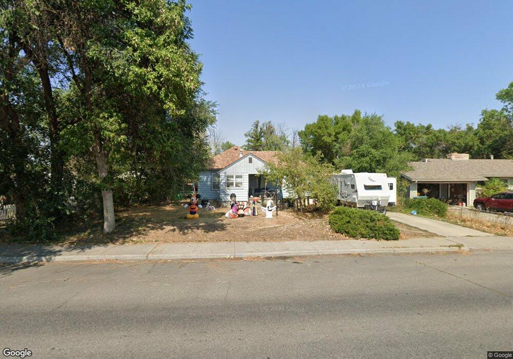
1033 Lewis Ave Billings, MT 59102
East Central Billings NeighborhoodEstimated Value: $300,000 - $330,000
4
Beds
2
Baths
992
Sq Ft
$319/Sq Ft
Est. Value
About This Home
This home is located at 1033 Lewis Ave, Billings, MT 59102 and is currently estimated at $316,159, approximately $318 per square foot. 1033 Lewis Ave is a home located in Yellowstone County with nearby schools including Broadwater School, Lewis & Clark Junior High School, and Billings Senior High School.
Ownership History
Date
Name
Owned For
Owner Type
Purchase Details
Closed on
Nov 23, 2005
Sold by
Grisso Cheryl and Grisso Eric
Bought by
Boetticher Andrew K and Spenny Michelle L
Current Estimated Value
Home Financials for this Owner
Home Financials are based on the most recent Mortgage that was taken out on this home.
Original Mortgage
$104,000
Interest Rate
6.16%
Mortgage Type
New Conventional
Purchase Details
Closed on
Aug 10, 2005
Sold by
Grisso Cheryl
Bought by
Grisso Cheryl and Grisso Eric
Create a Home Valuation Report for This Property
The Home Valuation Report is an in-depth analysis detailing your home's value as well as a comparison with similar homes in the area
Home Values in the Area
Average Home Value in this Area
Purchase History
| Date | Buyer | Sale Price | Title Company |
|---|---|---|---|
| Boetticher Andrew K | -- | None Available | |
| Grisso Cheryl | -- | None Available |
Source: Public Records
Mortgage History
| Date | Status | Borrower | Loan Amount |
|---|---|---|---|
| Previous Owner | Boetticher Andrew K | $104,000 |
Source: Public Records
Tax History Compared to Growth
Tax History
| Year | Tax Paid | Tax Assessment Tax Assessment Total Assessment is a certain percentage of the fair market value that is determined by local assessors to be the total taxable value of land and additions on the property. | Land | Improvement |
|---|---|---|---|---|
| 2025 | $2,701 | $304,800 | $53,323 | $251,477 |
| 2024 | $2,701 | $271,900 | $48,340 | $223,560 |
| 2023 | $2,718 | $271,900 | $48,340 | $223,560 |
| 2022 | $2,523 | $221,800 | $0 | $0 |
| 2021 | $2,399 | $221,800 | $0 | $0 |
| 2020 | $2,390 | $210,500 | $0 | $0 |
| 2019 | $2,285 | $210,500 | $0 | $0 |
| 2018 | $2,188 | $197,300 | $0 | $0 |
| 2017 | $2,124 | $197,300 | $0 | $0 |
| 2016 | $2,034 | $191,600 | $0 | $0 |
| 2015 | $1,989 | $191,600 | $0 | $0 |
| 2014 | $1,715 | $86,655 | $0 | $0 |
Source: Public Records
Map
Nearby Homes
- 1107 12th St W
- 1214 Clark Ave
- 1232 Burlington Ave
- 1225 Clark Ave
- 1230 Clark Ave
- 1263 Yellowstone Ave
- 1116 8th St W
- 1265 Yellowstone Ave
- 1256 & 1260 Yellowstone Ave
- 1506 9th St W
- 805 Clark Ave
- 1310 Yellowstone Ave Unit 6
- 1310 Yellowstone Ave Unit 11
- 1310 Yellowstone Ave Unit 16
- 743 Clark Ave
- 1113 Avenue D
- 3 Carrie Lynn Dr
- 1240 Avenue D Unit 7
- 743 Avenue C
- 1019 Miles Ave
- 1037 Lewis Ave
- 1039 Lewis Ave
- 1025 Lewis Ave
- 1036 Burlington Ave
- 1030 Burlington Ave
- 1040 Burlington Ave
- 1045 Lewis Ave
- 1020 Burlington Ave
- 1034 Lewis Ave
- 1044 Burlington Ave
- 1036 Lewis Ave
- 1007 Lewis Ave
- 1026 Lewis Ave
- 1010 Burlington Ave
- 1036 and 1038 Lewis Ave
- 1024 Lewis Ave
- 1040 Lewis Ave
- 1046 Burlington Ave
- 1028 Lewis Ave
- 1028 Lewis Ave