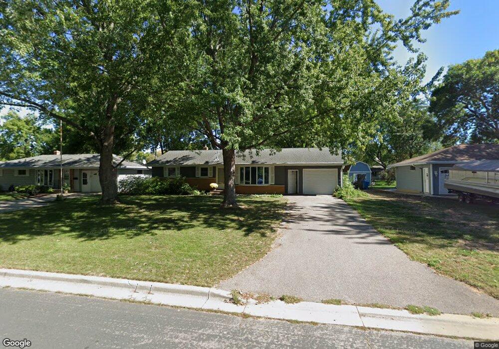
1033 Scott St S Shakopee, MN 55379
Estimated Value: $302,385 - $347,000
3
Beds
1
Bath
1,092
Sq Ft
$299/Sq Ft
Est. Value
About This Home
This home is located at 1033 Scott St S, Shakopee, MN 55379 and is currently estimated at $326,096, approximately $298 per square foot. 1033 Scott St S is a home located in Scott County with nearby schools including Sweeney Elementary School, East Middle School, and Shakopee Senior High School.
Ownership History
Date
Name
Owned For
Owner Type
Purchase Details
Closed on
Aug 7, 2019
Sold by
Knutson Kristine K and Estate Of Margaret R Sager
Bought by
Knutson Kristine K
Current Estimated Value
Create a Home Valuation Report for This Property
The Home Valuation Report is an in-depth analysis detailing your home's value as well as a comparison with similar homes in the area
Home Values in the Area
Average Home Value in this Area
Purchase History
| Date | Buyer | Sale Price | Title Company |
|---|---|---|---|
| Knutson Kristine K | -- | None Available |
Source: Public Records
Tax History Compared to Growth
Tax History
| Year | Tax Paid | Tax Assessment Tax Assessment Total Assessment is a certain percentage of the fair market value that is determined by local assessors to be the total taxable value of land and additions on the property. | Land | Improvement |
|---|---|---|---|---|
| 2025 | $2,674 | $271,400 | $145,200 | $126,200 |
| 2024 | $2,676 | $271,400 | $145,200 | $126,200 |
| 2023 | $2,898 | $260,700 | $139,700 | $121,000 |
| 2022 | $2,686 | $276,300 | $139,700 | $136,600 |
| 2021 | $2,288 | $224,600 | $113,900 | $110,700 |
| 2020 | $2,516 | $212,700 | $102,000 | $110,700 |
| 2019 | $2,586 | $206,900 | $94,400 | $112,500 |
| 2018 | $2,252 | $0 | $0 | $0 |
| 2016 | $2,030 | $0 | $0 | $0 |
| 2014 | -- | $0 | $0 | $0 |
Source: Public Records
Map
Nearby Homes
- 921 Holmes St S
- 621 Menke Ave
- 348 Columbine Ln
- 764 Monnens Ave
- 414 4th Ave W
- 723 5th Ave W
- 612 11th Ave E
- 120 4th Ave E
- 528 Shakopee Ave E
- 335 Bluestem Ave
- 786 Regent Dr
- 539 7th Ave E
- 1286 Jefferson Ct
- 793 Lupine Ct
- 291 Appleblossom Ln
- 1187 Jackson St S
- 1538 12th Ave W
- 508 Hackney Ave
- 1603 3rd Ave W
- 1562 Liberty Cir Unit 2403
- 1027 Scott St S
- 1047 Scott St S
- 1023 Scott St S
- 1034 Atwood St S
- 1024 Atwood St S
- 1048 Atwood St S
- 1111 Scott St S
- 1007 Scott St S
- 1012 Atwood St S
- 1034 Scott St S
- 1044 Scott St S
- 1026 Scott St S
- 1006 Atwood St S
- 1022 Scott St S
- 1114 Atwood St S
- 1108 Scott St S
- 1006 Scott St S
- 1124 Atwood St S
- 1118 Scott St S
- 1131 Scott St S