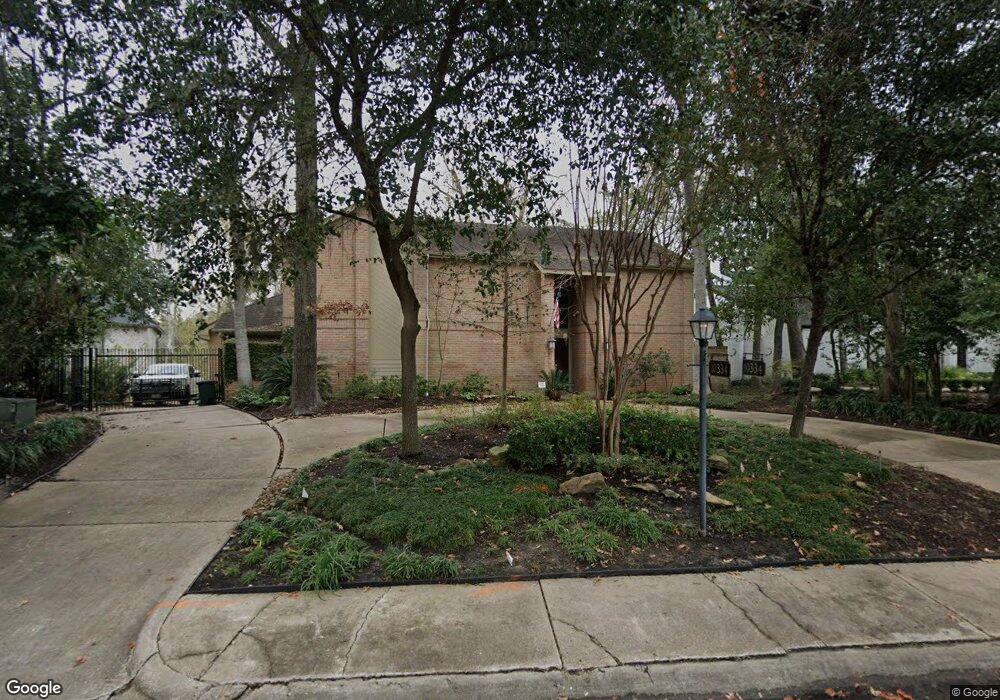
10334 Briar Dr Houston, TX 77042
Briar Forest NeighborhoodEstimated Value: $941,000 - $1,060,000
3
Beds
4
Baths
3,284
Sq Ft
$303/Sq Ft
Est. Value
About This Home
This home is located at 10334 Briar Dr, Houston, TX 77042 and is currently estimated at $994,331, approximately $302 per square foot. 10334 Briar Dr is a home located in Harris County with nearby schools including Walnut Bend Elementary School, Paul Revere Middle School, and Westside High School.
Ownership History
Date
Name
Owned For
Owner Type
Purchase Details
Closed on
Feb 8, 2005
Sold by
Landry Raymond P and Landry Laura L
Bought by
Allford Daniel W and Allford Kathryn T
Current Estimated Value
Home Financials for this Owner
Home Financials are based on the most recent Mortgage that was taken out on this home.
Original Mortgage
$359,650
Outstanding Balance
$183,045
Interest Rate
5.77%
Mortgage Type
Purchase Money Mortgage
Estimated Equity
$811,286
Create a Home Valuation Report for This Property
The Home Valuation Report is an in-depth analysis detailing your home's value as well as a comparison with similar homes in the area
Home Values in the Area
Average Home Value in this Area
Purchase History
| Date | Buyer | Sale Price | Title Company |
|---|---|---|---|
| Allford Daniel W | -- | American Title Co |
Source: Public Records
Mortgage History
| Date | Status | Borrower | Loan Amount |
|---|---|---|---|
| Open | Allford Daniel W | $359,650 | |
| Closed | Allford Daniel W | $124,850 |
Source: Public Records
Tax History Compared to Growth
Tax History
| Year | Tax Paid | Tax Assessment Tax Assessment Total Assessment is a certain percentage of the fair market value that is determined by local assessors to be the total taxable value of land and additions on the property. | Land | Improvement |
|---|---|---|---|---|
| 2025 | $9,759 | $889,972 | $560,498 | $329,474 |
| 2024 | $9,759 | $860,793 | $560,498 | $300,295 |
| 2023 | $9,759 | $903,301 | $560,498 | $342,803 |
| 2022 | $18,408 | $917,563 | $560,498 | $357,065 |
| 2021 | $18,302 | $815,900 | $560,498 | $255,402 |
| 2020 | $17,288 | $804,517 | $560,498 | $244,019 |
| 2019 | $16,423 | $698,000 | $560,498 | $137,502 |
| 2018 | $13,695 | $688,000 | $298,932 | $389,068 |
| 2017 | $17,329 | $688,000 | $298,932 | $389,068 |
| 2016 | $15,754 | $813,000 | $298,932 | $514,068 |
| 2015 | $10,465 | $740,000 | $298,932 | $441,068 |
| 2014 | $10,465 | $641,966 | $298,932 | $343,034 |
Source: Public Records
Map
Nearby Homes
- 238 Litchfield Ln
- 168 Litchfield Ln
- 12625 Memorial Dr Unit 180
- 12625 Memorial Dr Unit 17
- 12625 Memorial Dr Unit 4
- 12625 Memorial Dr Unit 146
- 12625 Memorial Dr Unit 87
- 12625 Memorial Dr
- 12625 Memorial Dr Unit 11
- 246 Litchfield Ln
- 171 Litchfield Ln
- 152 Litchfield Ln
- 10323 Pine Forest Rd
- 161 Litchfield Ln
- 201 Litchfield Ln
- 12633 Memorial Dr Unit 74
- 12633 Memorial Dr Unit 177
- 12633 Memorial Dr Unit 14
- 12633 Memorial Dr Unit 51
- 12633 Memorial Dr Unit 83
- 10338 Briar Dr
- 10335 Briar Dr
- 10331 Briar Dr
- 10322 Briar Dr
- 10339 Briar Dr
- 10327 Briar Dr
- 10318 Briar Dr
- 10346 Briar Dr
- 10323 Briar Dr
- 107 Briar Hill Dr
- 111 Briar Hill Dr
- 103 Briar Hill Dr
- 115 Briar Hill Dr
- 10310 Briar Dr
- 10319 Briar Dr
- 10350 Briar Dr
- 203 Briar Hill Dr
- 10302 Briar Dr
- 10315 Briar Dr
- 207 Briar Hill Dr